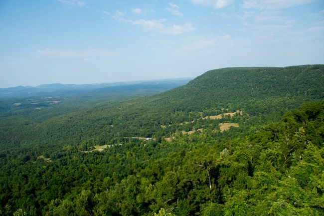
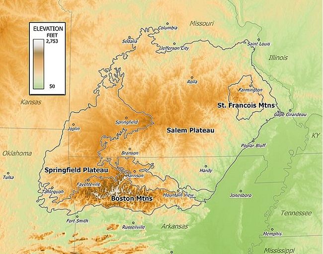
There are two mountain ranges in the Ozarks: the Boston Mountains of Arkansas and the St. Francois Mountains of Missouri. Buffalo is the highest point in the Ozarks, and it is in the Boston Mountains. Geologically, the area is a broad dome with an exposed core in the St. Francois Mountains. The Ozarks cover nearly 120,000 km2, making it the most extensive highland region between the Appalachians and the Rockies. Together with the Ouachita Mountains, the area is known as the U.S. Interior Highlands.
The Salem Plateau makes the largest geologic area of the Ozarks. The second-largest is the Springfield Plateau, nicknamed the “Queen City of the Ozarks”. Important cities in the Ozarks are included Fayetteville, Bentonville, Springdale, Eureka Springs, and Fort Smith. Branson, just north of the Arkansas–Missouri border, is a tourist destination and popularizer of Ozark culture.
Whitaker Point Trail (Ozark Mountains Trek)
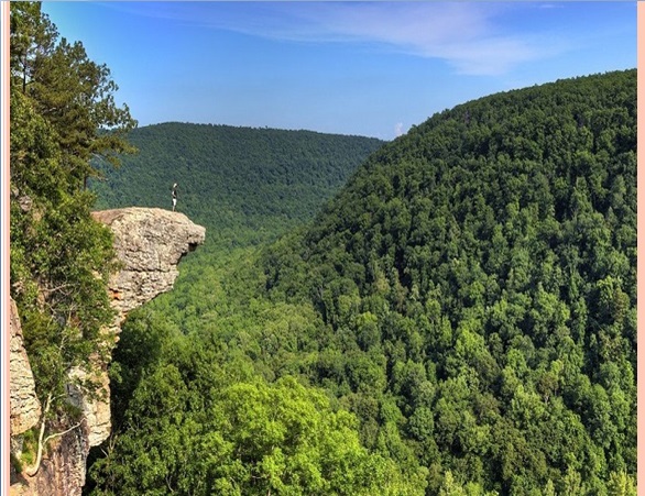
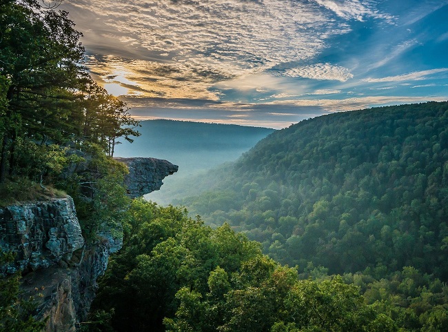
Whitaker Point (Hawksbill Crags) is one of the most photographed spots in the Ozarks mountain area. The hike to Hawksbill Crag is a famous adventure activity, and it is relatively easy. Getting to the trailhead is a bit trickier. Try this 4.6 km., out and back trail near Pettigrew, Arkansas. Generally considered a moderately challenging route but this is a very popular area for trekking. The trail is open year-round and is beautiful to visit anytime.
Geology and Physiography
The St. Francois Mountains in the northeastern Ozarks are the eroded remnants of an ancient range that form the geological core of the highland dome. The igneous and volcanic rocks of the St. Francois Mountains are the exposed remains of a Proterozoic mountain range 100 of million years old. The remaining hills are the exposed portion of an extensive terrane of granitic and rhyolitic rocks dating from 1485 to 1350 Ma that stretches from Ohio to western Oklahoma.
The core of the range existed as an island in the Paleozoic seas. Reef complexes occur in the sedimentary layers surrounding this ancient island. These flanking reefs were points of concentration for later ore-bearing fluids which formed the rich lead-zinc ores that have been and continue to be mined in the area. The igneous and volcanic rocks extend at depth under the relatively thin veneer of Paleozoic sedimentary rocks and form the basal crust of the entire region. Dolomite and Limestone laid down c. 500 mya nonconformally overlies reddish rhyolite that formed close to 1500 mya in the St. Francois Mountains.
Also read- Belogradchik Rock- A Strange-shaped Limestone and Sandstone formation
Karst features such as springs, losing streams, sinkholes and caves are common in the limestones of the Springfield Plateau and abundant in the dolomite bedrock of the Boston Mountains. Missouri is known as “The Cave State” with over 7,300 recorded caves. The majority of these caves are found in the Ozark counties. Geographic features include limestone and dolomite formations, which are rocky, desert-like areas on hilltops.
Lake of Ozarks
Lake of the Ozarks is a reservoir created by the Osage River in the northern part of the Ozarks in central Missouri. Tributaries to the Osage are included-The Niangua River, Grandglaize Creek, and Gravois Creek. The lake has a surface area of 220 km2.
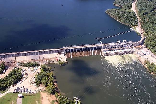
Located in the heart of Missouri, The Lake of the Ozarks is a famous lake resort destination, offering world-class boating, golfing, shopping and fishing. The Lake of Ozarks county is located within the Ozark Mountains with Bagnell Dam at an elevation of 201 m. Lake of Ozarks and the bank of the Ozarks lie in central Missouri on the Salem Plateau of the Ozarks. Margaritaville Lake of the Ozarks extends across four Missouri counties.
Lake of the Ozarks water level history
Lake of the Ozarks water level fluctuations as winter approaches. Lake and river level fluctuations occur for several reasons. One reason is the Osage River level may fluctuate when Ameren Missouri’s Bagnell Dam releases water to meet increased electricity demand. Lake of Ozark’s water level is noticeably low for this time of the year 2022. lake of the Ozarks water level map showing the current year’s level.
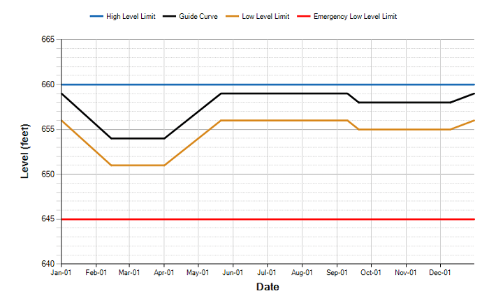
The Lake of the Ozarks water level chart is showing water level from January to 1 December 2022. Compare to last year, this year the water level is dropped unexpectedly. this is a little worry for Environmentalists and ecologists.


