The Kerguelen Islands are an overseas territory of France, But their far-off location in the southern Indian Ocean places these islands far closer to Antarctica than to mainland Europe. In fact, the islands are so remote and the landscape so harsh that the reason they have called“The Desolation Islands.” It was first discovered in January 1774 by the navigator Chevalier Kerguelen-Trémarec onboard Le Roland, during his second expedition to the region.
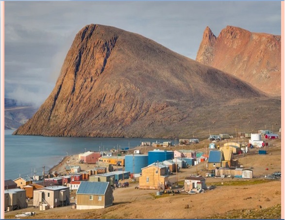
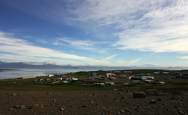
There are no indigenous inhabitants, but France maintains a permanent presence of 45 to 100 soldiers, scientists, engineers, and researchers. There are no airports on the islands, so all travel to and from the outside world is conducted by ship.
Geology
The Kerguelen Islands form an emerged part of the submerged Kerguelen Plateau, which has a total area nearing 949000 km2. The plateau was built by volcanic eruptions associated with the Kerguelen hotspot and now lies on the Antarctic Plate.
The major part of the volcanic formations visible on the islands is characteristic of effusive volcanism, which caused a trap rock formation to start emerging above the level of the ocean 35 million years ago.
Other forms of volcanism are present locally, such as the strombolian volcano Mont Ross, and the volcano-plutonic complex on the Rallier du Baty Peninsula. Various veins and extrusions of lava such as trachytes, trachyphonolites, and phonolites are common all over the islands.
The Kerguelen Islands are composed primarily of Tertiary flood basalts and a complex of plutonic rocks. The trachybasaltic-to-trachytic Mount Ross strato-volcano at the Southern end was active during the late Pleistocene. An active fumarole field is related to a series of Holocene trachytic lava flows and lahars that extend beyond the icecap. Trachytic ignimbrite was considered to represent the last major eruptive event on the Kerguelen Archipelago at 26,000-28000 years.
A few lignite strata, trapped in basalt flows, reveal fossilized araucarian fragments, dated at about 14 million years of age.
Also, read- The Fantastic Sculpture Devil’s Golf Course in Death Valley
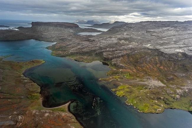
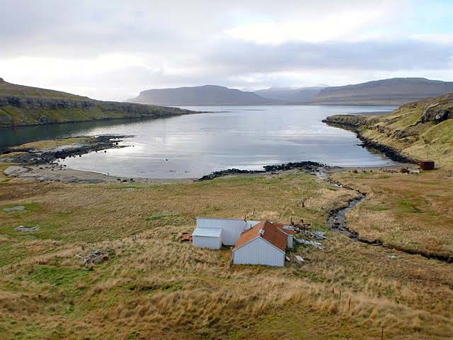
Glaciation caused the depression and tipping phenomena that created the gulfs at the north and east of the archipelago. Erosion caused by the glacial and fluvial activity carved out the valleys and fjords; erosion also created conglomerate detrital complexes and the plain of the Courbet Peninsula.
Topographic Features
The main island, Grande Terre, is of volcanic origin. About 150 km long east-to-west and 120 km north-to-south, it is the third-largest island belonging to France after Grande Terre in New Caledonia, and Corsica. Covering an area of 6,675 km², it has a highly irregular coastline with a number of large peninsulas linked to the island by low, narrow isthmuses.
Inland, the main features are the numerous valleys and ridges with the highest point, the glaciated Mount Ross, reaching a height of 1,850 m. Mount Ross is the youngest volcanic edifice recognized in the Kerguelen Archipelago. The Kerguelen Islands lie in the Northern part of the Kerguelen-Gaussberg ridge, having been built up by a series of thick lava flows over millions of years.
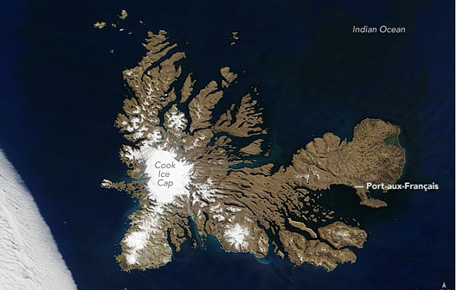
Cook Glacier covers nearly one-third of the island, and the abundant rainfall combined with glacial meltwater keeps numerous streams and lakes full of water. Peat marshes, lignite, and guano deposits are found on the island.
Origins of the Kerguelen Plateau
Kerguelen Plateau stretches across the southern Indian Ocean near Antarctica about 23000 km. The structure is the world’s largest submerged plateau, was once thought to be a fragment of Antarctica that splintered off when the Indian Ocean began to form. However, an Ocean Drilling Program which bored into the basement rock of the submerged plateau found it to be composed of basalt, the typical oceanic crust formed from molten mantle rock that rises to the surface.
Geo-Scientist believes that these basement basalts erupted when the area was either above water or very close to the surface about 97 million years ago. Soil and vegetation probably covered parts of the plateau, because there are claystone, siltstones, and small pieces of wood in the sediments blanketing the basalts.
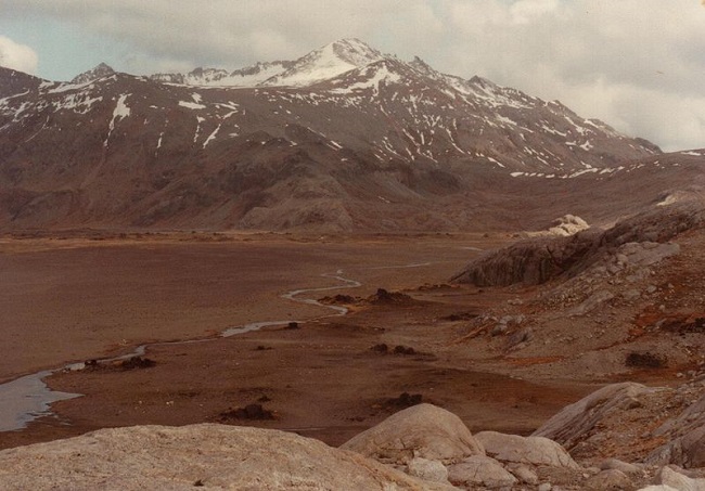
The plateau then apparently began sinking slowly into the ocean. Limestones containing fossils of urchin-like creatures and other animals testify that the plateau was once at a shallow depth. Over the last 60-70 million years, however, this area has subsided more rapidly. At some time, the ocean over the plateau began to cool as a continent-circling ocean current started to seal off the Antarctic climate, sending it into its current deep-freeze state. It appears that icebergs from a glacial cap on Antarctica first reached the Kerguelen plateau during the early Oligocene period, which began 37 million years ago.


