Karai Badlands
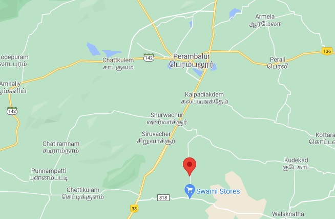
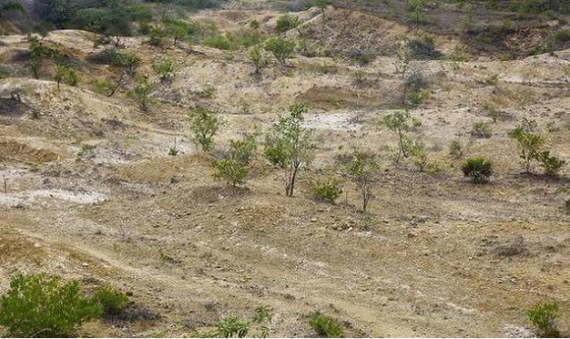
The Karai Badlands National Geological Monument is located in the Karai area along the Karai-Kulakkalnattam road of Perambalur District, Tamil Nadu. A four km. The stretch of badlands with natural conical mounds and typical fossils of Cretaceous age is exposed as badlands with a series of conical mounds separated by gulleys.
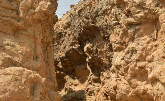
Badland topography, on either side of the Alattur-Ariyalur road, spreads within 40-70 km. The radius marks the lower part of the marine Cretaceous rocks that mainly consist of clay & sandstone of the Karai Formation. Like the Grand Canyon in Colorado, US, Ariyalur is considered a Cretaceous Park of South India by geoscientists.
Geological Survey of India (GSI) has declared Karai Badland as a National Geological monument for its maintenance, protection, promotion, and enhancement of geo-tourism.
Stratigraphy
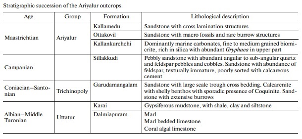
The Rock formation is here exposed in the Cretaceous of Trichinopoly, which dates back to the Late Cretaceous. The Succession in the area is broadly divided into 4 Groups -Uttathur, Trichinopoly, Ariyalur, and Ninniyur, where the Uttathur is the oldest. After comparing the age and color of the rock formations here with those of the Himalayas, we have found that they are of the same age. The Karai Formation of the Uttatur Group at the Karai-Kulakkalnattam section in the Perambalur district forms the lower part of the Cretaceous sedimentary succession of the Cauvery Basin.
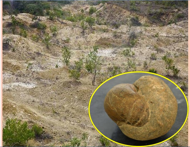
Karai Badlands area is the type area for the Karai Formation. The Karai Formation is exposed as badlands with a series of conical mounds separated by gulleys. It is a wasteland with scanty vegetation and without any topsoil on either side of the Karai-Kulakkalnattam road.
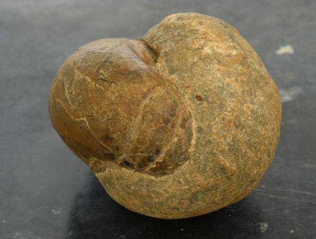
The Karai Badlands Formation consists of grey-brown, gypsiferous, glauconitic mudstone, and marl with sporadic thin interbeds of siltstone and calcareous sandstone, particularly in its upper part- sporadic calcareous, siderites, and phosphatic concretions/nodules and concretionary horizons occur in some intervals. A variety of marine fossils like ammonites, nautiloids, belemnites, worm tubes, pelecypods, gastropods, and oysters occur in abundance.
The importance of this “Geoheritage Site” lies in the fact that it provides one of the best-exposed sections of Cretaceous rocks with its unique lithology and diversity of extinct marine life. The region is a magnet for cement companies because of the purity of Ariyalur’s limestone. The factories burn a mixture of powdered limestone, gypsum, coal, and other chemicals to produce cement and clinker. But unchecked mining has led to air pollution and large quantities of overburdened soil being heaped up randomly.
How Badland is a form
The Cretaceous Period (135- 65 Million Years) witnessed a series of major geological events in the history of the Earth. Of these, the most significant is the worldwide marine transgression, which has left its mark in many parts of the world, including South India. The land covering modern-day Ariyalur, Kallagudi, Dalmiapuram, Kozhakalnatham, Uttathur, Karai, Anaipadi, and Kallankurichi was affected by this geological event.
Also, read- Geotourism around Fabulous Andaman and Nicobar Islands
The mouth of the Vellar River was considered the entry point (Transgression) of the sea from the Bay of Bengal. After being a marine haven for 40 million years, the sea undergoes regression, leaving behind a vast graveyard of shellfish, corals, clams, gastropods, and branchiopods. These formed huge bands of sedimentary rocks, most of them limestone, Shale & Siltstone. Over time, this formation undergoes a weathering and erosion process and forms Badland topography in the area.
The Cauvery Basin was formed during the fragmentation of Gondwanaland in the Lower Cretaceous. Sedimentation in the Cauvery Basin commenced with fluviatile deposition represented by the Terani Plant bed of Upper Gondwana of the Lower Cretaceous age. The depositional environment varied from fluviatile to lacustrine. The Cretaceous deposit in the Cauvery Basin of Tamil Nadu consists of an exceptionally complete shallow marine sequence with very rich faunal assemblages, which have attracted the attention of paleontologists from all over the world.
Also Read- Geotourism And Modern Geotechniques
How to Reach Karai Badlands
Karai Badlands is a unique geo-heritage site located in the Perambalur district of Tamil Nadu. The nearest major airport is Tiruchirappalli International Airport, about 90-100 km away. From the airport, you can hire a taxi or take a bus to Perambalur. The nearest railway station is Ariyalur Railway Station, around 40 km away from Karai Badland.


