The Ice Age Floods Trail
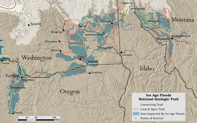
The Ice Age Floods Trail is an Ice Age Floods pathway in the US states of Montana, Idaho, and Washington. The landscape around this trail is unusual and has attracted the attention of visitors. The Ice Age Floods National Geologic Trail is a network of marked touring routes extending across parts of Montana, Idaho, Washington, and Oregon.
Apart from this, several special interpretive centers are located across the region. The trail represents the largest, most systematic, and most dramatic story of the Ice Age Floods to bring significant economic and cultural benefits to the researchers. The Ice Age Trail (18,000 years ago), and probably in previous Ice Ages, the greatest known glacial-outburst floods in America inundated portions of the Pacific Northwest.
Huge Ice Age glacial-outburst floods occurred in other parts of the world as well. As you can see, even today, much smaller outbursts and floods have occurred in many places. Ice Age Floods National Geologic Trail Map- The map shows the Ice Age flood trail’s location and the major states where it occurs.
History
The Ice Age Floods National Geologic Trail in parts of Montana, Idaho, Washington, and Oregon was established by the National Park Service (NPS). It is a National Geologic Trail, designating the Ice Age Floods pathways. The Ice Age Floods National Geologic Trail is a network of routes connecting natural sites and facilities that provide an interpretation of the geological consequences of the Glacial Lake Missoula floods of the last glacial period that occurred about 18,000 to 15,000 years ago. It includes sites in Washington, Oregon, Idaho, and Montana. It was designated as the first National Geologic Trail in the United States in 2009.
Geologic concept and Ice Age Trail
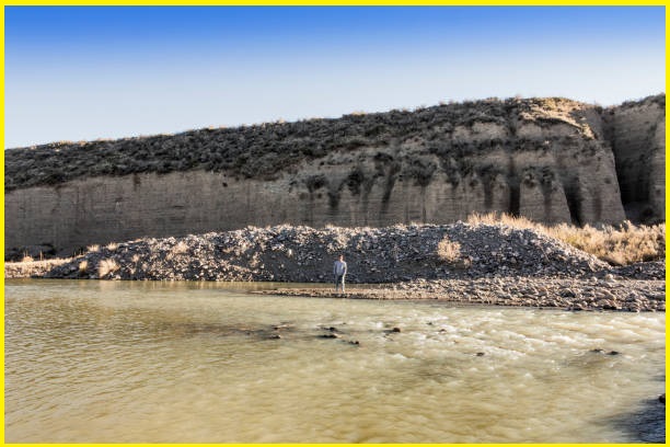
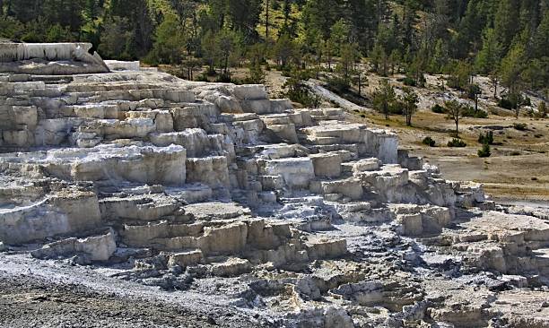
At the end of the last Ice Age (Wisconsin Ice Age), a branch of the Cordilleran Ice Sheet moved out of Canada into the Idaho panhandle region. There, it formed a 610 m-high ice dam that blocked the mouth of the Clark Fork River, creating glacial Lake Missoula, which impounded greater than 80 cu mi of water. The lake extended up the valleys eastward for over 320 km. The periodic rupturing of the ice dam resulted in the Missoula Floods that swept across Idaho and Eastern Washington, and then down the Columbia River Gorge approximately 40 times over the years. The flood front swept in a wave across Idaho and Washington at speeds approaching 100 km/h.
These floods could not continue down the Columbia River, forcing flood over the highlands of Eastern Washington, vastly transforming the landscape by forming the Grand Coulee, Moses Coulee, the Channeled Scablands, Dry Falls, Palouse Falls, and many similar features. The cumulative effect of the floods was to excavate 50 cu mi of loess, sediment, and basalt from the channeled scablands of eastern Washington and to transport it downstream. Over a period of 2,000 to 2,500 years, the repetition of ice dam failure and the flood were repeated 40-60 times, leaving a lasting mark on the landscape.
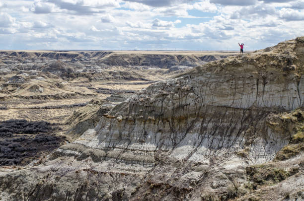
Several characteristic features illustrate the Ice Age trails-
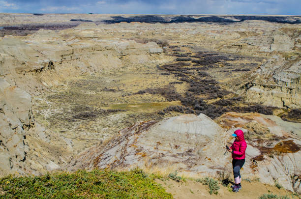
The landscape is extensively eroded, with deep-walled canyons in the Grand Coulee, Moses Coulee, the Wallula Gap, and the Columbia River Gorge.
There are giant ripple marks 9.1 m high and gravel bars over 6.4 km long and 91 m high, which would have required extreme currents to form.
There are 200 short tons of erratic boulders that originated in Canada and Montana, found up valleys. These boulders were ice-rafted in and deposited as the ice was stranded & melted in the backwaters of temporary lakes.
Also read- Mount St. Helens- An Active Volcano Trail And Hiking Destination USA
Ice Age floods the National Geologic Trail
A mile south of Washtuchna, Washington, State Road 261, which has been curling through close hills, suddenly straightens and drops down the wide Washtuchna Coulee. On either side of the road, the land sweeps up to rocky outcroppings. Here, one can see the ice age floodwaters that first tore open this former river channel some 15,000 years ago. Turn left and see in and out of those rocky ledges themselves. This is the road to Palouse Falls State Park, which might become one of the favorite stops in the Ice Age Floods Geologic Trail now being developed by the National Park Service.
Also Read- Geotourism And Modern Geotechniques
The Waterfalls of the Palouse River drop nearly 61 meters into a narrow canyon, creating a unique feature. Geologists believe that at the end of the last ice age, a huge glacial lake in the area of what is now Missoula, Montana, released ice and rock-laden torrents of water ripped away the topsoil and cut into the underlying basalt.
Could this flood happen again?
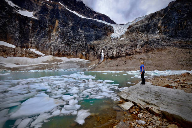
Global warming is a major concern; due to this, the Antarctic or Greenland Ice Sheets may produce cataclysmic sea level changes. In the far distant future, long-term climate cycles may cause large ice sheets to return. Then similar outburst floods may happen again, possibly even in this region.
Source- NPS.gov, recreation.gov, wikipedia.org


