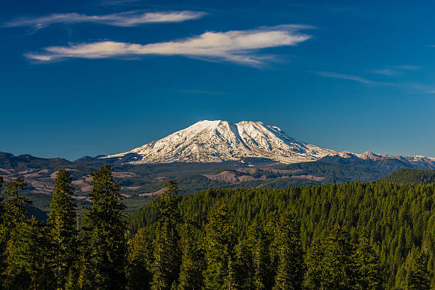
Mount St. Helens
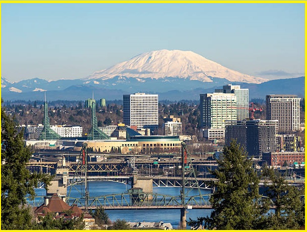
Mount St. Helens is an active stratovolcano located in Skamania County, Washington, United States. It lies 85 km northeast of Portland, Oregon, and 158 km south of Seattle. Mount St. Helens takes its English name from a British diplomat, Lord St. Helens, a friend of explorer George Vancouver, who surveyed the area in the 18th century. The volcano is part of the Cascade Volcanic Arc, a segment of the Pacific Ring of Fire.
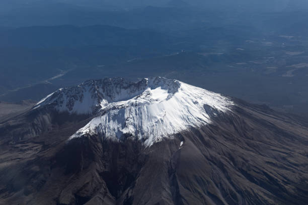
Mount St. Helens eruptions- Mount St. Helens eruption of May 18, 1980, remains the deadliest and most economically destructive volcanic event in U.S. history. Due to this major eruption, 52 people were killed, and 200 homes, 47 bridges, 24 km of railways, and 298 km of highway were destroyed. A massive debris avalanche, triggered by a magnitude 5.1 earthquake, caused a lateral eruption that reduced the elevation of the mountain’s summit from 2,950 m to 2,549 m, leaving a 1.6 km wide horseshoe-shaped crater.
The 1980 eruption disrupted terrestrial ecosystems near the volcano. The volcanic ash of the St. Helens eruption greatly affected the aquatic system, and it took many years for the surrounding lakes to return to their normal state.

Geographic and Geological settings
Mount St. Helens is geologically young compared with the other major Cascade volcanoes. It formed only within the past 40,000 years, The volcano is considered the most active in the Cascades within the Holocene epoch (10,000 years). Mount St. Helens is 55 km west of Mount Adams, in the western part of the Cascade Range. The volcano is approximately 80 km from Mount Rainier, the highest of the Cascade volcanoes. Mount Hood, another volcanic peak in Oregon, is 100 km southeast of Mount Saint Helens. An earthquake in 1980 preceded the eruption of Mount St. Helens, blanketed towns hundreds of miles in volcanic ash, and permanently altered the mountain’s face. Plants and animals in the blast zone were destroyed instantly.
Geology
Mount St. Helens is part of the Cascades Volcanic Province, an arc-shaped band that extends from southwestern British Columbia to Northern California. It is roughly parallel to the Pacific coastline (Pacific Ring of Fire). This is the place where a dense oceanic plate sinks beneath the North American Plate-a process known as subduction. As the oceanic slab sinks deeper beneath the continental plate, high viscous magma ascends upward through the crust lid rock along a path of least resistance, both by way of fractures and faults as well as by melting wall rocks. Some of the melt rises toward the Earth’s surface to erupt, forming the Cascade Volcanic Arc.
Mount Saint Helens is primarily an explosive dacite volcano with a complex magmatic system. The volcano was formed during four 4 stages beginning about 275,000 years ago and has been the most active volcano in the Cascade Range during the Holocene. About 12,800 years ago, tephra, lava domes, and pyroclastic flows erupted, forming the older St. Helens edifice, but a few lava flows extended beyond the base of the volcano. The bulk of the modern edifice was constructed during the last 3,000 years when the volcano erupted a wide variety of products. Mount St. Helens elevation- Since its 1980 eruption, the summit elevation has decreased. A survey in 1982 gave a measurement of 2549.7 m. The elevation difference is likely due to erosion and loss of rimrock by crater-wall collapses.
Also Read- Geotourism And Modern Geotechniques
What type of volcano is Mount St. Helens? Mount St. Helens is an active stratovolcano. A stratovolcano, also known as a composite volcano, is a conical volcano built up by many layers of lava and tephra. Stratovolcanoes are characterized by a steep profile with a summit crater and periodic intervals of explosive eruptions and effusive eruptions.
Mount St. Helens National Volcanic Monument
In 1982, the Mount Saint Helens National Volcanic Monument was established by President Ronald Reagan. The Mount St. Helens Visitor Center opened to the public to see and better experience the monument of Mount St. Helens. The place is functioning as a gateway to the mountain, to tell the historical significance of the landscape before and during the eruption. A vantage point offers a view of the Western slope of the mountain, visible from the walking trail. A high archway and elaborately carved wooden columns contribute to providing a glimpse of the towering volcano and nearby forest.
Also, read- Arizona Crater National Park-A Gigantic Impact Crater in the Arizona desert
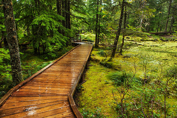
Even without access to the cone, one can watch steam emissions from the safety of Coldwater Ridge Visitor Center or get closer to the volcano at the Johnston Ridge Observatory. Mount Margaret’s backcountry recently reopened to campers and hikers. For short hikes in the 1980 blast area, visit Meta Lake on the east side of the monument and take along a flashlight to explore Ape Cave, a lava tube formed 2,000 years ago.
Climbing
Mount Saint Helens is a popular hiking spot, and it is climbed year-round. It is a common climbing destination for both beginning and experienced mountaineers. The best time to climb the mountain is late spring through the early fall foliage. All routes include sections of steep, rugged terrain. The standard hiking route in the warmer months is the Monitor Ridge Route, which starts at the Climbers Bivouac. This is the most crowded route to the summit in the summer, at about 1,400 m in approximately 8 km to reach the crater rim. The Worm Flows Route is considered the standard winter route on Mount St. Helens, as it is the most direct route to the summit. The route is 1,700 m in elevation over about 10 km from the trailhead to the summit. The mountain is now circled by the Loowit Trail at elevations of 1,200–1,500 m.
How to Reach Mount St. Helens
Mount Saint Helens is 158 km south of Seattle and 85 km. north of Portland, Oregon. The closest major airport to Mount Saint Helens is Portland International Airport is 85 km from the center of Mount Saint Helens.


