Tikal Guatemala
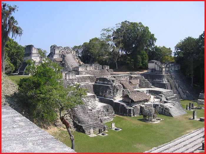
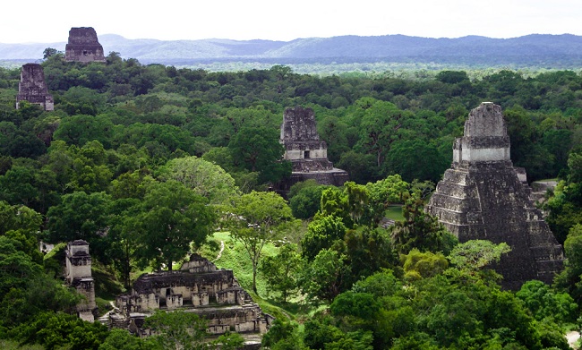
Tikal is the largest Mayan site on the American continent and contains some of the most fascinating archaeological remains of the ancient Maya civilization. Tikal remained a mystery for centuries, after being abruptly abandoned by the Maya over 1000 years ago and overgrown by a dense jungle. It comprises 576 km2 of lush jungle surrounding the Maya ceremonial center. Tikal is Guatemala’s most famous cultural and natural preserve and was declared a national park in 1955 and a World Heritage site by UNESCO in 1979. Tikal National Park is located in Northern Guatemala’s Peten Province and extends into neighboring Mexico and Belize.
Tikal national park
Tikal National Park is one of the few World Heritage sites inscribed according to both natural and cultural criteria for its extraordinary biodiversity and archaeological importance. It comprises 57,600 hectares of wetlands, savannah, tropical broadleaf, and palm forests with thousands of architectural remains of the Mayan civilization from the Preclassic Period (600 B.C.) to the urban center around 900 AD. The national park consists of a wide variety of fauna and flora. Cats, including Jaguar and Puma, several species of monkeys and anteaters, and more than 300 species of birds.
History
Tikal was discovered by Ambrosio Tut, a gum collector or Chiclero. He saw the temples’ roof combs in the distance. He ran to the island city of Flores to inform Modesto Mendez, then Governor of the Peten Province, in northern Guatemala. When they arrived at the site the impressive temples, the open plazas, and the several-story buildings, where priests and kings once lived.
Also read- The Secret of an Ancient Mesoamerican City-Teotihuacan
Tikal is the ruin of an ancient city, which was likely to have been called Yax Mutal, in Guatemala. It is one of the largest archeological sites and urban centers of the pre-Columbian Maya civilization. It is located in the archeological region of the Peten Basin in what is now northern Guatemala. Situated in the department of El Peten, the site is part of Guatemala’s Tikal National Park.
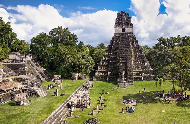
Tikal was the capital of the most powerful kingdoms of the ancient Maya. Though monumental at the site dates back as far as the 4th century BC, Tikal reached its peak during the Classic Period, c. 200 to 900. During this time, the city dominated much of the Maya region politically and economically, interacting with areas of Mesoamerica such as the great metropolis of Teotihuacan in the Valley of Mexico. There is evidence that Tikal was conquered by Teotihuacan in the 4th century AD.
Geography-Tikal Guatemala
Tikal is approximately 303 kilometers north of Guatemala City. The closest large modern settlements are Flores and Santa Elena, nearly 64 kilometers away from here. It is 19 kilometers south of the contemporary Maya city of Uaxactun and 30 kilometers northwest of Yaxha.
The city covered an area greater than 16 square kilometers that included about 3,000 structures. The topography of the site consists of a series of parallel limestone ridges rising above swampy lowlands. The major architecture of the site is clustered upon areas of higher ground and linked by raised causeways spanning the swamps. The area around Tikal has been declared the Tikal National Park and the preserved area covers 570 square kilometers. The ruins lie among the tropical rainforests of northern Guatemala and have dominated a natural east–west trade route across the Yucatan Peninsula.


