The Mysterious rock formations of Batanes Island Philippines
Batanes Island
Batanes Island is created by a series of volcanic activities and other geologic forces when Mt. Iraya erupted around 325 BC. Batanes is a group of islands located in the northernmost part of the Philippines. It is composed of 10 islands, three of which are inhabited: Batan, Sabtang, and Itbayat. The islands are known for their stunning landscapes, unique culture, and well-preserved traditional houses made of stone.
Geologically, Batanes is distinct from the rest of the Philippines as it is not part of the “Ring of Fire”. The islands were formed through the collision of the Philippine Sea Plate and the Eurasian Plate, which created a unique landscape of rolling hills, jagged cliffs, and secluded coves. Batanes Island are also home to several unique rock formations, including the Nakabuang Arch, the Vayang Rolling Hills, and the Valugan Boulder Beach.
Batanes Island is known for its stunning natural landscapes, including its mysterious rock formations. These formations are found along the coastlines of the islands and are composed of columns of rock that have been shaped by the forces of wind and water over millions of years.
The rock formations are made up of basalt, a volcanic rock that is known for its hexagonal shapes. The pillars and columns of rock are believed to have been formed by the slow cooling of molten lava that flowed into the sea millions of years ago. The formations come in a variety of shapes and sizes, with some reaching up to 20 meters in height.
Geography and geology
The Batanes island has a total area of 219.01 square kilometres comprising 10 islands situated within the Luzon Strait between the Balintang Channel and Taiwan. The islands are sparsely populated and three largest islands, Batan, Itbayat, and Sabtang, are the only inhabited islands. The Entire islands are part of the Luzon Volcanic Arc.
Basco, its capital town, is about 280 kilometers north of Aparri, Cagayan and some 860 kilometers north of Manila and about 190 kilometers south of Taiwan. Batanes Philippines map-Batanes Island is composed of three main islands- Batan, Sabtang, and Itbayat. The provincial capital, Basco, is located on Batan Island.
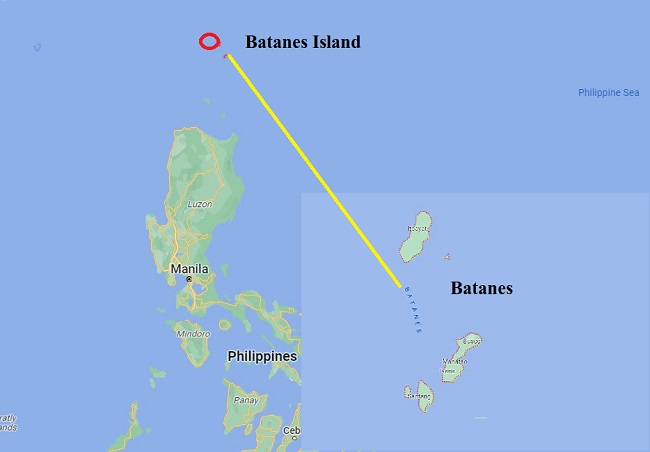
Almost one-half of Batanes is hills and mountains, situated between the vast expanse of the waters of Bashi Channel and Balintang Channel, where the Pacific Ocean merges with the China Sea. The area is a sea lane between the Philippines and Japan, China, Hong Kong and Taiwan. It is rich with marine resources, including the rarest sea corals in the world. The terrain of the province, while picturesque at almost every turn.
Geology of Batanes is a result of its location near the boundary of the Eurasian and Philippine Sea tectonic plates. The islands are composed of volcanic rocks and sedimentary rocks, with some areas displaying evidence of past volcanic activity.
Also read- The Lewisian Gneiss- One of the Oldest Gneiss rocks in Scotland
Batanes Island were formed as a result of volcanic activity, with most of the volcanoes now dormant or extinct. The hills and cliffs are made up of sedimentary rocks that have been eroded over time by the wind and waves. The landscape is characterized by deep ravines, limestone cliffs, and rocky shorelines, which make it a popular spot for hiking and exploration. Batanes Island is also situated in the typhoon belt, which means that it is regularly hit by typhoons that bring strong winds and heavy rains.
Batanes Island tourist spot
Batanes Island is a beautiful and unique tourist destination in the Philippines, with a wide range of attractions and natural wonders to explore. Some popular tourist spots in Batanes:
Sabtang Island
Sabtang is a small island located off the coast of Batan Island. It is known for its well-preserved traditional Ivatan houses, which are made of stone and cogon grass. Sabtang also has beautiful beaches, stunning landscapes, and a unique culture.
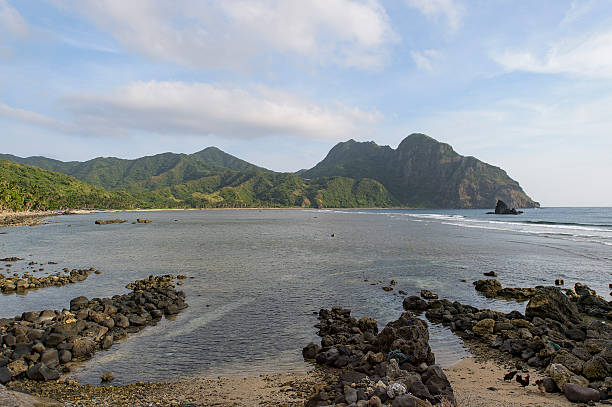
Valugan Boulder Beach
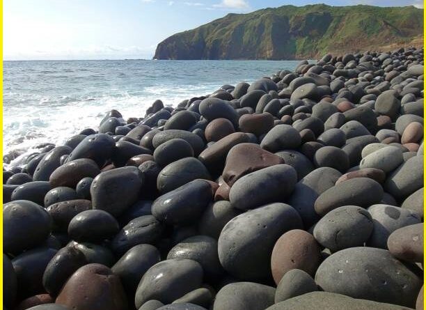
Valugan Boulder Beach is located on the northern coast of Batan Island. While it is not a typical sandy beach, it is a beautiful spot for watching the sunrise and sunset and enjoying the stunning views of the Pacific Ocean. The beach is covered in large boulders, which were formed by the eruption of Mt. Iraya.
Nakabuang Arch
Nakabuang Arch is a natural rock formation is one of the most popular tourist attractions on the island and is known for its unique shape and stunning views of the sea. The arch is formed by two large rock formations that have been eroded by the wind and waves over time. The smaller rock sits on top of the larger rock, creating an archway that stands tall over the surrounding landscape. The arch is surrounded by crystal-clear waters and a small stretch of white sand beach, making it a great spot for swimming and relaxing.
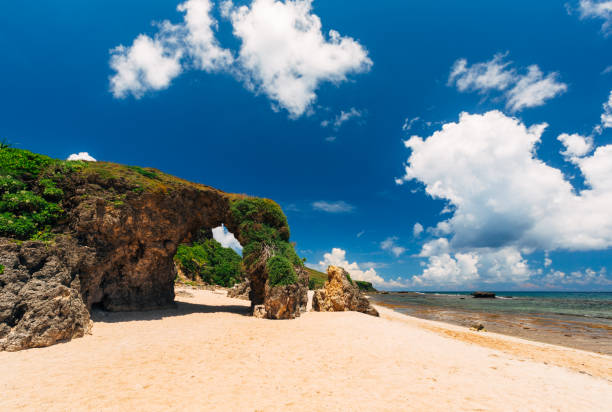
To reach Nakabuang Arch, visitors must take a boat or tricycle from the town of San Vicente on Sabtang Island. From there, it is a short walk to the arch, which is located on the western coast of the Batanes Island. The arch is best visited during low tide when the waters are calm and visitors can walk underneath the archway.
Marlboro Country
Marlboro Country is a vast rolling hills and pasturelands on the island of Batan. It is named after the Marlboro cigarette commercials that were filmed there in the 1990s. Marlboro Country is a popular spot for hiking and enjoying the panoramic views.
Chawa View Deck
Chawa View Deck is located on the eastern coast of Batan Island. It offers a panoramic view of the sea, as well as the rolling hills and cliffs of the island.
Vayang Rolling Hills
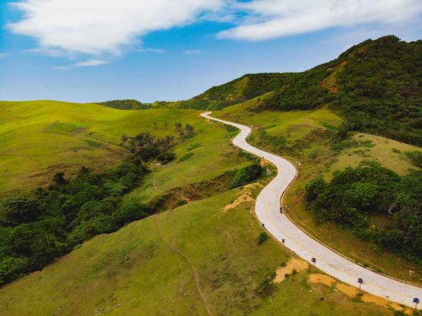
Vayang Rolling Hills is a picturesque landscape located on Batan Island. The hills are covered with a lush carpet of grass and dotted with grazing cows and carabaos, giving the area a pastoral feel. The wind-swept hills are also home to a variety of plants and flowers, including wild reeds, ferns, and small bushes.
Vayang Rolling Hills is a popular spot for visitors to Batanes Island who want to experience the beauty of the island’s natural scenery. Visitors can hike up the hills to get a closer look at the rolling landscape and take in the breathtaking views. It’s also a great spot for picnics, kite flying, and photography. To get to Vayang Rolling Hills, visitors can take a tricycle or a rented motorcycle from the town of Basco, which is the provincial capital of Batanes. The hills are located about 2.5 kilometers from Basco and can be reached by a rough road.
Batanes beach
Batanes has several beautiful beaches that are perfect for swimming, sunbathing, and relaxing. Some of the most popular beaches in Batanes are- White Beach is located on Sabtang Island. It is a long stretch of white sand beach with clear blue waters, perfect for swimming and sunbathing.
Mahatao Beach is located on the eastern coast of Batan Island. It is a small but picturesque beach with crystal-clear waters and fine white sand. The beach is surrounded by lush green hills and is a great spot for picnics and relaxing. Homoron Blue Lagoon is located on Sabtang Island. It is a stunning natural pool with clear blue waters and a small sandy beach. The lagoon is surrounded by towering cliffs and lush vegetation, making it a popular spot for swimming and diving.
How to reach Batanes island
The only way to reach Batanes Island is by air, as there are no regular ferry services to the islands due to the distance and the rough sea conditions. The main gateway to Batanes is through Basco Airport, which is located on Batan Island. The airport is served by several airlines, including Philippine Airlines, Skyjet Airlines, and Cebu Pacific. Flights to Batanes are usually available from Manila, Clark, and sometimes from other cities like Tuguegarao and Laoag.
Travel time from Manila to Basco is approximately 1.5 hours. Once you arrive at Basco Airport, you can take a tricycle or a rented motorcycle to get around the island. There are also tour companies and transport services that offer guided tours and transfers to the different parts of Batanes.
