
Where is the great dividing range
The Great Dividing Range is a mountain range that runs along the east coast of Australia for more than 3,500 kilometers. It runs from the northern tip of Queensland down to the state of Victoria. The Great Dividing range is one of the most significant landforms in Australia that forms a natural barrier between the eastern coastal region and the inland area of Australia and has played an important role in shaping the geography, climate, and ecosystems of the continent. Some of Australia’s largest cities, including Brisbane, Sydney, and Melbourne, are located along the eastern coast and are influenced by the climate patterns that are created by the Great Dividing Range. It is one of the most significant landforms in Australia and has played an important role in shaping the geography, climate, and ecosystems of the continent.
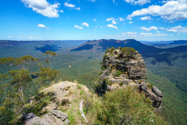
The Great Dividing Range is a popular destination for tourists, with many opportunities for hiking, camping, and outdoor activities. There are also many scenic drives and lookout points along the range that offer stunning views of the surrounding landscape.
Geography
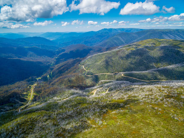
The Great Dividing Range is a complex system of mountains, plateaus, and hills, with many peaks rising over 1,000 meters above sea level. The Dividing Range was formed due to the tectonic uplift and erosion. The range has been shaped by glaciation, weathering, and erosion over millions of years. It has a significant impact on the climate of eastern Australia. The range acts as a barrier to the prevailing westerly winds, which causes rainfall to be concentrated on the eastern side of the range. The western side of the range is generally drier and arider. The Range is home to rainforests, eucalypt forests, grasslands, and alpine regions. Australia’s indigenous peoples lived in the region for tens of thousands of years. The range also played a significant role in the exploration and settlement of Australia by European colonizers.
Also, read- Fish River Canyon Namibia-The 2nd Largest Canyon in the World
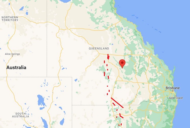
Great dividing range map- The Map is showing the location and major Town. Travelers can use the map to explore the range and plan their trip, including finding hiking trails, scenic routes, and other points of interest. There are a number of maps and guidebooks available that provide more detailed information about the Place and its various attractions.
How was the great dividing range formed?
The Great Dividing Range in Australia was formed more than 300 million years ago during the Paleozoic Era, through a process of tectonic uplift and erosion. The range was formed when two continents, Australia and Antarctica, collided to form the supercontinent Gondwana. This collision caused massive tectonic activity and the formation of mountain ranges, including the Great Dividing Range. Over time, the range has been shaped by glaciation, weathering, and erosion. It was originally much higher, but millions of years of erosion have worn down the peaks and valleys of the range, forming the complex system of mountains, plateaus, and hills that exist today. The dividing Range is also subject to the forces of plate tectonics, which can cause earthquakes and other geologic activity in the region. Despite its age, the range continues to shape the geography and Australia’s landscape.
Great dividing range hike
The Range is a fantastic place to go hiking, with a variety of trails to suit different skill levels and interests. Here are some popular hiking routes along the Great Dividing Range:
The Great North Walk- This is a 250-kilometer trail that runs from Sydney to Newcastle, passing through the Great Dividing Range. It takes about two weeks to complete and offers stunning views of the mountains and surrounding countryside.
The Goldfields Track-This is a 210-kilometer trail that runs through the Great Dividing Range in Victoria, passing through historic gold-mining towns and beautiful mountain landscapes. The trail is divided into three sections, each taking about 3-4 days to complete.
The Three Capes Track-This is a 46-kilometer trail in Tasmania that includes stunning views of the Great Dividing Range. The trail takes about 4 days to complete and includes beautiful coastal landscapes, ancient forests, and incredible views of the Tasman Sea.
The Border Track-This is a 21-kilometer trail that follows the border between New South Wales and Queensland, passing through the beautiful rainforests and stunning mountain landscapes of the Dividing Range. The trail takes about 2 days to complete.
Mount Feathertop-This is a popular hiking destination in Victoria that offers stunning views of the Great Dividing Range. The trail is a challenging 22-kilometer trek that takes about 8-10 hours to complete.
Before embarking on a hike in the Dividing Range, it is important to research the trail, check weather conditions, and ensure that you have appropriate equipment and supplies. Additionally, it is important to follow any safety guidelines provided by local authorities to ensure a safe and enjoyable hiking experience.


