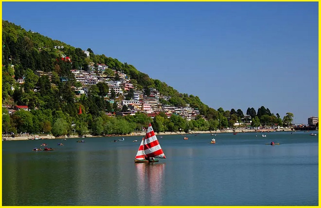
Naini Lake -The Heart of Nainital
Naini Lake, the centerpiece of Nainital and one of Uttarakhand’s prime attractions, lies at an altitude of about 2,000 meters. Surrounded by seven picturesque hills, this serene lake is a favorite among travelers, especially honeymooners. Discovered in 1839 by P. Baron, it remains one of India’s most visited lakes. Nestled at the foothills of the Kumaon range, Nainital is a charming hill station encircled by scenic peaks such as Ayarpatha, Naina, and Deopatha. The town’s name originates from the lake itself—derived from “naina” (eye) and “tal” (lake), translating to “Lake of the Eye.” The lush ridges and forested slopes surrounding Naini Lake add to its spellbinding beauty, with the majestic Himalayas forming a stunning backdrop.
Mythological Significance:
According to legend, sages Atri, Pulaha, and Pulastya created the lake by filling a hollow with water from Lake Mansarovar in Tibet, making a dip in Naini Lake as sacred as one in Mansarovar. The lake has two ends: Mallital (north) and Tallital (south). A boat ride in Lake, organized by the Nainital Boat Club, is a must-do experience.
Naini Lake, Nainital is a natural freshwater lake and Tectonic in origin, the lake was originally almost circular but has taken on a crescent shape over time due to frequent landslides. It features an outflow at its southeastern end. Nainital, along with other Kumaon lakes, plays a crucial role in the region’s tourism and recreational activities and holds a significant place in Kumaoni folklore. Situated in Nainital district—often referred to as the Lake District of India—Naini Lake, Nainital is one of the four major lakes of Kumaon, alongside Sattal, Bhimtal, and Naukuchiatal, and is the third-largest lake by surface area in Uttarakhand.

Naini Lake view Point
Geology
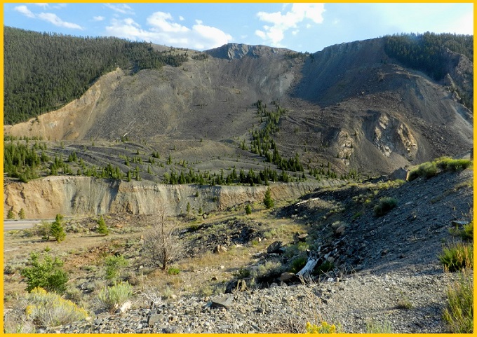
The Krol Group of rocks, consisting of slates, marls, sandstones, limestones, and dolomites with occasional small dyke intrusions, dominates the geology around Naini Lake. The lake is believed to have formed due to tectonic activity. Balia Nala, the primary stream feeding the lake, follows a fault line, while other tributaries align with major joints and faults.
A total of 26 major drains, including 3 perennial ones, feed into the lake. The catchment area features highly folded and faulted rock formations resulting from multiple phases of deformation. The surrounding hill slopes, being steep and geologically unstable, are highly prone to landslides and mass movements, triggered by both natural and human factors. Several significant landslides have occurred in the past, and many existing settlements around the lake are situated within identified landslide-prone zones.
Hotels near Naini Lake
India Hotel – Mall Road Nainital
Hotel Himalaya
Nainital Willows
Elphinstone The Lake Side
Hotel Welcome Park
Lake Side Inn
The Imperial Green
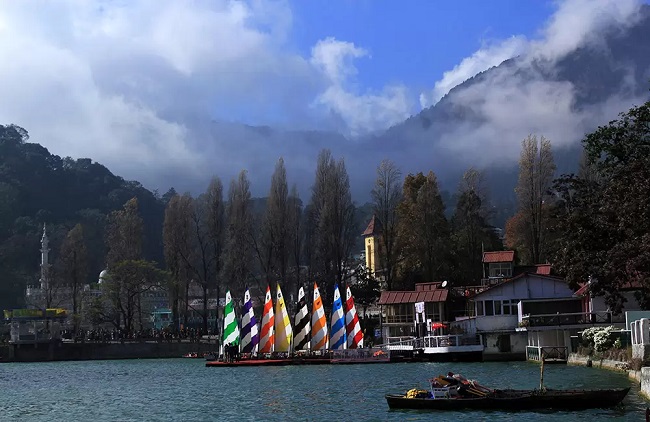
Naini Lake Boating
Boating on Lake is one of Nainital’s most popular attractions, offering picturesque views of the surrounding hills and the bustling town. Visitors can choose from different options, including rowboats (half-round or full-round) and paddle boats, with fares regulated by the government. Boating services typically operate from 6:00 AM to 6:00 PM, providing a tranquil and scenic way to experience the lake’s charm while enjoying glimpses of the lively Mall Road along the shoreline.
Kainchi Dham to Naini Lake distance
The distance between Kainchi Dham and Lake in Nainital is approximately 17–20 kilometers by road, depending on the route taken. The drive typically takes about 35 to 45 minutes under normal traffic conditions.
