
Rock of Gibraltar
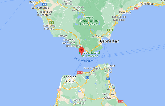
The Rock of Gibraltar is a monolithic limestone promontory located in the British territory of Gibraltar, near the entrance to the Mediterranean. It is 426 m high and Most of the Rock is covered by a nature reserve, which is home to around 300 Barbary macaques. These macaques, as well as a network of tunnels, attract many tourists from all around the world. The Rock of Gibraltar is known as one of the two traditional Pillars of Hercules, of Romans as Mons Calpe, the other pillar being Mons Abila, Monte Hacho or Jebel Musa on the African side of the Strait. According to ancient myths says Greeks and the Phoenicians, and the Romans, the two points marked the limit to the known world. Although the Phoenicians had sailed beyond this point into the Atlantic, both northward and southward. Rock of Gibraltar map showing the location of the Rock and major features on the map.
Geography and Geology
Gibraltar is located just south of Spain’s Costa del Sol on the Iberian Peninsula. It is separated from Spain by a small 1.6-kilometre-wide strip of land that has been turned into an airport runway. Gibraltar is just north of the Strait of Gibraltar and is just 13 km from Morocco. It is small, but it is one of the most densely populated countries in the world. Gibraltar is only 5 km long and 1.2 km wide, but has a population of 35,000. As a British overseas territory, Gibraltar is technically a part of Britain and certain jurisdictions are under British rule the UN has officially listed Gibraltar as a Non-Self-Governing Territory similar to The Cayman Islands and Bermuda.
Also read- Nastapoka Arc-A geological Puzzle in Hudson bay, Quebec
The Rock of Gibraltar is a monolithic Jurassic limestone promontory. The geological formation was created when the African tectonic plate collided tightly with Europe about 55 million years ago. The Mediterranean became a lake that, dried up during the Messinian salinity crisis. About 5 million years ago, the Atlantic Ocean broke through the Strait of Gibraltar, and as a result, flooding created the Mediterranean Sea.
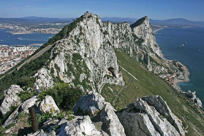
The Rock of Gibraltar is a monolithic promontory. The Main Ridge has a sharp crest with peaks nearly 426 m above sea level, formed by Early Jurassic limestones and dolomite. The rock is a deeply eroded and highly faulted limb of an overturned fold. The sedimentary strata composing the Rock of Gibraltar are overturned, with the oldest strata overlying the youngest strata. These strata are the Catalan Bay Shale Formation (youngest), Gibraltar Limestone, Little Bay Shale Formation (oldest), and Dockyard Shale Formation. These strata are noticeably faulted and deformed.
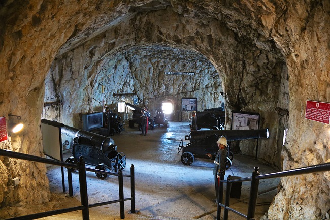
Fortification
The Rock is crisscrossed by a great complex of underground fortifications, known as the Great Siege Tunnels. This network of tunnels was begun by the British in 1782, during the Great Siege of Gibraltar by the Spanish. When World War II began in 1939, the civilian population was evacuated to the United Kingdom, Jamaica, and Madeira so that Gibraltar could be fortified against the German attack. In 1942 there were over 30,000 British soldiers, sailors, and airmen on Gibraltar Rock. The tunnel system was expanded, and the Rock became a keystone in the defence of shipping to the Mediterranean.
Attraction in Rock of Gibraltar
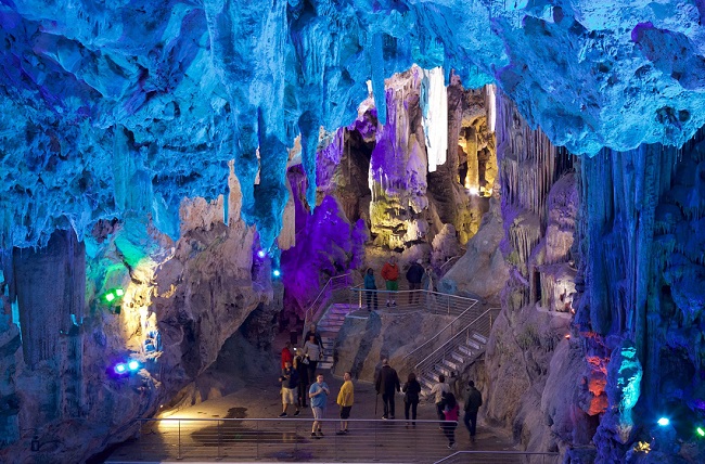
St. Michael’s Cave
St. Michael’s Cave is the largest of the island’s more than 150 caves. It lies at least 274 meters above sea level and is full of spectacular stalactites and stalagmites. First recorded in AD 45, and is known to have sheltered Neanderthals more than 40,000 years ago. The legends say that the island is secretly connected to Africa via a 24-kilometre-long tunnel. The largest area of the cave, the Upper Hall, is connected via 5 passages to a smaller hall.
Barbary macaques
Gibraltar is famous for its Barbary macaques, a species native to Morocco and the only monkeys living wild anywhere in Europe. The best place to see them is in the Upper Rock Nature Reserve on the island. They’re wild and do bite. Also, from time to time, they venture into the town.
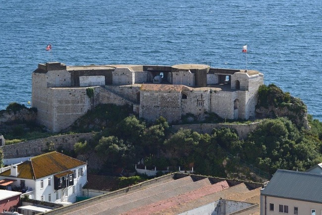
Hike to the Highest Point and O’Hara’s Battery
Gibraltar’s Highest Point is some 426 meters tall and is well worth exploring. The place is reachable by Gibraltar Cable Car. Here one can find O’Hara’s Battery, an impressive artillery fortification that was built in 1890. Now open to the public, it’s worth a visit to see how these large artillery pieces worked. Travellers can also enjoy superb views from Signal Hill.
The Great Siege Tunnels
This is the most significant military installation in the Mediterranean, and an engineering marvel. Carved out of the sheer face of the “Notch,” the northern face of the Rock, using nothing but manual Labour, these tunnels were built by the British in just six weeks as a Defense against a combined force from France and Spain when they attacked to recapture the Rock from the British.
How to Get to the Rock of Gibraltar
There is an airport at the Rock of Gibraltar. The airport landing strip is located at the border and runs between Spain and Gibraltar. The best way to reach the Rock of Gibraltar is from the Spanish Side of Gibraltar in La Linia border. It was a 30-minute walk to the Rock of Gibraltar from here.


