The Thomson Dikes
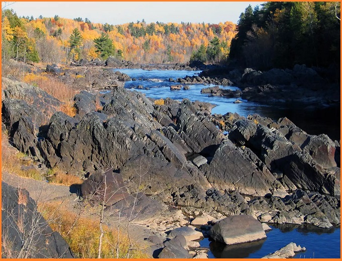
The Thomson Dikes in Minnesota are striking examples of diabase dikes—dark, mafic igneous intrusions that cut through much older sedimentary rocks of the Thomson Formation. These dikes formed during the Midcontinent Rift, a major tectonic event around 1.1 billion years ago, when magma rose from deep within the Earth and forced its way into fractures in the crust.
The Thomson Dikes are especially visible near areas like the St. Louis River and Thomson Dam, where erosion has exposed these resistant igneous bodies. Because diabase is harder than the surrounding sedimentary rocks, the dikes often stand out prominently in the landscape, forming ridges, cliffs, or linear rock features.
What is Dyke
Geologically, a dike is a sheet-like body of magma that intrudes vertically or steeply across pre-existing rock layers. At Thomson, these diabase dikes penetrate folded and metamorphosed rocks such as graywacke, slate, and siltstone, creating sharp, contrasting bands of dark igneous rock against lighter sedimentary host rocks.
The dikes typically trend in a northeast direction and often occur in swarms, reflecting repeated episodes of magma injection during rifting. They acted as feeders for ancient volcanic eruptions whose surface lavas have since been eroded.
Also read- Geotourism And Modern Geotechniques
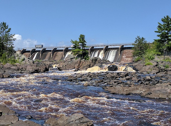
Thomson Dam
Thomson Dam, also known as Thomson Hydro Station or Thomson Water Project, is an embankment and concrete gravity dam located on the Saint Louis River near the town of Thomson. The structure includes a 488 m main dam along with several auxiliary dams, which together with Precambrian bedrock outcrops of the Thomson Formation impound the river to form the Thomson Reservoir.
Thomson Formation
The Thomson Formation consists of a thick sequence of interbedded metagraywacke, slaty graywacke (metasiltstone), and slate. Smaller amounts of phyllite and hornfels are also present, along with numerous diabase dikes throughout the area.
Despite undergoing lower greenschist-facies regional metamorphism, the primary sedimentary structures remain exceptionally well preserved. The bedding typically strikes within about 10° of east–west and dips moderately either northward or, more commonly, southward. Features such as load structures, convolute bedding, small-scale cross-bedding, and graded bedding are clearly visible at many outcrops. Previous sedimentological studies have identified a dominant north–south paleocurrent direction, a subordinate east–west trend, and a northerly source region for the sediments.
The entire area has been influenced by at least one major folding event, producing generally open, upright, subhorizontal, and symmetric to asymmetric folds that trend east–west and contain axial-planar cleavage.
Also Read- Nonesuch Potholes, Michigan: An Unforgettable Natural Phenomenon
How To Reach The Thomson Dikes
The Thomson Dam (and adjacent geological dikes) is located near Thomson, MN, along MN-210, close to Jay Cooke State Park. You can reach it by parking at the Greely Creek trailhead on Highway 210, which accesses trails leading toward the dam area. The dikes are best viewed near the swinging bridge and along the river where Hwy 210 crosses.


