Chesapeake Bay
The Chesapeake Bay is the largest estuary in the United States, located in the Mid-Atlantic region. It is primarily separated from the Atlantic Ocean by the Delmarva Peninsula, which includes parts of Maryland’s and Virginia’s Eastern Shores and the state of Delaware.
The bay’s southern entrance lies between Cape Henry and Cape Charles. Spanning Maryland in the north and Virginia in the south, the Chesapeake Bay plays a vital role in the ecology and economy of both states and the broader watershed region.
Over 150 major rivers and streams flow into its vast 166,534 km² drainage basin, which encompasses portions of six states—New York, Pennsylvania, Delaware, Maryland, Virginia, and West Virginia—as well as Washington, D.C.
The Chesapeake Bay extends roughly 320 kilometers, from the Susquehanna River’s northern headwaters to its opening at the Atlantic Ocean. At its narrowest, the bay is only 4.5 kilometers wide between Plum Point in Kent County and Romney Creek. Its widest section stretches 48 kilometers just south of the Potomac River’s mouth, which serves as the border between Maryland and Virginia.
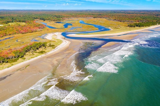
Estuary- An estuary is a partially enclosed coastal body of water where freshwater from rivers blends with saltwater from the ocean, forming a brackish transition zone. These environments are among the most productive on Earth, providing vital habitats and serving as nurseries for numerous fish and shellfish species. Protected from the open sea by natural barriers such as islands and peninsulas, estuaries play a key role in supporting biodiversity as well as human activities like transportation, fishing, and recreation.
Geology
The Chesapeake Bay is a ria, or drowned valley, formed from the ancient Susquehanna River when sea levels were lower. The Chesapeake Bay’s geology, shape, and location are rooted in a massive bolide impact at the end of the Eocene epoch, approximately 35.5 million years ago, which created the Chesapeake Bay impact crater and, subsequently, influenced the formation of the Susquehanna River valley.
Also Read- Ultimate Blue Ridge Mountains Vacation That Brings Your Dreams Come True
Around 10,000 years ago, as sea levels rose following the last ice age, the Susquehanna River valley flooded, giving rise to the modern bay. Along parts of the bay, particularly the Calvert County, Maryland, shoreline, stand the Calvert Cliffs, formed from ancient marine deposits left by receding waters millions of years ago. These cliffs are renowned for their rich fossil beds, particularly for fossilized shark teeth that are often found along nearby beaches. The nearby community of Scientists’ Cliffs, established in 1935, was named to reflect its founders’ vision of creating a retreat for scientists.
Tourism
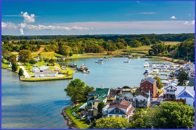
The Chesapeake Bay is a major attraction for tourists visiting Maryland and Virginia each year. Its waters offer a wide range of recreational activities, including fishing, crabbing, swimming, boating, kayaking, and sailing, all of which contribute significantly to Maryland’s tourism-driven economy. Annapolis, in particular, is often highlighted as a favorite destination for families and water sports enthusiasts. Commentator Terry Smith once reflected on the bay’s charm, noting its remarkable natural beauty.
Chesapeake Bay Map
Map showing the Chesapeake Bay, located between Maryland and Virginia. This estuary lies between the Delmarva Peninsula to the east and the North American mainland to the west, highlighting its unique geography and the major areas.

Chesapeake Bay Bridge
The Chesapeake Bay Bridge, or simply the Bay Bridge, is a major dual-span bridge in Maryland that stretches across the Chesapeake Bay. It links the state’s rural Eastern Shore with its urban and suburban Western Shore, connecting Stevensville to Sandy Point State Park near Annapolis, the state capital. The original span, completed in 1952 and measuring 6.4 km long, was once the world’s longest continuous over-water steel structure. A parallel span was added in 1973. The bridge is named after William Preston Lane Jr., Maryland’s 52nd governor, who initiated its construction in the late 1940s.
Chesapeake Bay Bridge-Tunnel
The Chesapeake Bay Bridge–Tunnel (CBBT), officially named the Lucius J. Kellam Jr. Bridge–Tunnel, is a 28.3 km engineering marvel that spans the mouth of the Chesapeake Bay, connecting the Delmarva Peninsula with the Hampton Roads region in Virginia. Opened in 1964, it replaced the ferry service that had operated there since the 1930s. The bridges were dualized in 1999, and work began in 2017 to add a parallel tunnel.
Also read- Geotourism and Modern Geotechniques
Comprising 19 km of bridges and two tunnels, each about 1.6 km long, the CBBT is one of only 14 bridge–tunnel systems worldwide—and one of just three in both Hampton Roads and the entire United States. Carrying U.S. Route 13, it shortens travel between Hampton Roads and the Delaware Valley by approximately 153 km and 1.5 hours compared to routes through the Washington–Baltimore area.
How long is the Chesapeake Bay Bridge
Maryland’s Chesapeake Bay Bridge spans 4.3 miles, while the separate Chesapeake Bay Bridge–Tunnel in Virginia is significantly longer, stretching 17.6 miles across the bay’s mouth.


