Lake Urmia
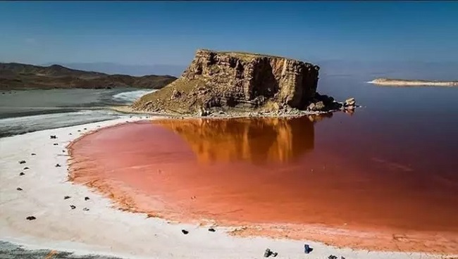
Lake Urmia, a vast hypersaline lake in northwestern Iran, lies between East and West Azerbaijan provinces, west of the Caspian Sea. At its largest, it was the Middle East’s biggest lake and ranks as the sixth-largest saltwater lake in the world, covering about 6,000 km². The lake stretches 140 km in length, 70 km in width, and reaches a maximum depth of 20 m. By late 2017, Lake Urmia, Iran, had shrunk to just 10% of its former area and held only 1/60 of its 1998 water volume, primarily due to prolonged drought, extensive damming of inflowing rivers, and intensive groundwater extraction. The lake, along with its roughly 102 former islands, is designated as a national park under the protection of the Iranian Department of Environment.
Lake Urmia, Iran, once contained around 102 islands, the largest of which was Shahi Island. As water levels declined, the island eventually became a peninsula connected to the lake’s eastern shore. Shahi Island holds historical significance as the burial site of Hulagu Khan, a grandson of Genghis Khan, and his son Abaqa. Both were laid to rest in a castle perched atop cliffs rising more than 300 m. above the lake’s edge.
Lake Urmia Map
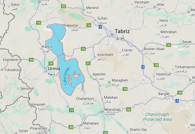
The lake is located between the provinces of East Azerbaijan and West Azerbaijan in Iran, and west of the southern portion of the Caspian Sea. Lake Urmia, one of the world’s largest salt lakes, lies to the east of the city, and the border with Turkey lies to the west.
Lake Urmia Shrinkage
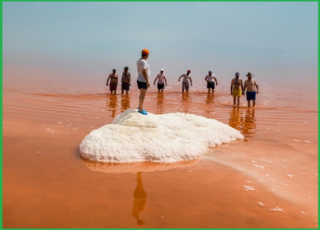
Lake Urmia in Iran is an example of a closed-basin lake undergoing severe shrinkage. Since 1995, reduced inflows have led to a steady decline in its surface area. As an endorheic lake, Urmia receives water only from rainfall and river runoff. With no natural outflow, water leaves the lake solely through evaporation, making its levels highly sensitive to fluctuations in rainfall and human water use. When inflowing rivers are diverted for agriculture or other purposes, the lake’s natural balance is disrupted.
Ramsar Site
Lake Urmia was recognized as a Biosphere Reserve and a National Park (Ramsar Site) on 23 June 1975. Lake is a vast hypersaline lake dotted with numerous islands and bordered by extensive brackish marshes. Fed by rainfall, springs, and streams, the lake experiences seasonal fluctuations in both water level and salinity. The surrounding marshes host reed beds and support large breeding colonies of waterbirds, notably between 40,000 and 80,000 pairs of flamingos. The site also serves as a critical staging area for migratory waterbirds.
Also read- Navi Mumbai: The City Beyond Dreams
To Do List for Visitors
How to Reach Lake Urmia
To visit Lake Urmia in northwestern Iran, the most convenient entry point is Shahid Madani International Airport in Tabriz. From there, you can take a taxi or train to Azarshahr, a nearby city close to the lake. From Azarshahr, local transport or a private car can take you directly to the lake, its national park, and the surrounding attractions.


