Pulpit Rock Norway
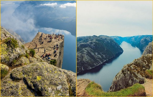
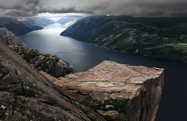
One of the world’s natural wonders and the most breathtaking viewing platform, Preikestolen or Pulpit Rock, is located close to the town of Stavanger, Norway. Preikestolen, popularly called Pulpit Rock, a unique square-shaped rocky cliff 604 meters above sea level that looks over Norway’s Lysefjord. The cliff is a 6 km hike from the base of the Preikestolen Fjellstue Mountain.
Athlete Thomas Peter Randulf first noticed Preikestolen Pulpit Rock. While onboard the ship Oscar II, Randulf spotted the enormous plateau hanging above Lysefjorden. He decided to conquer the massive flat rock above the fjord. Preikestolen became one of Norway’s most well-known tourist attractions.
In 2015, Lonely Planet ranked Preikestolen Rock Mountain as number 1 on their listing of “most breathtaking viewing platforms” in the world. Every year, a number of people from all over the world hike the 6-kilometer trail up to Preikestolen.
How it formed
The fjord was created by glaciers. Millions of years ago, the area around the Lysefjord was a shallow mountain valley that had been created as rivers and creeks eroded the landscape. During the ice ages, this valley was covered with glaciers.
Toward the end of the last Ice Age, 10,000 years ago, as the glaciers carved out, debris was pushed downward and outward along the valley while the sea level simultaneously began to rise. Over time, the debris accumulated into massive piles and walls, known as moraines.
Also read- The Lewisian Gneiss- One of the Oldest Gneiss rocks in Scotland
The seawater eventually broke through the valley’s end moraine, and it’s causing it to flood. At this point, the fjord was formed. Though the floor of the Lysefjord is 457 meters below sea-level at its deepest point, the end moraine at the mouth of the fjord resulted in a depth of just 13 meters.
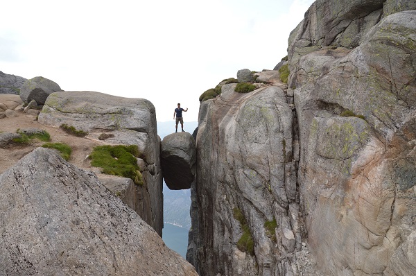
There is much scenic beauty in this terrain. The location Kjeragbolten is a rock formation in which a large rock is stuck in a crack in the mountain. It has the appearance of a bolt, hence its name Kjeragbolten.
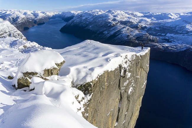
The best time to go to Preikestolen is in the summer. The hike is also open during the winter months. The hike is very risky; you shouldn’t attempt it in Norway’s mountains, as the rocks on the trail can be extremely slippery. There are several flights a day from Oslo to Stavanger Airport. From there, you can easily reach Lysefjord.
Pulpit Rock Hike
Hiking to Preikestolen (Pulpit Rock) is arguably Norway’s most famous outdoor experience. Scaling Preikestolen is a world-class 8–9 km journey that rewards hikers with a breathtaking 604-meter drop-off over the Lysefjord. Starting from the Fjellstue, this moderate 4–5 hour trek climbs 500 meters of rugged terrain and is best tackled during the prime window of May through October.”
Hike Details-
Distance: 8 km (5 miles) round trip. Time: 4–5 hours total (including time for photos at the top). Elevation Gain: ~500 meters (1,640 feet). Difficulty: Moderate. It is not a “walk in the park”—there are steep sections with stone stairs (built by Nepalese Sherpas) and some rocky scrambling.
Alo Read- Geotourism And Modern Geotechniques
Pulpit Rock Campground
The famous 1,982-foot Pulpit Rock Campground cliff is located near Jørpeland, about a 30-minute drive from Stavanger, overlooking the Lysefjord. They offer everything from standard tent/RV spots to “Hikers’ Nests” (mini cabins) and even a mountain lodge if you want a real bed before the big hike. It is the closest possible place to stay to the start of the Preikestolen hiking trail. Unique Features are floating saunas on the lake, pedal boat rentals, and a 20-hole disc golf course.
How to Reach Pulpit Rock
To reach Pulpit Rock (Preikestolen) in Norway, travel to Stavanger via flight, then take a bus or drive (approx. 40-60 mins) to the Preikestolen Basecamp. From there, it is a 4–5 hour round-trip hike (roughly 8km total) featuring moderate to difficult terrain, with the trailhead offering parking and amenities.