Water Pocket Fold
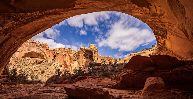
The Water Pocket Fold is one of the most amazing landscapes on the planet. Capitol Reef National Park is America’s known to everyone, mainly because of the magnificent Water pocket Fold. A water pocket is a 160-km-long, monocline sharp fold of Earth’s crust that was formed when thick layers of horizontal sedimentary rocks, mainly Sandstones, shales, mudstones, and limestones, had been deposited in the region. The Water pocket Fold extends from southern Wayne County in northern Kane County of southern Utah, United States.
Geology
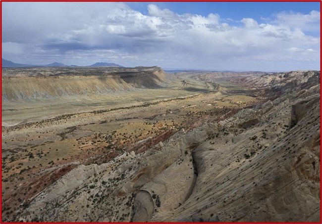
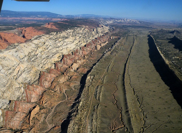
This Long Fold belt creates the most outstanding geological feature on the Earth. The landscape of rugged cliffs and canyons, striking natural bridges, arches, and other distinct formations makes the landscape unique in the region. This warp in the Earth’s crust is a classic monocline fold. A monocline is essentially a single fold in rock strata. Water Pocket fold formed between 50- 70 million years ago when a major mountain-building process, the Laramide orogeny, reactivated in a fault zone in western North America. Movement along the fault caused the west side to shift upwards relative to the east side.
The overlying sedimentary layers were exposed above the fault and formed a monocline. The rock layers on the west side of the fold have been lifted more than 2,134 m higher than the layers on the east. Water pocket owes its name to deep potholes found in the canyons that can hold water for years. Recent uplift of the entire Colorado Plateau and the resulting erosion have exposed this fold at the surface within the last 15 to 20 million years.
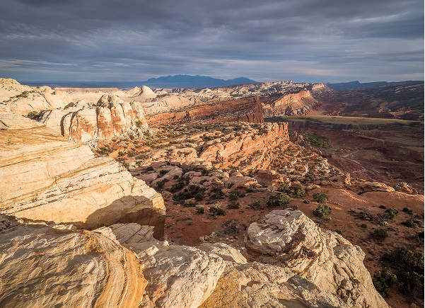
Parallel ridges of the Fold rise from the desert like the swell of giant waves rolling toward the shore. Capitol Reef is named for a particularly colorful section of the fold where rounded Navajo sandstone forms capitol-like domes and sheer cliffs. These cliffs form a barrier to travel and are often referred to as a “reef.”Cathedral Valley, at the northwestern boundary, is the lower end of the incline, highlighted by deep erosion and free-standing tower-like sandstone monoliths. The vast Bentonite Hills roll at the southern end of the park.
Also Read- 8 Best Natural Hot Springs in the USA
Other Scenic features
Parallel to the Water Pocket Fold, there is the Notom-Bullfrog Road. There are many trailheads and gorgeous vistas from the Notom-Bullfrog Road. For a breathtaking backdrop, you can take the Burr Trail, which cuts across the Fold. Hiking and horseback riding are popular on the Burr Trail; here, visitors can see natural bridges, sandstone arches, and other majestic formations.
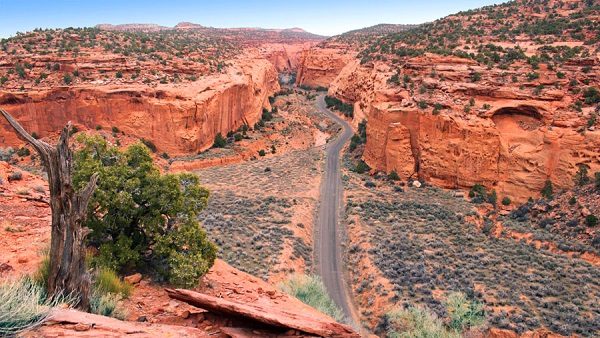
Notom-Bullfrog Road passes through some significant places, such as Burro Wash, Sheets Gulch slot canyons, and Cottonwood Wash. These canyons are clustered together, making the area a popular destination for hikers.
Also read- Geotourism and Modern Geotechniques
Lower Muley Twist Canyon is well-known to hikers. Its narrow, deep, contorted canyon trailhead is found at the top of the Burr Trail. Upper Muley Twist Canyon displays dramatic views of the Water Pocket Fold. Here, visitors can see the rock that has been eroded into strange formations, like huge arches. Along the Notom-Bullfrog Road, there are five camping sites, where visitors can stay and take an adventurous view of the surrounding landscape.
Scenic Highway 24 runs through the heart of the park and is the only paved road that crosses the rugged terrain of the Water Pocket Fold. There are tons of slot canyons and trails to be explored in Capitol Reef.
The nearest airport to the Capitol Reef National Park is Salt Lake City. For a scenic approach to the National Park, the visitors start at Bryce Canyon National Park and follow Utah 12 over Boulder Mountain to Utah 24.
How To Reach Water Pocket Fold
The Waterpocket Fold is located within Capitol Reef National Park, reachable via Highway 24. Once in the area, the Fold can be explored mainly using the Burr Trail Road or the Notom-Bullfrog Road. The Notom-Bullfrog Road begins off Highway 24, while the Burr Trail Road offers spectacular vistas and connects from the west (Boulder) or the south (Route 276).


