The Incredible Geological Feature-Saar Loop in Mettlach
Saar Loop Mettlach
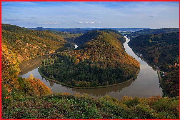
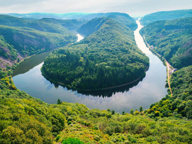
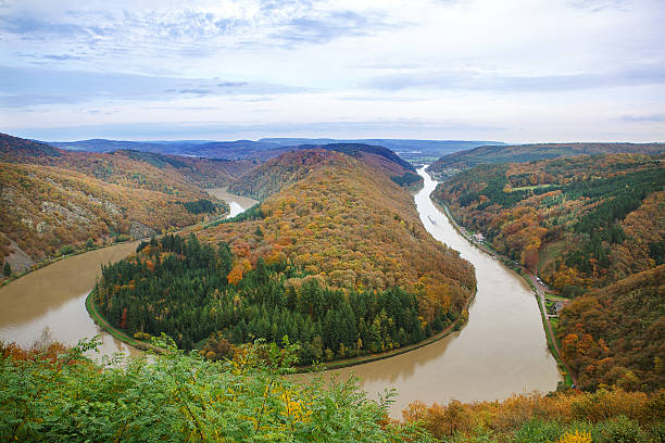
The Saar Loop is located near the town of Mettlach on the Saar River in Saarland, Germany. The loop is a natural bend in the river that forms a horseshoe-shaped curve, and it is one of the most famous and picturesque spots in the region. The loop is surrounded by forested hills and offers stunning views of the river valley. “Saar Loop”, a distinctive hairpin turn in the course of the Saar River is a popular destination for outdoor activities such as hiking, cycling, and fishing, and there are several trails and lookout points that provide visitors with excellent views of the surrounding scenery.
Mettlach itself is a charming town known for its historic architecture, particularly its half-timbered houses and the Abbey of St. Lutwinus. The town is also famous for being the home of Villeroy & Boch, a renowned manufacturer of ceramics and tableware. The river makes a sharp bend and flows back on itself, creating a loop-like shape, Thats he name The Saar Loop.
Saar River
The Saar is a river in northeastern France and western Germany, and a right tributary of the Moselle. IThe river rises in the Vosges mountains on the border of Alsace and Lorraine and flows northwards into the Moselle near Trier. It has two headstreams, that both start near Mont Donon, the highest peak of the northern Vosges. After 246 kilometres (129 kilometres in France and 117 kilometres in Germany) the Saar flows into the Moselle at Konz between Trier and the Luxembourg border. It has a catchment area of 7,431 square kilometres.
Geography
The Saar River originates in the Vosges mountains on the border of Alsace and Lorraine, in France, then it flows through western Germany to its confluence with Mosel river, near Trier. Within Germany the Saar River pursues a winding course and reaches a barrier in the form of Hunsrück, a low mountain range that made of hard quartzite rock. Here the river, unable to carve a way through this hard rocks and makes a full 180-degree turn and cuts a deep U-shaped gorge through the thick mountains.
This remarkable Horseshoe bend located above Mettlach that i sknown as Saar Loop or Saarschleife in German. The river flows parallel for a long stretch in the opposite direction before turning left and continuing its northward journey towards Mosel river. The best views of Saar loop is near a rocky lookout point at the apex of the Saar loop about 180 meters above the river.
Also read- An Extraordinary Sandstone Feature in Germany- The Externsteine Rock
The Church of St. Gangolf and the ruins of the 12th century Montclair Castle lies in a ridge near Saar loop. The castle is located about 290 metres above sea level on the high ridge of the Saar loop and known as Castle Hill. It can be reached by boat. A continuous walking and bike path runs both on the inside as well as on the outside loop.
Saarland Region
Saarland is a federal state (Bundesland) in southwestern Germany. It is the smallest state by area and the second smallest by population. Saarland shares borders with France, Luxembourg, and the German states of Rhineland-Palatinate and North Rhine-Westphalia. The region has a long history of being contested between France and Germany, and its unique culture reflects this blend of influences. Saarland has a diversified economy, with a mix of industry, services, and tourism. The region is known for its scenic countryside, historic towns and castles, and rich cultural heritage, and it attracts many visitors each year.
How to get Saar Loop Mettlach
Saar Loop is about a 30-minute drive from Saarbrücken and can be reached via the A8 motorway. Travelers can also take a train from Saarbrücken to Mettlach, and from there, take a bus to the Saar Loop viewpoint. Bus number 156 operates on this route. If you’re feeling adventurous, you can also bike or hike to Saar Loop from nearby towns. There are several trails that lead to the viewpoint.
