How is that possible?
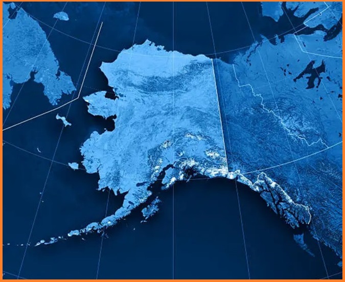
Alaska extends so far west that it crosses into the eastern hemisphere. Semisopochnoi Island, part of Alaska’s Aleutian Islands, is technically the easternmost point in North America.
At the eastern tip of Semisopochnoi Island in the Aleutian chain lies the easternmost point in the United States (179.777°E). Surprisingly, this island is closer to Russia than it is to mainland Alaska. However, it’s not the closest point to Russia’s distinction belonging to Little Diomede Island in the Bering Strait. Little Diomede is just 4 km from its Russian counterpart, Big Diomede, despite being separated by a 21-hour time difference.
Also Read- When Los Angeles Meets San Francisco: A Tectonic Tale
Just 105 km southeast of Semisopochnoi Island lies the westernmost point in the United States, located in the Alaska Maritime National Wildlife Refuge (179.143°W). This refuge, made up of several uninhabited islands, represents one of the most remote outposts on America’s northern frontier. But the Aleutian chain extends even farther west. The westernmost and most remote point is Attu Station, located at 172°E. Attu sits just 770 km from Ust’-Kamchatsk on the Russian mainland—a stark contrast to the 2,400 km needed to reach Anchorage.
Westernmost: Alaska’s Aleutian Islands stretch far into the western hemisphere, making it the westernmost state in terms of longitude.
Easternmost: The Aleutian Islands also cross the 180th meridian (the International Date Line), placing some of them in the eastern hemisphere. This technically makes Alaska the easternmost state as well!

Geography of Alaska
Alaska occupies the northwestern corner of the North American continent, bordered to the east by Canada. It is one of only two U.S. states not sharing a border with another state, the other being Hawaii. Alaska is geographically unique with more ocean coastline than all the other U.S. states combined. About 800 km stretch of Canadian territory, primarily British Columbia, separates Alaska from the state of Washington. As a result, Alaska is an exclave of the United States—part of the continental U.S. and the West Coast but not connected to the contiguous states.
The State is bordered to the east by Yukon and British Columbia in Canada, to the south by the Gulf of Alaska and the Pacific Ocean, to the west by Russia (Chukotka Autonomous Okrug), the Bering Sea, the Bering Strait, and the Chukchi Sea, and to the north by the Beaufort Sea and the Arctic Ocean.
