Sierra Nevada California
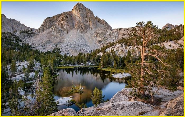
Sierra Nevada Mountains also known as the “Range of Light,” is one of the most beautiful single continuous ranges in the United States. The mountain range is located between the Central Valley of California and the Great Basin. The Rockies is the longest mountain range in the United States, while the Sierra Nevada is the longest continuous and unified mountain chain. This mountain chain is located in the Western United States, mainly in California and Nevada, forming America’s “western backbone. The range is home to sequoias, the world’s largest tree. The Sierra is home to 3 national parks, twenty wilderness areas, and 2 national monuments. These areas include Yosemite, Sequoia, and Kings Canyon National Parks and Devils Postpile National Monument.
Geography Of The Sierra
The Sierra Nevada straddles the Western United States. The Basin and mountain Range Province flank the Sierra Nevada on the east, with the Central Valley of California on the west. The Mojave Desert borders the mountain range on the southeast. The Sierra Nevada mountain range is 640 kilometers long from north to south, 110 kilometers wide, and occupies an area of approximately 63,100 sq. km. Some Notable features within the range include Hetch Hetchy Valley, Kern Canyon, Lake Tahoe, and several long rivers.
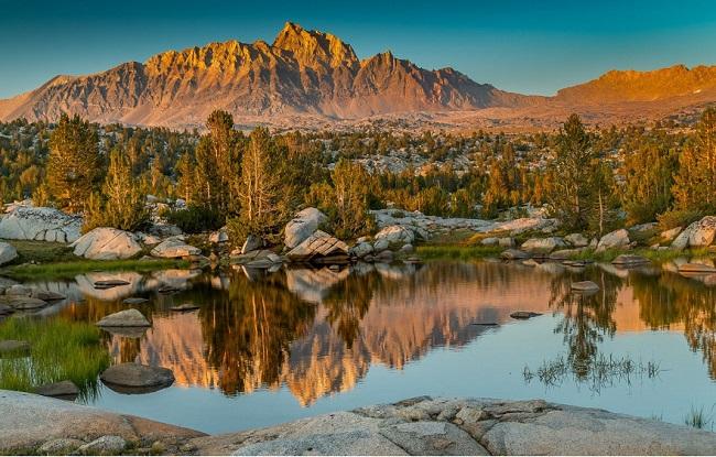
The Sierra Nevada Mountains have a magnificent skyline, making it one of the most beautiful physical features in North America. It is part of the American Cordillera and is drained by several rivers discharging into the nearby water bodies. The San Joaquin River and its tributaries drain the middle third of the west slope and empty into the Suisun Bay at San Francisco. Sacramento River and Kings Rivers are notable rivers. apart from these some other rivers those drain in the eastern part of the sierra are Susan, Truckee, Carson, Walker, and Owen Rivers.
Geology Of The Sierra Nevada Mountains
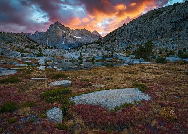
The Sierra Nevada California was formed by the uplifting and upfaulting of the Earth’s crust millions of years ago. More than one hundred million years ago during the Nevadan orogeny, granite formed deep underground. Although the uplifting began millions of years ago, the major events that shaped the Sierra Nevada took place about 5 million years ago. The events were associated with the crustal extension of the Basin and Range Province. The oldest rocks in the Sierra Nevada are metasedimentary, which comprise schists, marbles, slates, and hornfels. Granite rocks began forming in the Triassic period and are found mostly on the north and crest’s east. This Erosion by glaciers exposed the granite and formed the light-colored mountains and cliffs that make up the range.
The uplift caused a wide range of elevations and climates in the Sierra Nevada, which are reflected by the presence of 5 life zones. Uplift continues due to faulting caused by tectonic forces, creating spectacular fault block escarpments along the eastern edge of the southern Sierra.
History Sierra Nevada
The exploration of Sierra Nevada California began around 1827 with Jedediah Smith, the first American to explore the mountains. In 1833, Joseph Reddeford Walker found a route to California. many tribes live in Siera Nevada- The Martis people inhabited the northcentral parts of Sierra Nevada as early as 3,000 BCE. The Paiute tribes, Sierra Miwok, Tubatulabal, and Kawaiisu tribes are lives here. California Gold Rush is what made the Sierra Nevada Mountains famous. The gold began in 1848 when James Marshall discovered a shiny object at Sutter’s Mill. By March 1848, rumors about the gold discovery had spread across San Francisco.
Read More- A Tranquil Town in Granite Terrain-Boulder Colorado
Weather in the Sierra Nevada
Sierra Nevada Mountains’ proximity to the Pacific Ocean and its mid-latitude location is responsible for the mild mountain climate in the region. California’s Mediterranean climate also influences the Sierra Nevada’s weather patterns. Winter temperature below -18 degrees Celsius is common in the valleys and rare on the mountain slopes. The summer days are generally dry. The summer temperatures average 6-32 degrees Celsius. Winters are generally cool, with heavy snow.
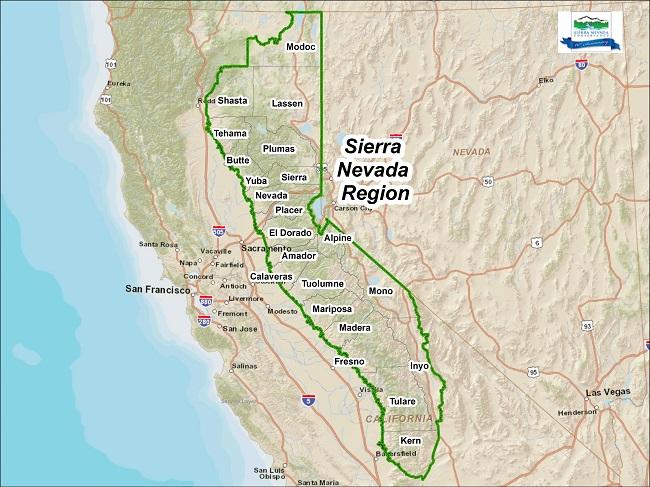
Sierra Nevada Mountains Map shows the famous location and distance from Nevada. San Francisco is in the west of the mountains while las vegas are in the south-east side.
Attraction in the Sierra Nevada Mountains
Sequoia National Park
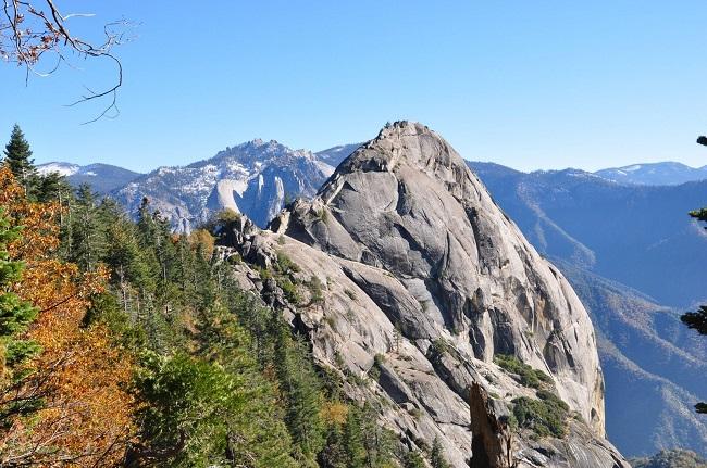
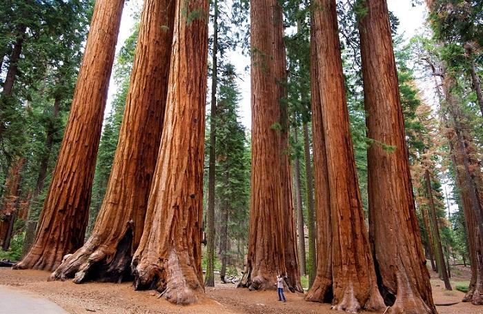
Sequoia National Park is located in the southern Sierra Nevada east of Visalia, California. The park contains the highest point in the contiguous United States, Mount Whitney, 4,421 m above sea level. The park is known for its giant sequoia trees, including the General Sherman tree, the largest tree on Earth by volume. The General Sherman tree grows in the Giant Forest, which contains 5 of the 10 largest trees in the world. UNESCO designated the areas as Sequoia-Kings Canyon Biosphere Reserve in 1976.
The Devil Postpile National Monument
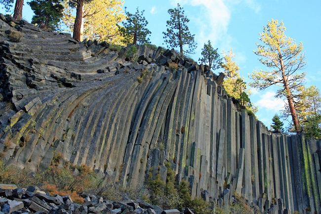
Devil’s Postpile National Monument is a National Monument located near Mammoth Mountain in Eastern California. The monument protects Devil’s Postpile, an unusual rock formation of columnar basalt. The Basalt flow is all closely and perfectly fitted together like a vast mosaic. The formation is a rare feature in the geologic world and ranks as one of the world’s finest examples of columnar basalt. Its columns tower 20 meters high and display an unusual symmetry. The monument encompasses a 7323 ha area and includes two main attractions: the Devil’s Postpile formation and Rainbow Falls, once called a gem unique. When the sun is overhead, a bright rainbow highlights the spectacular falls.
The Kern Canyon
The Kern Canyon is a canyon in Kern County, California. It is located in the Southern Sierra Nevada. The canyon was formed by the Kern River and connects the Kern River Valley and southern San Joaquin Valley. California State Route 178 follows the canyon, from east of Bakersfield up to the Lake Isabella area.
Lake Tahoe
Lake Tahoe is a freshwater lake in the Sierra Nevada of the United States. It is Lying at an elevation of 1,897 m and straddles the state line between California and Nevada. Lake Tahoe is the largest alpine lake in North America, Its depth is 501 m. The lake was formed about 2 million years ago as part of the Lake Tahoe Basin, and its modern extent was shaped during the ice ages. It is known for the clarity of its water and the panorama of surrounding mountains on all sides. Lake Tahoe is a major tourist attraction in both Nevada and California. It is home to winter sports, summer outdoor recreation, and scenery enjoyed throughout the year. Snow and ski resorts are a significant part of the area.
Sources- Worldatlas.com, Wikipedia.org,


