Sandakphu Darjeeling- A Dreamland and Paradise for Trekkers
Sandakphu Darjeeling
Sandakphu or Sandakpur is the highest peak in West Bengal situated on the border of West Bengal of India and Nepal. It is 83 km from Darjeeling and a wonderful place to experience Darjeeling Tourism with the best trekking places in Eastern Himalayas. Sandakphu is the highest point in the Singalila range situated at an altitude of 3640 meters. Sandakphu means ‘Height of the Poison Plant’ and derives its name from the poisonous plants that grow in the Mountain. Sandakphu is a ‘Trekkers Wonderland’ along the Singalila range and is considered the highest trek in West Bengal.
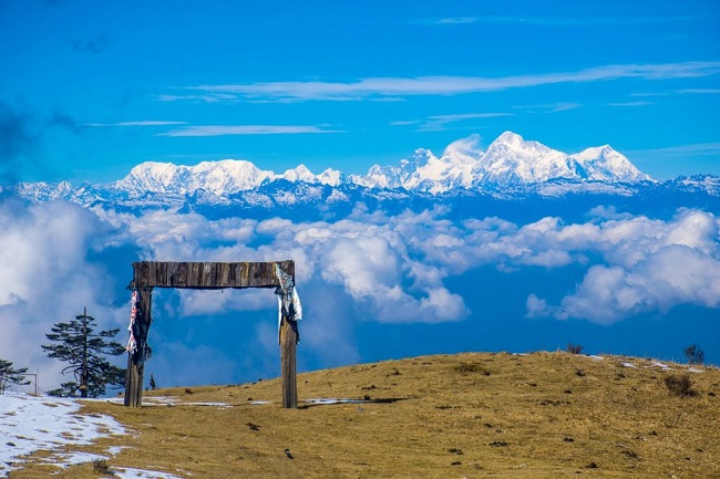
Four of the five highest peaks in the world, Everest, Kangchenjunga, Lhotse and Makalu can be seen from its summit. Sandakphu is a true paradise for all adventure lovers. From the highest point on this hill station, one can get never seen views of the Himalayan Range. A long stretch of the Himalayas starting from Bhutan to Mt. Everest is visible. River Teesta flows through the lower valley of Sandakphu Darjeeling. The thundering River Teesta also offers a great option for adventure sports, especially river rafting. It is the only place in the world where you will find rhododendron and silver fir forests.
Geography
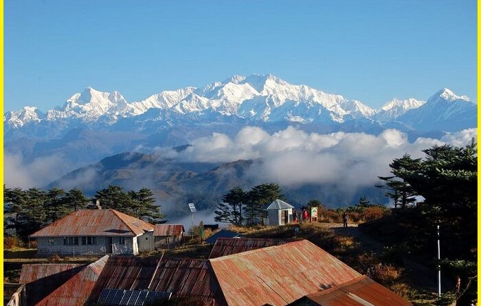
Sandakphu Darjeeling is a mountain peak in the Singalila Ridge on the border between India and Nepal. It is the highest point in the state of West Bengal. The peak is located at the edge of the Singalila National Park and has a small village on the summit with a few hotels. Four of the five highest peaks in the world, Everest, Kangchenjunga, Lhotse and Makalu can be seen from its summit. From here the pristine view of the entire Kangchenjunga Range is also seen. Sadakphu trek is perhaps one of the best and certainly the most popular of all the treks in Darjeeling. It offers the travellers an excellent view of the Kanchenjunga and the Everest group of mountain peaks in Nepal, Sikkim and Bhutan.
Also, read- Doodhpathri-a Piece of Heaven in Pir Panjal range Kashmir
Sandakphu Trek
The trek along the Singalila Ridge to Sandakphu-Phalut trek is one of the most popular Among the tourist. Trekkers can see the stupendous vistas of the Kangchenjunga and Everest ranges with seasonal wildflowers and opportunities for birdwatching. Treks begin at Manebhanjan which is 28 km from Darjeeling. The traveller needs to take a permit from the Forest Department located by the roadside just before the steep uphill route starts from Maneybhanjang. Taking a guide and optionally porters for the trek to Sandakphu and Phalut is mandatory. Maneybhanjang to Meghma a 9 km. the trek is a steep climb and one needs to trek another 2 km to reach Tonglu. There is a Trekkers Hut at Tonglu.
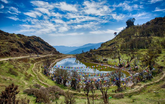
Tonglu to Tumling (2 km) and then to Gairibas (7 km) is a gradual descent making it an easy route for the trekkers. There is a Trekkers Hut at Phalut as well. One can be rewarded with an awesome view of some of the highest peaks in the world including the Everest group, Kanchenjunga, Chamolhari, Pandim and Three Sisters.
The Sandakphu Trek route inside the Singalila National Park has four legs or stages.
- Manebhanjan to Meghma (2600 m)- This is a 4-hour trek through the lower forest. The route goes via Chitre.
- Meghma to Gairibans (2621 m): There are two alternative trekking routes. They respectively go via Tonglu (3070 m) and Tumling (2900 m). From Tumling, a shorter trail cuts through Nepal and Jaubari (2750 m).
- Gairibans to Sandakphu (3636 m)-
- Sandakphu to Phalut (3600 m): It is a one-day trek via Sabarkum (3536 m) covering 21 km.
On this trekking route, Jamuna is most valuable for trekkers. There are many beautiful places like Dhap Pokhari, and Choyatar (an area for red pandas). There is a three jungle Hile Samudayik Ban, Choyatar Samudayik Ban, Hangetham Samudayik Ban.
Sandakphu Darjeeling Tourism
Phalut
Phalut is the second-highest peak in West Bengal, located inside the Singalila National Park. The Phalut top is try junction of Nepal, Sikkim and India and the best place for Sandakphu Darjeeling tourism. The word Phalut is derived from the Lepcha word Fak-Luk which means ‘Barren Peak’. A small bunkhouse of the Indian Army can be found on the peak. The indigenous tribes that live near Phalut are called Phalutians. They have worshipped the peak as a god for more than 300 years and refer to the peak as “Omna Re Ay”.
Tumling
Tumling is famous for the view of the snow-capped peaks of the Singalila and the Kanchenjunga range. it is the best place for a night halt with assorted lodges dotting its sedate green environs. The lights of the towns of Darjeeling, Kurseong, Pasupati (Nepal), Siliguri and other places can be viewed on a clear night from this point. Tonglu to Tumling (2 km) and then to Gairibas (7 km) is a gradual descent making it an easy route for the trekkers. There is a trekker’s hut at Gairibas. Gairibas to Kalipokhri is a continuous 6 km climb through the rhododendron forest. There is a small pond at Kalipokhri called ‘Black pond’ which never freezes.
Chitre
Chitre, 1.5 hours trek Chitre is a small village about 3 km from Manebhanjan located at an altitude of 2542 meters. The route up to Chitre passes through pine, fir, and birch forests and bamboo glades. This part of the trek route is quite steep and really warms you up.
Gairibas
Gairibas is further 1km ahead and located at an altitude of 8,600 ft. From Tumling, up to Jhaubari is a gradual descent and a relatively easy trek. But after Jhaubari it is a steep descent up to Gairibas. There is a tea stall in Gairibas. Piping hot vegetarian momos are a great experience. The stall also offers noodles, toast and other snack items, and even meals. You can get packaged snacks, biscuits, soft drinks and bottled water. Opposite the stall is a check post of the Armed Border Force.
Shrikhola
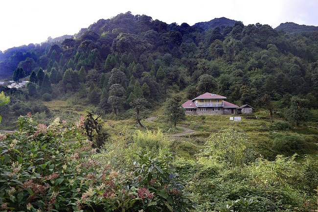
Srikhola is another place on the trek. This is where the vehicular roads end. On the way between Gurdum and Srikhola is a small village of Timbure which has some Sandakphu homestay accommodations. From Srikhola trekkers drive out through Rimbik and Maneybhanjan and back to Darjeeling or Siliguri.
Sandakphu weather
The summer season in Sandakphu usually starts from the month of April and continues till June. During this time, the average temperature in Sandakphu is 24 degrees Celsius during the day and 12 degrees Celsius at night. The weather remains pleasant and enchanting during this time.
Autumn arrives in the region of Sandakphu by Mid September and continues up to the month of October.
Sandakphu temperature-The best time for Trek is April to May when the temperature ranges from 6° C to 12° C. Travellers can also trek after the monsoon starting from October to early December when the temperature ranges from 1° C to 6° C.
How to Reach Sandakphu Darjeeling
The best way to reach Sandakphu is to first reach these cities- Siliguri, Bagdogra or Darjeeling and then reach Manebhanjan, Dhotrey and Rimbikb. New Jalpaiguri and Bagdogra are the nearest Airports. New Jalpaiguri serves as the nearest railhead to the base camp of the trek. Hire a cab or a bus from there to reach Darjeeling and then Sandkphu.
Pingback: Tirthan Valley-The Best Kept Secret of Himachal Pradesh - Geotourism