Joshimath Uttarakhand
Joshimath or Jyotirmath is a sacred place in Uttarakhand and the winter seat of Lord Badri. Situated in the Chamoli District, Joshimath is the place where one of the four ‘Maths’ was established by the Adi Shankaracharya in the 8th century. The city is dotted with a number of temples like Narsimha and Gaurishankar and the sacred Kalpvriksha, which is said to be 1200 years old. Located at a height of 1875 m Joshimath is also a gateway to several Himalayan mountain climbing expeditions, trekking trails and pilgrim centres like Badrinath.
Geography and Geology
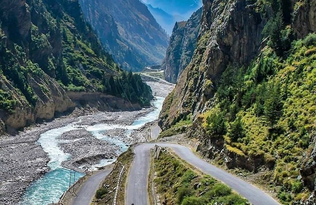
The Joshimath town is located on the middle slopes of a hill that is bordered on the west and east by the Karmanasa and Dhaknala streams and on the south and north by the Dhauliganga and Alaknanda rivers. Karmanasa, Patalganga, Belakuchi and Garurganga are a few streams that have their beginnings in the Central Himalayan region near Kunwari Pass. This drainage empties into the Alaknanda and Dhauliganga river. The District Chamoli is surrounded by Uttarkashi in North-West, Pithoragarh in the South-West, Almora in South East, Rudraprayag in the South-West and Tehri Garhwal in the West.
Since 7 February 2021, the area was severely affected by the 2021 Uttarakhand flood and its aftermath. The town is confirmed to be sinking due to its geographic location being along a running ridge. Structures around the town developed cracks and town people had to be evacuated.
Joshimath Uttarakhand is sinking due to tectonic activity because it is on a fault line and close to two other ones. A geological fault line called the Vaikrita Thrust (VT) almost touches Joshimath. Additionally, the Main Central Thrust (MCT) and Pandukeshwar Thrust (PT), two major geological faults, are relatively near the town. Joshimath Village is placed within the effect zone of any tectonic activity on MCT as it passes beneath Helang, a small town to the south of Joshimath, and juxtaposes with the rocks of the Garhwal Group.
The geology of the region is the part of Himalayas, the youngest mountains in the world. The section of the range is deeply cut into by the headwaters of the Alaknanda river, this trunk stream seeming to have reached a later stage of development than its tributaries. This much, however, is known that there has been an intense metamorphosis.
The upliftment in the area has been taken place in the mid-Pleistocene period and there are great stretches of high subdued topography and deepest gorges. The northern division and higher part are occupied by higher ranges and snow-covered peaks consisting entirely of medium to high-grade metamorphic rocks and are intruded by later volcanic rocks. The South Division is occupied by ranges of lower altitudes, with sedimentary and low-grade metamorphic rock also intruded by later volcanic rocks. They consist of rocks such as gneisses, limestone, phyllites, quartzite, sericite-biotite schists and slates.
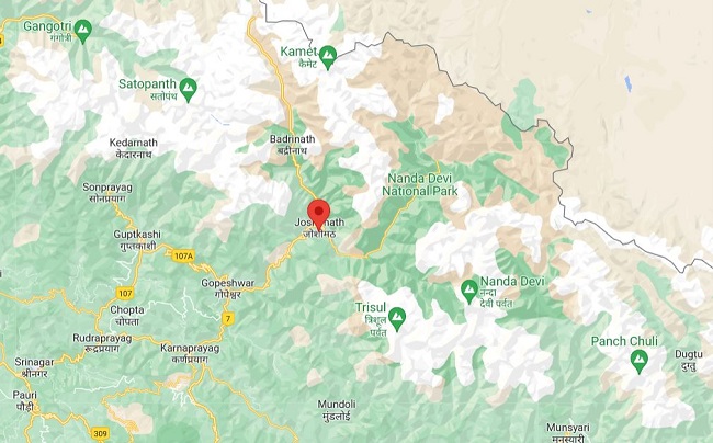
Weather Joshimath Uttarakhand- Joshimath has a Tundra climate. The district’s yearly temperature is 5.97ºC. Joshimath typically receives about 76.88 millimetres of precipitation and has 132.27 rainy days annually. Joshimath Map Shows the Location of Major cities and towns near Joshimath.
Best activity in Joshimath Uttarakhand
Blessed with the beauty of the Himalayas, Uttarakhand is an adventurer’s paradise. Both Garhwal Himalayas and Kumaon Himalayas have incredible treks for beginners and seasoned trekkers. Skiing in Auli is the best activity in Joshimath with many ski resorts and mesmerizing natural vistas. In the month of December, this place starts getting visitors who can enjoy skiing on the Snow. Mountain Biking– Joshimath is well-connected to many popular and offbeat places through both paved and dirt roads. Therefore, one can enjoy thrilling mountain biking in and around Joshimath. Trekking- Joshimath is a getaway to many trekking trails including Kuari Pass, Valley of Flowers and Bagini Glacier, Amongst these, the Valley of Flowers trek is the most popular one.
Attraction near Joshimath
Vishnu Prayag
Vishnu Prayag is a holy confluence of the Alaknanda and Dhauliganga rivers, tucked at 1,372 metres above sea level in the Chamoli district of Uttarakhand. The riveting Vishnuprayag is the first one among the Panch Prayag, the other four being Nandaprayag, Karnaprayag, Rudraprayag and Devprayag according to descending order of river. The name is due to the mighty river Alaknanda also known as ‘Vishnu Ganga‘ which blends with the river Dhauliganga that flows from the Niti Valley. There is also a suspension bridge which helps the visitors to cross the surging Alaknanda River.

Nanda devi Wildlife sanctuary
Nanda Devi National Park was established in the year 1982. The park is home to the second-highest mountain in India, Nanda Devi, which stands tall at a height of 7816 m. From here one can see the sight of the majestic Himalayan peaks like Changband, Dunagiri, Rishi Pahar, Trishul and many more. The park was renowned as a World Heritage Site by UNESCO in the year 1988. The park is pampered with a wide variety of wild creatures like Snow Leopard, Himalayan Tahr, Musk Deer and birds over an area of 630.33 sq km. It is also the home to the Nanda Devi Sanctuary and is one of the must-visit tourist destinations in Uttarakhand as its beautifully adorned with an extensive range of flora and fauna.
Valley of Flowers- Valley of flowers which is part of Nanda Devi National Park is spread over 87 square kilometres of area, situated at an altitude of 3500 m. The Valley of flower is declared a UNESCO World Network of Biosphere Reserves since 2004 offers mesmerizing views and is remarkably beautiful with a lot of species of flowers. Some rare species that can be spotted during the peak season is Brahma Kamal. The waterfalls, landscape, and lush green meadows add to the beauty of this place.
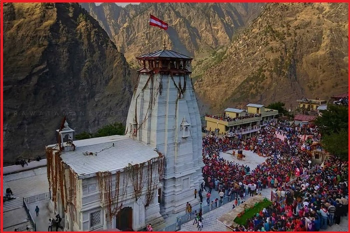
Badrinath Temple
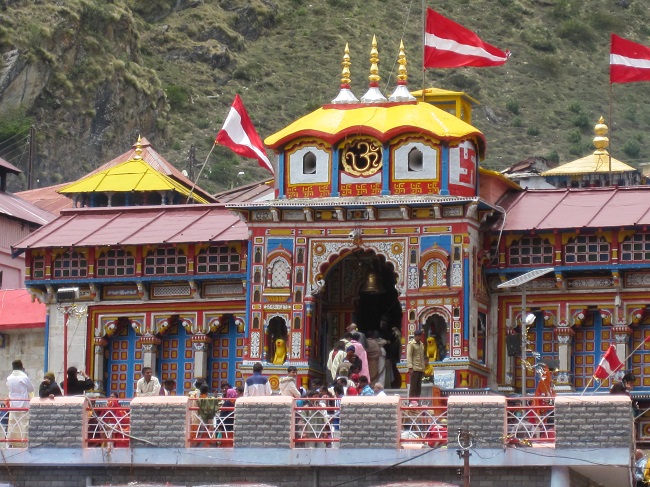
The picturesque town of Badrinath is a major Hindu religious centre, located at a height of 3,133 meters. The place is the pre-eminent abode of Lord Vishnu and is one of the holiest of the holy shrines of the Char Dham pilgrimage in India. Other Char Dham sites include Dwarka, Puri and Rameswaram. Situated between Nar and Narayan peaks, the pious land of Vishnu also belongs to the Chota Char Dham Yatra in Uttarakhand. Starting with Yamunotri, Gangotri and Kedarnath, Badrinath is the last and most celebrated stop in the pilgrimage tour of the Garhwal Himalayas. Around 3 km from Badrinath is the village of Mana, which is one of the last villages before the boundary of India ends and that of Tibet begins.
Kagbhusandi Tal
The Kagbhusandi lake (Tal) is situated some 46 km from Joshimath over the Kankul pass. It is said that it is cursed by crows. If crows fly over this lake they will die. People have found many crow feathers around the lake.
Biagini Glacier– Biagini Glacier is Some 58 km from Joshimath. The glacier is a well-known tourist attraction because of the trekking and camping activities held here. Vasudhara Waterfall-Vasudhara Waterfall is located near Badrinath temple and is a mesmerizing place. It is often used as a stoppage point for tourists who are trekking from Mana Village to Vasudhara waterfall. It is 52 km from Joshimath.
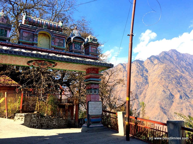
Shankaracharya Math
This is the math established by Adi Shankaracharya in North India. The math has temples of Badrinarayan and Rajrajeshwari Devi. It has a sacred cave where Adi Shankaracharya supposedly undertook Tap (meditation).
Narsingh Temple
Narsingh temple is an ancient temple of Lord Vishnu in Narsingh Avtar and the main temple of Joshimath. It has an idol of Lord Narsingh, which is considered established by Shankaracharya. When Badrinath temple remains closed during winter every year, an idol of Lord Badri is brought to Narsinh temple and worshipped for six months.
Bhavishya Kedar Temple- It is said that the present Kedarnath will disappear along with Badrinath and re-appear in Bhavishya Kedar temple at Joshimath. Tapovan- Tapovan has situated 10 km from Joshimath. It has natural hot water springs. The river Dhauliganga is visible from this Place. Gari Bhawani Temple and Kalpeshwar is other best place to see near Joshimath.
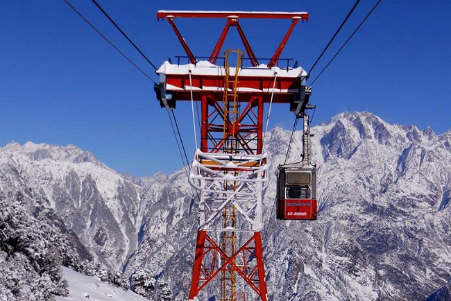
Ropeway
A ropeway to Auli is popular among tourists and one of the longest ropeways in Asia. The ropeway is the fastest route for tourists to go to Auli. It is open only during the winter season (November to March).
How to reach Joshimath Uttarakhand
The nearest airport to Joshimath is Jolly Grant Airport Dehradun at a distance of 286 km. and Rishikesh is the nearest railway head at a distance of 256 km. However, the fastest way to reach the place is Ambala cant railway station. from here one can reach Joshimath via Bus.
Summer is the best season to visit Joshimath because the temperature remains between 26 and 27-degree Celsius and this is the best time to Trek the valley and go for a long walk. The temperature in winter ranges between sub- 0 and 8 degrees Celsius. But even during this time, Joshimath Uttarakhand serves a dense number of tourists.


