Great Adventure destination Bolivia’s Altiplano; travel to explore the Geology and beautiful landscape.

Lake Titicaca occupies snow-white crystals of the world’s largest salt flats with flocks of pink flamingos in a brick-red lake with clear azure waters. The Altiplano offers a spectacular, vividly colored scene for travelers. People could easily spend a month exploring this region for geological as well as research purposes.
The Altiplano plateau is sandwiched between the western and eastern chains of the Andes Mountains. The eastern chain is called the Cordillera Real. The Andes are the classic example of introductory geology to study how subduction of an oceanic plate beneath a continental plate forms mountains. But this concept fails to account for the Altiplano’s lofty elevation, which is the subject of debate among the geoscientist.

The high topography of most mountain ranges and plateaus is supported by thick continental crust. Where two plates converge, the crust is shortened by stacking one slab of crust atop another along a thrust fault, which makes it thick. The 70-kilometer-thick crust beneath Bolivia’s Altiplano is among the thickest on Earth.
Also, read- The ‘Red Beach’? A unique place in the world, which you never heard of before!
Lake Titicaca
Lake Titicaca Located near Altiplano’s northern edge and making the border between Bolivia and Peru. it is South America’s largest lake, both by surface area and volume. The sparkling, snow-covered peaks of the Cordillera Real mountains reflected in the azure blue water are breathtaking sights. For the last 8,000 years, the Lake Titicaca Basin has been home to numerous civilizations. Tiwanaku controlled the area during the first millennium A.D and the Inca, conquered this region in the 15th century.

Salar de Uyuni
The Salar de Uyuni, the world’s largest salt flats situated On Bolivia’s southern Altiplano. The Salar’s salt-encrusted surface covers more than 10,000 square kilometers, is stark white. It is said that the pancake-flat Salar is all remains of paleo-Lake Tauca. This lake covered as much as 80,000 square kilometers of the Altiplano area between 18,500 and 8,500 years ago.

The salar is one of Bolivia’s most important mineral resources place. Salt has been mined here since the 16th century. Apart from this ulexite, a fibrous boron mineral used in fertilizers and lithium is also mined from this place; the salar is one of Earth’s largest sources of lithium, the lightest metal. The U.S. Geological Survey estimates 5.5 million tons of lithium in the Salar de Uyuni which is roughly half the world’s reserves.
Volcanoes And Fumaroales
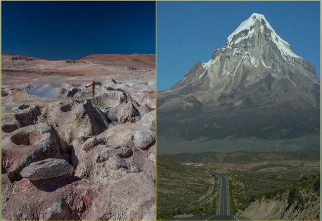
Apart from this you can see tucked between towering volcanoes and quinoa fields in this harshly beautiful and extremely remote landscape. San Antonio, Uturuncu, Licancabur, and Ollague are the names of volcanoes that admired the view together in the Bolivian plateau.

There are two other attractions; in the Stone Tree, a rock that has been carved by the wind into a treelike shape, and the Sol de Manana geothermal field, where boiling mud pots and steaming fumaroles can wonder you. The clouds of steam and smell of sulfur feel like a sky-high adventure in this spectacular part of the Andes.

Bolivia’s main El Alto International Airport is located 13 kilometers from the country’s capital, La Paz. This airport connects major destinations in South America, including Lima, Peru. Santiago, Chile, and Buenos Aires, Argentina with connecting flights to Miami and Los Angeles, Washington.


