Fernando de Noronha Archipelago: A UNESCO World Heritage Gem

Fernando de Noronha Archipelago

Fernando de Noronha until 1988, is an Atlantic Ocean archipelago belonging to the state of Pernambuco, Brazil. It lies about 354 km off the Brazilian coast and comprises 21 islands and islets, covering a total area of 26 km². The main island, which gives the archipelago its name, is the only inhabited one, spanning 18.4 km²  with an estimated population of 3,101 as of 2020. While much of the archipelago is relatively low-lying, some areas rise above 100 m in elevation.

The islands hold a unique administrative status in Brazil, forming a “state district” governed directly by the state of Pernambuco, even though they are geographically closer to Rio Grande do Norte. This district also encompasses the remote Saint Peter and Saint Paul Archipelago, situated 625 km northeast of Fernando de Noronha. In 1988, 70% of the islands’ area was designated as a national marine park.

In 2001, UNESCO recognized the archipelago as a World Heritage Site for its vital role as a feeding ground for tuna, sharks, sea turtles, and marine mammals. The islands observe UTC−02:00 year-round.

Geology

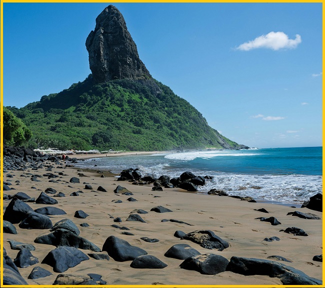
The islands of this archipelago represent the exposed peaks of a submerged mountain range. It comprises 21 islands, islets, and volcanic rock formations. The main island, which accounts for 91% of the total area, spans 18 km², measuring about 10 km in length and up to 3.5 km in width. The base of this massive volcanic structure lies 756 m below sea level. The volcanic rocks are diverse but predominantly silica-undersaturated, featuring lava types such as basanite, nephelinite, and phonolite. Other notable islands include Rata, Sela Gineta, Cabeluda, and São José, along with the islets of Leão and Viúva. The main island’s central highland is known as the Quixaba.

Fernando de Noronha

Tourism

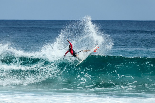
Fernando de Noronha’s beaches are major attractions for tourism and recreational diving. Among the most famous are Baía do Sancho, Baía dos Porcos, Dolphins Bay, Sueste Bay, and Praia do Leão. Thanks to the South Equatorial Current, which brings warm waters from Africa, divers can explore depths of 30 to 40 m without a wetsuit, with underwater visibility reaching up to 50 m.

Also Read- Floating Wonders in World’s Highest Navigable Lake

On the side facing the Brazilian mainland, the beaches appear in this order: Baía do Sancho, Baía dos Porcos, Praia da Cacimba do Padre, Praia do Bode, Praia dos Americanos, Praia do Boldró, Praia da Conceição, Praia do Meio, and Praia do Cachorro. The Atlantic-facing side has only three beaches: Praia do Leão, Praia do Sueste, and Praia do Atalaia. A popular walking route to explore the island begins at Praia dos Americanos, continues through Praia do Boldró, Praia da Conceição, and Praia do Meio, and ends at Praia do Cachorro.

Dolphin Bay is home to an extraordinary population of resident dolphins, while during low tide, Rocas Atoll unveils a breathtaking landscape of lagoons and tidal pools brimming with fish, along with a diverse array of shellfish, sponges, mollusks, corals, and other marine life.

How to Reach Fernando de Noronha Archipelago
To reach the Fernando de Noronha Archipelago, travelers must fly from mainland Brazil, with direct flights departing from Recife (Pernambuco) and Natal (Rio Grande do Norte), operated by airlines such as Azul and Gol. All visitors are required to pay an Environmental Preservation Fee either before arrival or upon entry. As the islands are a protected area with restricted access, it is essential to book flights and accommodations well in advance.
Flights to Fernando de Noronha- You can fly direct to Fernando de Noronha (FEN) several times per week with Azul and Gol. The journey takes about 1 hour 20–25 minutes, covering approximately 552 km.

Related Posts

Ultimate Punta Cormorant: Hidden Beach & Wildlife Adventure

Punta Cormorant, situated on the northern tip of Floreana Island in the Galápagos Islands, is famous for its distinctive green sand beach formed by olivine crystals, alongside a contrasting white coral sand beach

Avery Island: A Stunning Salt Dome and Wildlife Sanctuary in Louisiana

Avery Island, historically known in French as Île Petite Anse, is a notable salt dome widely recognized as the birthplace of Tabasco hot sauce. It is located in Iberia Parish in the U.S. state of Louisiana, about three miles (4.8 km) inland from Vermilion Bay

Leave a Reply

Your email address will not be published. Required fields are marked *

You Missed

Taconic Unconformity: Shocking Earth’s Missing Strata Revealed!

Taconic Unconformity: Shocking Earth’s Missing Strata Revealed!

Hanging Rock Klint, Indiana: Stunning 400-Million-Year-Old Fossil Reef

Hanging Rock Klint, Indiana: Stunning 400-Million-Year-Old Fossil Reef

Ultimate Punta Cormorant: Hidden Beach & Wildlife Adventure

Ultimate Punta Cormorant: Hidden Beach & Wildlife Adventure

Epic Geological Wonder: Palisades Sill, New Jersey

Epic Geological Wonder: Palisades Sill, New Jersey

Fort Dodge Gypsum Gypsum, Iowa: A Hidden Mississippian wonder

Fort Dodge Gypsum Gypsum, Iowa: A Hidden Mississippian wonder

Spectacular Ardnamurchan Ring Complex: Hidden Volcanic Secrets of Scotland

Spectacular Ardnamurchan Ring Complex: Hidden Volcanic Secrets of Scotland