Explore the world’s driest place ‘’The Atacama Desert’’ volcanoes ,hot springs and many more
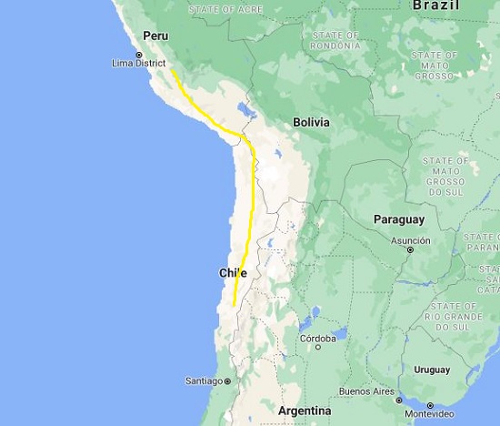
Chile’s Atacama Desert is the driest nonpolar desert on Earth. It stretches across a roughly 1,000 kilometers tract of land between the coastal Cordillera de la Costa mountain range and the Andes Mountains. The region consists of stunning geologic formations and has provided plenty of research opportunities to scientists. The Atacama is the oldest desert on Earth. It is experienced semiarid conditions for roughly the past 150 million years.
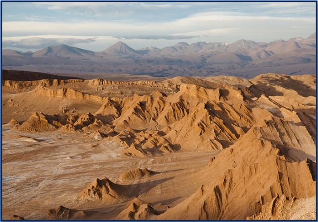
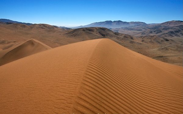
The Atacama, with its rust-colored rock canyons, snow-capped volcanoes, steaming, gurgling geysers, and turquoise sinkhole lakes are home to various species of plants and animals and a wonderful array of geological features. A rugged landscape of craggy outcrops, flat mesas, and vast sand dunes ringed by volcanoes that contrast against a brilliant sky. Vast salt flats, active geysers, and intense blue lagoons are just a few of the extraordinary features of this region.
The Atacama receives less than one millimeter of rainfall each year. Scientist Research shows that some of the Atacama’s riverbeds have been dry for 120,000 years, and some pockets of the South American desert are said to have never seen rain at all.
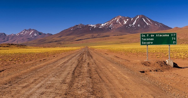
On the high Andean plateau, small villages San Pedro de Atacama situated up to 4,000 meters above sea level. It’s extreme and wonderful landscapes, quite unlike anywhere else on earth. The town is more than 1,000 miles from Santiago but has no airport. Streets are made of dirt, with no stoplights, and there is just one petrol station in 60 miles.
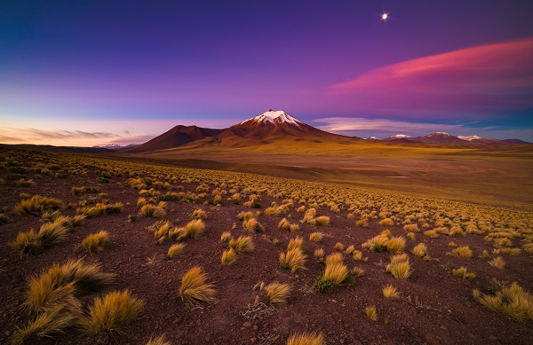
There are numerous volcanic cones, some exceeding 4,900 meters in elevation. The origin of the Atacama can be traced to the rise of the Andes, which began about 27 million years ago after the breakup of the Nazca and Cocos plates and the subsequent changes in the subduction geometry of the Nazca Plate below the South American Plate.
Also read- The driest place on earth: ‘The McMurdo Valley’, Antarctica; Explore the place on your own risk with possible extra-terrestrial life.
The Tertiary uplift of the Andes also gave rise to the Coastal Cordillera. The mountains of the Coastal Cordillera terminate in the north at the Morro de Arica, a steep promontory that overlooks the city of Arica.
Geologic wonderland
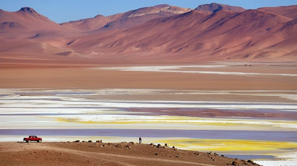
Most part of the Atacama Desert’s core is caked in thick salt deposits called Playas. It has stretch for miles and is nearly half a meter thick in some places. Alluvial fans, which are large, fan-shaped sediment deposits, connect the desert plateau with the mountains that surround it and suggest that water once flowed from the Andes into the desert.
Also read- Great adventure destination Bolivia’s Altiplano; travel to explore the Geology and beautiful landscape.
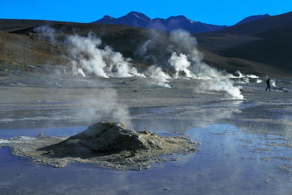
The Atacama also features a 700 km long and 20 km swath of desert known as the nitrate belt. Nitrate minerals can be used as explosives and fertilizer were mined extensively in the Atacama before the 1930s. There are hundreds of natural steam geysers around EI tatio, bubbling and spewing under the sunrise.
Apart from this some other minerals such as lithium, copper, and iodine, have also been mined nearby. The remnants of these mining operations can be seen from space. People can visit from Arica to the Lauca UNESCO sites. The ecological and geological diversity of northern Chile. Here you can see pelicans and sea lions on the coast to vicunas and flamingos in the salt flats, the limestone and sandstone of the Morro to the andesitic lava flows of Parinacota will challenge you to believe you are visiting the Atacama.