The Conewago Potholes
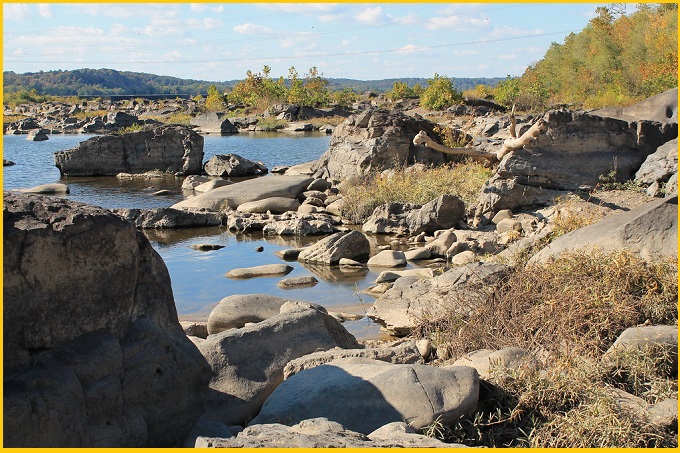
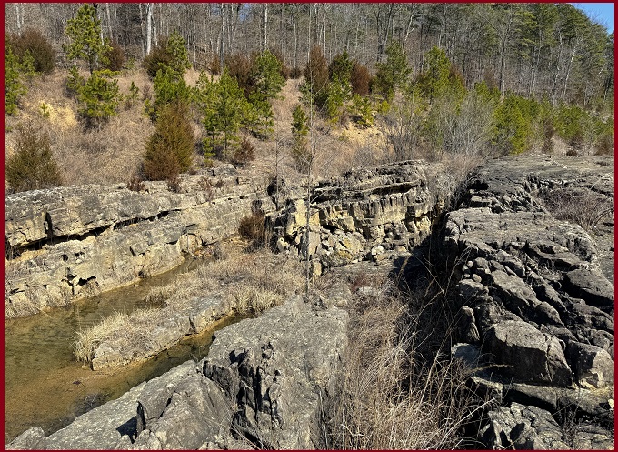
The Conewago Potholes are a striking geological feature found at Conewago wateralls along the Susquehanna River near Falmouth. These large, ancient cavities are usually visible during periods of low water in late summer and early autumn. Formed in hard Diabase, the potholes were gradually drilled by powerful vortices of sand-laden glacial meltwater, producing a dramatic, otherworldly landscape that attracts hikers and geology enthusiasts.
The pot holes of Conewago are probably one of America’s most extensive displays of deeply bored and sculptured igneous rock in a river bed. These were uncovered in 1947 for the first time in the memory of man when the drought parched the Susquehanna River, which retreated far below its normal low stage.
Geology
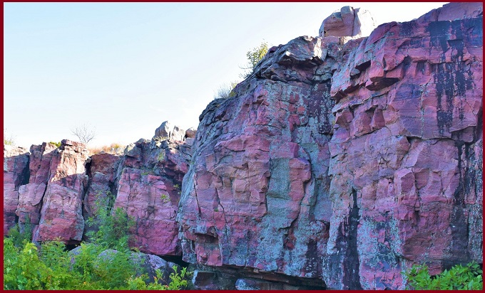
Numerous potholes, ripple marks, and smoothly sculpted rock surfaces become visible at Conewago along the Susquehanna River. These features are carved into a tough, dark igneous rock, which intruded into the region as magma roughly 200 million years ago during a period of continental rifting that thinned the Earth’s crust. The resistant diabase, along with nearby rocks that were hardened by the intense heat of the magma, narrows the river channel and concentrates the flow of water.
Formation
The striking sculpted patterns in the rock illustrate the powerful erosive ability of moving water. Potholes likely formed where fast-moving, sand-laden currents created vortices at weak points in the rock surface. As the swirling water trapped quartz sand, it acted like a natural drilling tool, grinding and deepening the holes over time. Some potholes reach several feet in both diameter and depth, though most measure about one to two feet across.
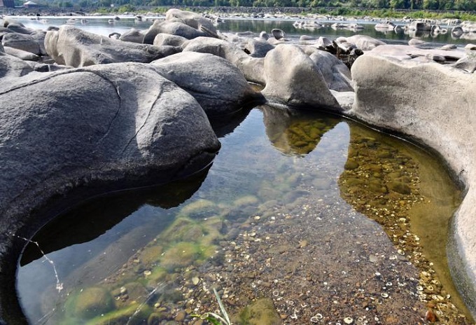
Because diabase is massive and extremely durable, it withstands the force of swift river currents while the constantly rotating, abrasive sand gradually wears it down. These erosional features at Conewago are believed to have developed during periods when the Susquehanna River carried enormous volumes of sediment-laden water from melting glaciers to the north.
Also read- Granite Pluton, Isle of Arran: A Paleocene Igneous Wonder
Evidence of the tremendous flow strength is seen in the large displaced blocks of diabase scattered nearby—some as large as trucks and weighing over 100 tons. Such extraordinary floods may have been triggered by the sudden failure of ice-dammed glacial lakes, while the narrow valley at Conewago would have further intensified the speed and power of the rushing waters.
Conewago Waterfall
Conewago waterfalls in Lancaster County were historically a major natural barrier along the lower Susquehanna River, located about 19 km downstream of Harrisburg. At this broad section of the river—nearly 2,400 m wide—the water descends about 5.8 m within a 0.40 km stretch on either side of Three Mile Island. The portion of the falls between the western bank and the island was later submerged after the construction of the York Haven Dam in 1904, which at the time ranked among the largest dams in the world. Today, that section of the falls lies beneath the waters of Frederic Lake along the island’s western side.
Also read- Geotourism And Modern Geotechniques
