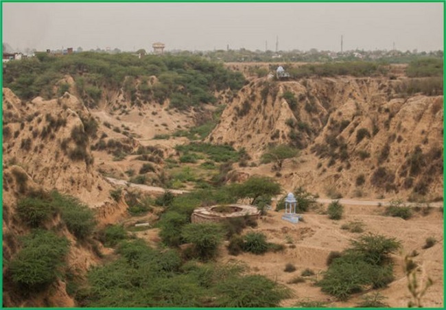
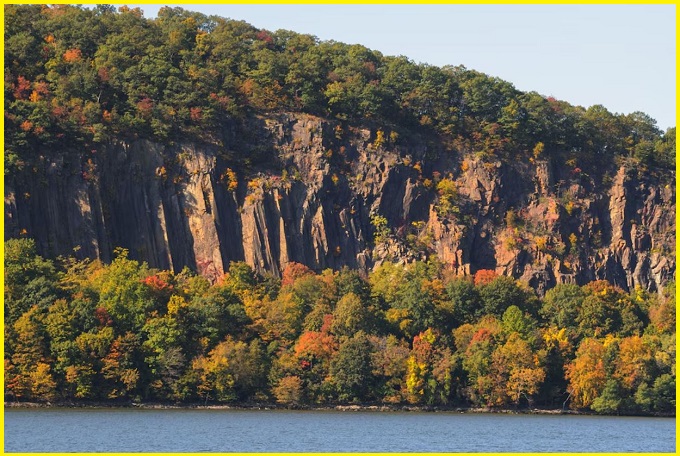
Chambal Ravines
The Chambal area in central India is one of the most complex regions in the world. The region’s major lifeline is the Chambal River. In this particular area, nearly 4,800 sq km of land has been affected by severely dissected ravines. Chambal ravines significantly increase soil loss from agricultural lands and severely impact agricultural productivity. This region is also known as Badland topography.
The badland topography is characterized by an undulating floodplain, gullies, and ravines. By definition, it is a type of dry terrain where softer sedimentary rocks and clay-rich soils have been extensively eroded by wind and water. Badlands are terrains with intense past or present erosion that create extremely impressive erosion landforms on Earth. They have poorly consolidated sediments and regolith, scarce vegetation, and intense drainage, all of which make agriculture and grazing impossible.
Chambal ravines are a type of fluvial erosional feature and are formed as a result of constant vertical erosion by streams and rivers flowing over semi-arid and arid regions. Chambal ravine erosion is actually a slow natural disaster and is a great threat to the inhabitants of the region. The formation of ravines slowly engulfs valuable agricultural land each year. There are no major industries in the Chambal valley, so the alternative livelihood options are dependent on agriculture.
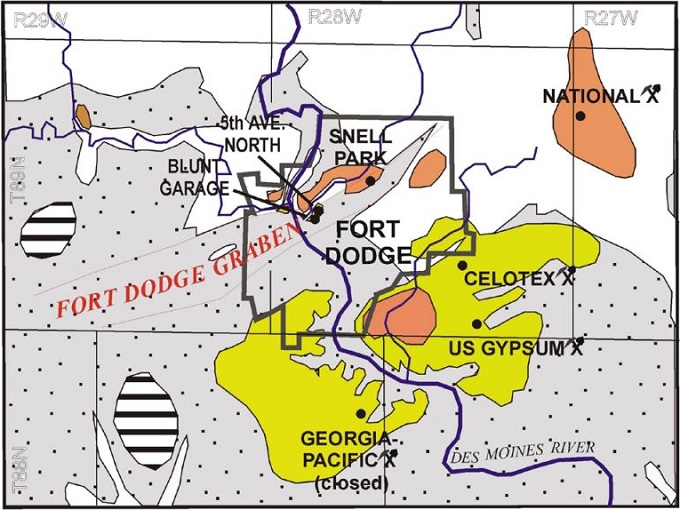
Chambal Ravines Map
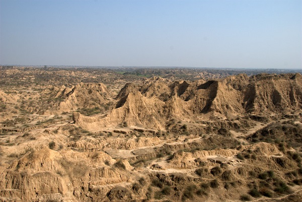
The ravines (or badlands) are a distinctive and often rugged area carved by the Chambal River. The most well-known and protected part of this area is the National Chambal Sanctuary, which spans parts of Madhya Pradesh, Uttar Pradesh, and Rajasthan, and protects the unique ecosystems and wildlife of the region.
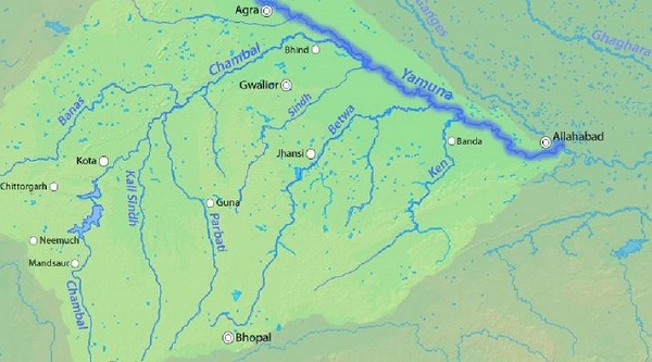
Chambal River is a major tributary of the Yamuna River that originates from the Himalayas. The Chambal ravines are formed on both sides of the Chambal River and its tributaries. The area between Bhind and Morena is the most dissected, with irregular topography, steep ridges, low hills, deep trenches, and broad incised meanders.
Also read- Pearl of Fortresses that Perched on a rocky outcrop-The Gwalior Fort
Geotourism in Chambal Ravines
Badlands refer to intensely dissected landscapes mainly by fluvial erosion, where vegetation is sparse or absent at the time of formation. Other characteristics of badlands are a very high drainage density of rills and gullies, V-shaped valleys, and short, steep slopes often fringed by gently sloping planar surfaces. By definition, badlands are useless for agriculture or grazing but have many other values, like biological, ecological, cultural, and scientific.
Chambal Sanctuary
Chambal is one of the cleanest rivers in the Indian plains. Part of this area has been declared as the national Chambal sanctuary. It is known for Crocodiles, Gharials, various types of Tortoises, Sarus cranes, etc. It also has a good number of Gangetic River Dolphins and land mammals such as Jackals, Wolves, porcupines, and hares. The tourism industry has been flourishing in this region for a long time. There are multiple archaeological sites hidden within the ravines. Ater fort near Bhind is also located deep inside the ravines. There are tourist-oriented facilities in Deori, Bah, and Jarar. Boat rides and river safaris can also be available in some of these places, especially in Jarar and Bah. Jeep and Camel rides are the best experiences in the place.

Chambal Ravines are located 80 km south of Agra, on the Rajasthan-UP-Madhya Pradesh border in the Chambal Valley. Chambal River offers travellers boat safaris and an opportunity to sight Alligators and rare birds, including Cranes, Indian Skimmers, etc. Bateshwar Temples are home to the ancient temple complex of 108 Shiva Temples, popularly known as Bateshwar Temples. Bateshwar Temples are set on the banks of the River Yamuna and are unique as they are one of the rare temples where Shiva is depicted as a person and not a Linga.
Recently, the Indian government, in collaboration with the World Bank, has decided to convert large areas of ravines in the Gwalior-Chambal belt of Madhya Pradesh into arable land. More than 3 lakh hectares of rugged land are not cultivable, and if this area is improved, then this will become agricultural land.
Read- Geotourism And Modern Geotechniques
How to Reach Chambal Ravines
Chambal Ravines can be reached from nearby towns like Dholpur (Rajasthan), Morena & Bhind (MP), and Bah (UP). Dholpur and Morena are situated on the rail and road network connecting Delhi, Agra, and Gwalior. So it is very easy to reach by train or bus from Delhi or Agra. One can also take a glimpse of the Chambal ravines from a moving train passing through these areas. Visitors can even set up their base in Agra or Gwalior, and then make day trips to this area.


