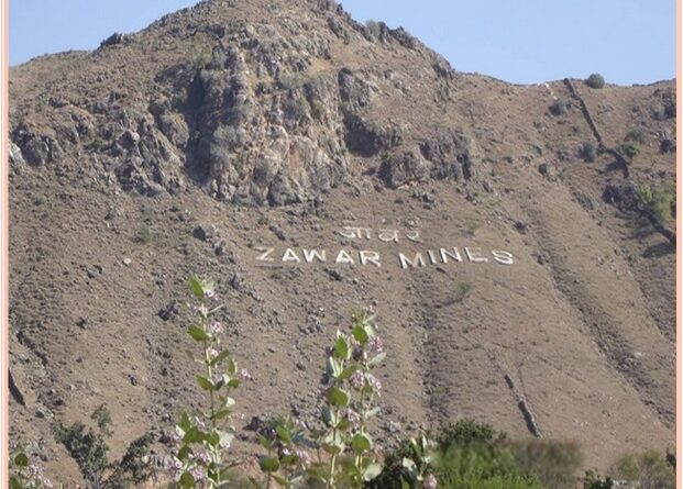
Zawar Group of Mines-The Oldest Zinc mines in the world and A Geoheritage site
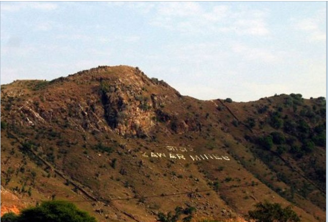
Zawar is in a mountainous region. It features a rock garden and five centrally-located temples. Zawar township was created by mining company Hindustan Zinc Limited, for the extraction of zinc and lead. An 80MW power plant provides electricity for mining zinc and leads from three major mines.
Zawar is a municipality made by mining organization Hindustan Zinc Limited, for the extraction of zinc and lead. Zawar is known for its 2,500-year-old smelting technique which was lost to the world, a technique re-discovered by an Englishman in the 18th century. Zawar has its name from the Urdu word jawaharat or jewelry, as it was a flourishing center for the export of silver in the 13th century CE. Zawar was also an important pilgrimage center in the medieval era, and the zawar hills are dotted with the ruins of a hundred Jain and Hindu temples.
In 1965, the government nationalized the industry and Hindustan Zinc limited took over the mines. Vedanta resources is the majority shareholder (64.92 %) in HZL since 2003 and operates four mines in the Zawar area, namely Mochila, Balaria, Zawar mala, and Baroi. Mining is done underground and the main products are lead and Zinc Concentrate. Mine is at least 480 feet deep with 4 levels 120 feet apart vertically.
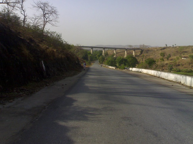
In 1988, the American Society of Metals (ASM International) recognized Zawar Mine as an ‘International Historical Landmark.’ The Geological Society of India recognized Zawar as a National Geological Monument in 2016.
Stratigraphy and Ore
Zawar lies in a wide expanse of typical Aravalli rocks, comprising a thick series of phyllites with quartzite and dolomite horizons. According to Heron’s stratigraphical divisions, the formations at Zawar are of the Upper Aravalli age. Zawar Group Pb-Zn Mines Have Mochia mogra, Bavaria, Zawar mala, and Baroi mines with an average zinc-lead reserve grade of 4.6%. The Zawar has a reserve of 14.2 million MT and a mineral resource base of 82.2 million MT. The host rock is Dolomite of mixed sedimentary-volcanic origin of early Proterozoic.
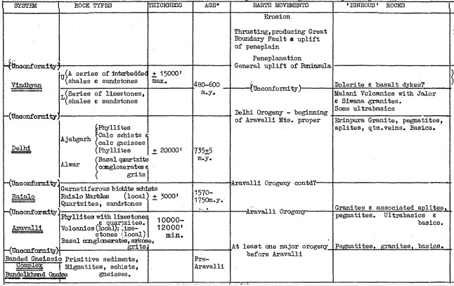
The overall control of mineralization is provided by the Main Dolomite, but other controls play important roles in connection with mineral distribution within this horizon In the immediate mine area the Main Dolomite comprises beds of pure dolomite, siliceous dolomite, carbonaceous dolomite, arkose, and phyllite. Pure and siliceous dolomites, however, constitute the bulk of the horizon, the remaining types providing only rare and irregular marker beds.
The dolomite of the area is actually folded several times and is the north limb of the main E-W anticline fold, it ultimately dips down as the true north limb. It is this tight, repeated folding that increases the width of the limb. One of these subsidiary folds is intimately associated with the mineralization of the area. The results of underground mapping indicate that the local succession in the immediate mine area is as follows:-
Dolerite Dyke
Upper Phyllite
Upper QuartZite
Dolomite
BaSal Conglomerate
Lower Quartzite
Lower Phyllite
Basal Quartzite – L. Aravalli
The lead-zinc ores occur in a shear zone associated with two recognized generations of folds and are contemporaneous with wall-rock alteration and subsequent mineralization. Flow directions of mineralizing solutions are deduced from the mineral zoning pattern; galena follows sphalerite paragenetically and lead-rich zones are assumed to lie farther from the two inferred centers of mineralization at cross faults.
Also read- The Majestic Araku Valley, in the Eastern Ghats and scenic hill station
The zonal fronts are not parallel to isotherms as determined by sphalerite geothermometry. Microscopic observations and theoretical considerations indicate that the wall-rock alteration was caused by a gaseous medium and that the ore metals were probably carried as complexions.
