
Tromelin Island
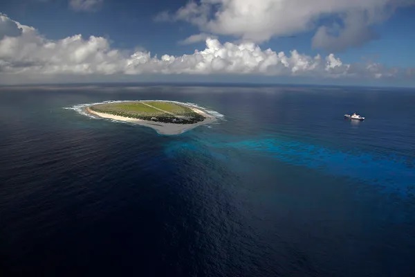
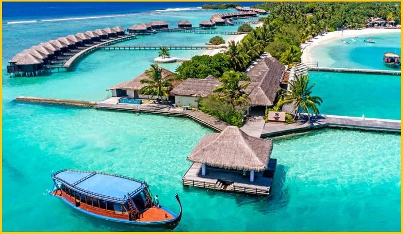
Tromelin is a small coral reef island located in the Indian Ocean, approximately 440 km East of Madagascar and 580 km North of La Réunion in the Indian ocean. The low, flat, sandy island is a part of French overseas territory. It is the site of a meteorological station important in forecasting Indian Ocean cyclones. A wildlife sanctuary, Tromelin is home to sea turtles and many seabirds but is uninhabited except for visiting scientists. Tromelin has facilities for scientific expeditions and a weather station. It is a nesting site for birds and green sea turtles. See Tromelin island google Maps.
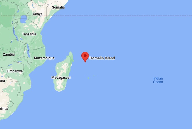
Tromelin (Iles Eparses) has been administered on behalf of the French state by the senior administrator of the French Southern and Antarctic Lands (TAAF- Les Terres Australes et Antarctiques Francaises), based in Reunion. The Iles Eparses had previously been under the administration of the prefect of Reunion since the independence of Madagascar in 1960. Since 1952, it has been the site of a French meteorological station. But back in 1761, the island was just an uncharted speck in the Indian Ocean.
Tromelin island shipwreck
Back in 1761, a French ship was ferrying around 160 enslaved men and women out of Madagascar, bound for French plantations. They ran into the reef surrounding Tromelin Island while trying to navigate it in the dark. The Ship was destroyed and water rushed into the cargo, however, some 60 of the Slaves were able to swim to the Tromelin island. In 1776, fifteen years after ship wreckage, eight people were rescued from the Tromelin island in the Indian Ocean rest of them died due to various diseases.
Also, read- An Unusual Comb ridge Utah-Geology and its Origin
Geology of Tromelin island
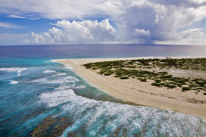
Tromelin is situated in the Mascarene Basin and is part of the Iles Eparses. It is currently only 7 m high. The Coral island was formed as a volcano, now eroded, and developed an atoll ring of coral. Tromelin is about 1,700 m long and 700 m wide, with an area of 80 ha, covered in scrub dominated by octopus bush and surrounded by coral reefs. Access by sea is quite difficult as there are no harbors and only anchorage. A 1,200 m airstrip provides a link with the outside world. Radiometric datings suggested that Sea-level of Tromelin changes in the Holocene. Subsequent possible sea-level positions have been inferred from coral conglomerates left by high-energy waves. These conglomerates might be interpreted as a beach rock, cemented mainly in the former intertidal zone when sea level was still approximately 1.2 m above present.
Tromelin Island is an ideal place to monitor weather, especially cyclones, bound for Madagascar. In 1954, French authorities built a weather station in Tromelin and it is still in operation today and consists of a few buildings.
Scattered Island Indian ocean
The Scattered Islands in the Indian Ocean consist of four small coral islands, an atoll, and a reef in the Indian Ocean, and have constituted the 5th district of the French Southern and Antarctic Lands. Though sovereignty over some or all of the Islands is contested by Madagascar, Mauritius, and Comoros. None of these islands has any permanent population.
Two islands Europa and Juan de Nova, and the Bassas da India atoll lie in the Mozambique Channel west of Madagascar, while a third island, Tromelin, lies about 450 kilometers east of Madagascar and the Glorioso Islands lies about 200 kilometers northwest of Madagascar. Banc du Geyser, a mostly submerged reef in the Mozambique Channel is a part of the Glorioso Islands.
How to get to Tromelin island
The islands have been classified as nature reserves. Except for Bassas da India, they all support meteorological stations those on the Glorioso Islands, Juan de Nova, and Europa Island are automated. Tromelin island weather station, in particular, provides warnings of cyclones threatening Madagascar, Mauritius, or Reunion. Each of the islands, except Banc du Geyser and Bassas da India, has an airstrip (Tromelin island airport) of more than 1,000 meters

