Trekking adventures in The Highest mountain in South America-Mount Aconcagua
Mount Aconcagua
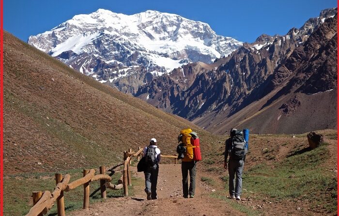
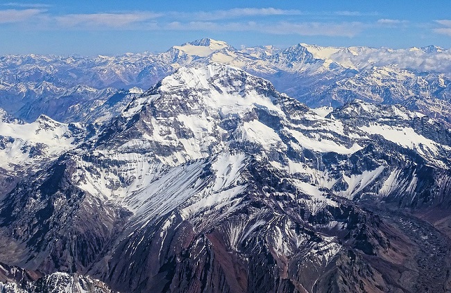
Aconcagua is a mountain in the Principal Cordillera of the Andes mountain range, in Mendoza, Argentina. It is the highest mountain in the south Americas, the highest outside Asia, and the highest in the Southern Hemisphere with an elevation of 6,961 meters. The mountain and its surroundings are part of the Aconcagua Provincial Park. The mountain has a number of glaciers. The largest glacier is the Ventisquero Horcones Inferior about 10 km long, which descends from the south face to about 3,600 m in elevation near the Confluences camp. Aconcagua is bounded by the Valle de las Vacas to the north and east and the Valle de los Horcones Inferior to the west and south. It lies 112 kilometers northwest of the capital, the city of Mendoza, about 5 kilometres from San Juan Province, and 15 km from Argentina’s border with neighboring Chile. The mountain is one of the Seven Summits of the seven continents. Some other large glacier systems are the Ventisquero de las Vacas Sur and Glacier Este systems at about 5 km long.
Geologic history
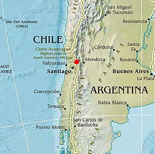
Mount Aconcagua was created by the subduction of the Nazca Plate beneath the South American Plate. Aconcagua was an active stratovolcano (from the Late Cretaceous or Early Paleocene through the Miocene) and consisted of several volcanic complexes on the edge of a basin with a shallow sea. The rocks found on Aconcagua’s flanks are all volcanic and consist of lava, breccias and pyroclastic. The shallow marine basin had already formed earlier in the Triassic, even before Aconcagua arose as a volcano. The colorful greenish, blueish and grey deposits that can be seen in the Horcones Valley and south of Puente Del Inca, are carbonates, limestones, turbidites and evaporates that filled this basin. The red-coloured rocks are intrusions, cinder deposits and conglomerates of volcanic origin. Aconcagua, Argentina weather-January and February have the best weather in Aconcagua. Rain is rare at the high camps, but precipitation in the form of snow is very common. Conditions at the high camps even in good weather are normally very cold, with temperatures at 0 degrees F when starting out for the summit before sunrise. However, snow storms and strong winds should be expected anytime. Mount Aconcagua map-The Aconcagua map sowing the Andes mountain range and Aconcagua peak in the red dot. Other provinces and places can be seen on the map.
Aconcagua Provincial Park
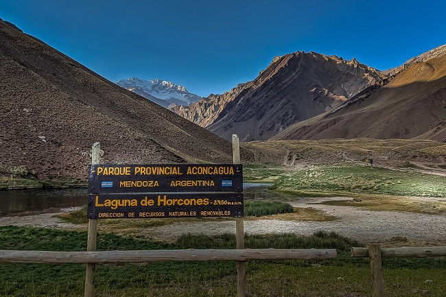
The Provincial Park located in this mountain range draws all types of thrill seekers ranging in difficulty including hiking, climbing and skiing. Some of the more visited attractions that draw tourists all year long besides Mount Aconcagua are Horcones Lagoon and Plaza de Mulas or Plaza Francia. Wildlife in Aconcagua-The vegetation and wildlife on Aconcagua is concentrated below 4,000 m. Many varieties of birds inhabit the area, including the purple eagle and a species of snipe called agachona. Spotted sandpipers and torrents, a type of duck, thrive in some of the areas with water. Mountain rats and the red fox are among the most common land animals.
Climbing
Mount Aconcagua is a popular choice for climbers who have summited Kilimanjaro. With a very short climbing season and limited numbers of climbing each season, Aconcagua only supports a few climbing operators.
Also, read- Katskhi Pillar in Western Georgia-The most isolated church in the world
Climbing in Mount Aconcagua is easy. It is the highest non-technical mountain in the world since the northern route does not absolutely require ropes, axes, and pins. Although the effects of altitude are severe, the use of supplemental oxygen is not common. Altitude sickness will affect most climbers to some extent, depending on the degree of acclimatization.
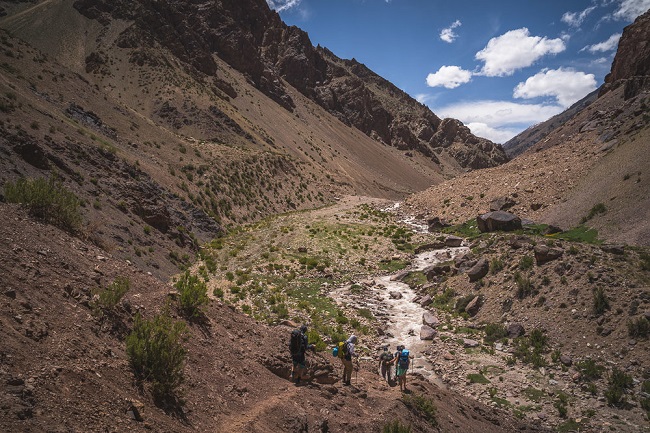
The routes to the peak from the south and south-west ridges are more demanding, and the south face climb is considered quite difficult. The Polish Glacier Traverse route, also known as the “Falso de los Polacos” route, approaches through the Vacas valley. The third most popular route is the Polish Glacier itself. The best time for climbing Aconcagua is from mid-December to the end of January. The climbing season runs from mid-November to the end of March.
Campsites
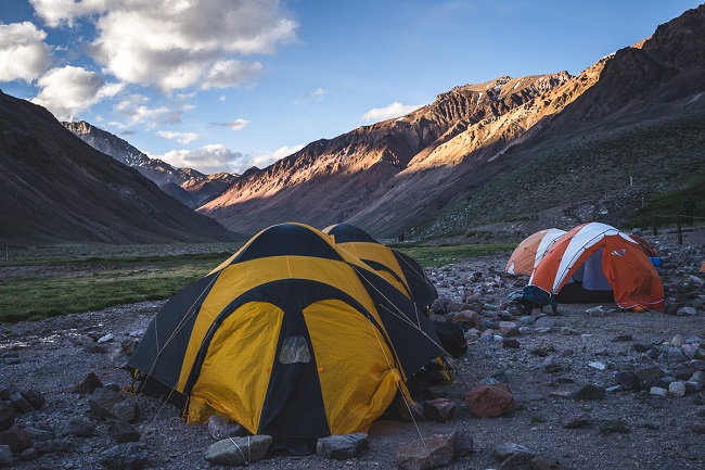
The sheer height of Aconcagua, along with the freezing temperatures on the mountain, make it a challenging ascent, even for accomplished mountaineers. Since the summit is close to 7,000 m, climbers have to spend sustained periods camping in tough conditions, so, that they are mentally and physically draining. Many campsites on the normal route are located. Puente del Inca, 2,740 meters, A small village on the main road, with the best facilities are campsites. Some other campsites in the route are- Confluencia, 3,380 meters, and A campsite a few hours into the national park. Plaza de Mulas, 4,370 meters. Base camp is claimed to be the second largest in the world. The weather conditions high up on the mountain can change rapidly, with freezing temperatures as low as -30 °C.
How to reach Mount Aconcagua
The entrance to the park is located between the border with Chile and Puente del Inca, the location of the border crossing station aduana at Horcones. If you are traveling west on Route 7, the entrance into Parque Provincial Aconcagua will be on your right just past the border crossing station.
Sources-worldatlas.com, livescience.com, Alpineascent.com, wikipedia.org
