The Unseen Chevran Folding in Kotli Area, Kashmir
Kotli Chevron Fold
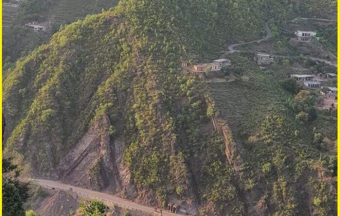
Kotli large-scale fold is well developed as Chevron folding in Kotli area, district Muzaffarabad Pakistan occupied Kashmir. The view of the Chevron fold is extremely rare and is not seen commonly in the ground. The fold is very clear and can be seen from many kilometers. both limbs of the fold are seen in road cutting with mega anticline ridges. The Chevron fold is part of Hazara-Kashmir syntaxis and lower tertiary in age. The Hazara Kashmir Syntaxis is an antiformal structure formed due to the Himalayan orogeny. The Tertiary molasse sequence lies in the core of the syntaxis, formed due to the uplift, erosion, and deposition in the Himalayan Foreland Basin the HKS collision between the Indian and Eurasian plates.
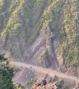
Geology of the area
In the study area, the lithological units are classified and described as under-Murree Formation is well exposed in Bani Nagala, Dasia, Nihani, Dhanna Karhali, Mora, and Kalak areas. In HKS and adjacent areas, Murree Formation is named for the cyclic sequence of sandstones and shales with claystone. Murree Formation consists of well-bedded sandstone, shales, grits, and subordinate siltstone. The Murree Formation is the oldest formation of the molasse deposits.
In the lower part of the formation fine to medium-grained ferruginous sandstone is found, which is compact, hard, and fractured in places. Its weathered color is reddish brown and its fresh color is light grey. The sandstone of the upper part is thickly bedded and massive and is composed of quartz, feldspar, muscovite, and clay particles. The color of the shales is red and maroon.
The Present Chevron folding is part of the Tatta Pani Anticline and is formed by the folding of the Muzaffarabad Formation, Hangu Formation, Margalla Formation, Chorgali Formation, and Kuldana Formation. The Muzaffarabad Formation is in the core whereas Hangu Formation, Margalla Formation, Chorgali Formation, and Kuldana Formation lie on the limbs. The Tatta Pani Anticline is an NW-SE trending fold. The strike of the northeastern limb is N50°W whereas the strike of the southwestern limb is N40°W. The dip of the northeastern limb is 56° NE and the dip of the southwestern limb is 36°SW. The trend and plunge fold axis of Tatta Pani Anticline is 4°/135°.
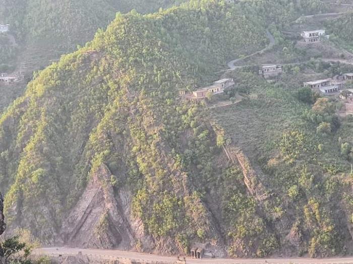
The Tattapani section lies about 16 km northeast of Kotli. This area belongs to the eastern Tethyan region and was classic for the tropical to sub-tropical marine and transitional sedimentary deposition. The Paleogene sedimentary units of the area are characterized by The Cambrian to The Eocene rock sequence, folded and imbricated in the Sub-Himalayas. The Cambrian Abbottabad Formation lies in the core and the Paleocene to Eocene rock sequence along the limbs of the anticline. The Paleogene rock sequence is well exposed in the northern limb of the anticline near the Tattapani area. The Paleogene rock sequence includes the Hangu Formation, Patala Formation, Margala Hill Limestone, Chor Gali Formation, and Kuldana Formation.
The Early Paleocene Hangu Formation unconformably overlies the Abbottabad Formation and shows unconformable sharp contact with the overlying Patala Formation. The Patala to Murree Formations shows transitional contact relationships. The present studies were made by Wadia (1928) described the Tertiaries of Kashmir as “Subathu” of the Eocene age along with Miocene Murree and Miocene- Pleistocene Siwalik Group. He correlated the Tertiaries of the Jammu hills to the corresponding rocks of the Kumaon, Simla Himalayas, western Punjab, and Kashmir Himalayas.
The lithostratigraphic units exposed are Hangu of the Early Paleocene, Patala of the Late Paleocene, Margalla Hill Limestone of Early Eocene, Chorgali of Early Eocene, Kuldana of Late Eocene, Murree of the Early Miocene, Chinji, Nagri, Dhok Pathan, Soan of Middle to Late Miocene, Mirpur of Pliocene Formations of and Recent Alluvium of Pleistocene.
Structural feature
Structurally, the area is highly deformed. Different folds and faults are mapped. The Gawan syncline, Gawan anticline, Sarda-Sarhota syncline, Mandi syncline, and Fagosh anticline are the major folds developed in the area. These are tight to open folds that extend northwest to southeast direction. Different parasitic folds along the limbs of the major folds are developed in the study area. The Riasi Fault or Himalayan Frontal Thrust and Fagosh Fault are two major faults present in the study area.
Also read- Mexican wonder-The Reserva De La Biosfera Sian Ka’an
What is Chevron’s fold?
Chevron folds are a Geological structural feature characterized by repeated well-behaved folded beds with sharp hinges. These folds develop repeated set of v-shaped beds. They develop in response to regional or local compressive stress. Inter-limb angles are generally 60 degrees or less. Chevron folding preferentially occurs when the bedding regularly alternates between contrasting competencies. high-competence sandstones and low-competence shales, provide the typical geological setting for chevron folds to occur.
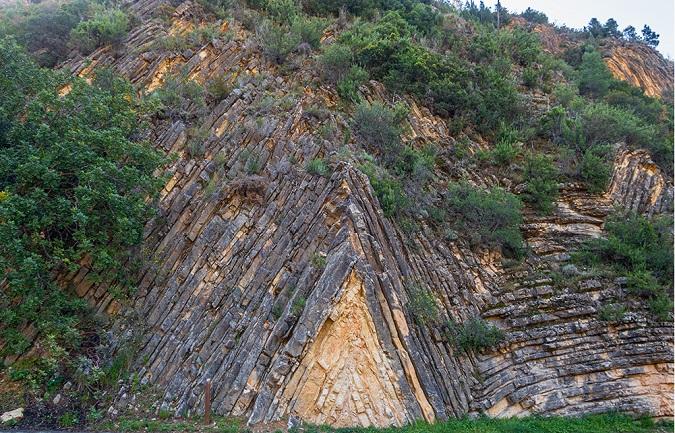
Kotli area lies on the SE of the Hazara-Kashmir Syntaxis (HKS) and is considered to be part of the sub to lower the Himalayas. The Main Boundary Thrust (MBT), trending in an NW-SE direction, has been demarcated by Wadia (1928) passing just South of Kotli city. The two prominent structural features of the area are the Tattapani-Karela and the Palana-Divigarh plunging anticlines. These major folds are trending NW-SE and have fold axis parallel to that of the Pir Panjal Range. Overall, the direction of compressive forces in the area seems to be NE-SW. Tattapani-Karela anticline is approx. 28km long and 4.5km wide with an NW-SE trending axis with a 15º–30º plunge. The dolomitized stromatolitic limestone of the Muzaffarabad Formation comprises the bulk of the anticline. In the study area, the Riasi Thrust, a part of the MBT, is located towards the southeast, marking a faulted contact between the Murree Formation and the Miocene to Pleistocene Middle Siwalik Group.
Sources-nceg.uop.edu.pk, ijsrp.org, science.gov, personal.umich.edu
