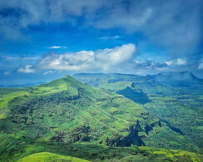
As people reach the summit of Kalsubai, can see the panoramic views of the area encompassing mountains, lush greenery and beautiful water bodies – these views are sure to make you forget all about the previous trek. Breathtaking views of the Bhandardara backwaters and the nearby hills like Harishchandragad, Ratangad, Harihargad, and Alang-Madan-Kulang forts are amazed you.
The base village is Bari, which is nestled at the foothills of Kalsubai mountain. You need to reach the end of the village where you’ll find a small stream and a Hanuman temple. The route from the temple leads straight to the peak and is a well-marked benchmark.
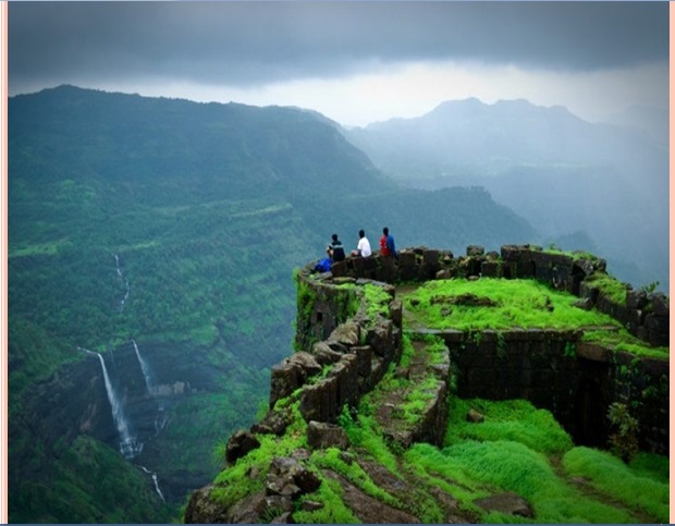
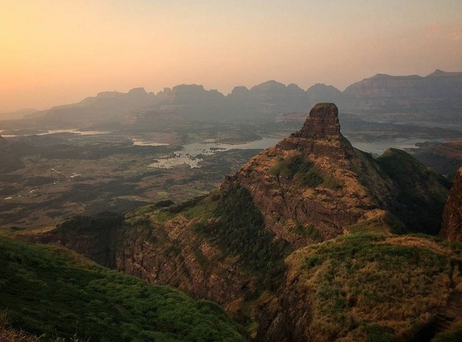
Ratangad Fort is a part of the Kalsubai range, which consists of some of the highest peaks in the Sahyadris. Ratangad gives you the best views of surrounding peaks and the Bhanadardara dam. Experience the colossal cliffs unfolding in front of your eyes, one behind the other as you walk on the edge of the fort.
The robustness of Sahyadris can be experienced only from a few forts and Ratangad is one of them. Standing in the “Eye of the Needle” is a major attraction. If you want to experience staying in caves, Ratangad is the perfect trek to do.
Geology
The mountain range of Western Ghats was formed by the Deccan basaltic flow Resting on the Deccan Plateau, a large igneous province, it consists of solidified flood basalt dating back to the Upper Cretaceous to Cenozoic era.
The peak along with the adjoining hills spans along a downward-slanting east to the west axis eventually merging with the formidable escarpment of the Western Ghats at almost right angles. Along its length, they form a natural boundary demarcating the Igatpuri Taluka, Nashik district at its north from the Akole Taluka, Ahmednagar district at its south. The mountain itself lies on the Deccan Plateau, with its base at an elevation of 587 meters above means sea level.
Ratangarh-Kalsubai Trek
Ratangarh-Kalsubai Trek is a 6.6 km-long trek with an elevation gain of around 1646 m. The trek has a moderately hard difficulty level, with lush green landscapes and multiple waterfalls. The peak attracts many trekkers and devotees to scale the mountain. To reach the summit there are well-designated trekking routes. The most popular route is through the eastern mountain face taking off from the base village Bari. The Waki river, a tributary of Pravara, takes origin on its eastern slope and flows like a stream through the outer fringes of Bari.
A short distance away from the stream a Hanuman temple has been built. This provides an important landmark to commence the trek as well as a resting post for those nearing the final lap of their trek. The route from behind this temple takes the hiker straight to the summit. The trek along this route is a mix of easy to ascend slopes as well as treacherous rocky outcrops overlooking the valley below. Considering the increasing footfall in recent years, the government has built iron ladders along the vertical hill slopes. These assist trekkers to allow for a convenient and safe ascent.
Ratangarh-Kalsubai Trek begins from Ratanwadi village. Make your way to Amruteshwar temple once you reach the village, This is a 1,200-year-old temple. The walls of this temple are adorned with beautiful and intricate stone carvings and sculptures. The Pravara River flows by the temple. The trail starts from the left side of the Pravara river, exactly opposite the Amruteshwar temple.
From the temple, touristic can see the gigantic Ratangad range. It can be easily recognized by its ‘Eye of the needle’ on top of the fort. On the right side of the fort, people can see a thumb-shaped pinnacle, which is known as Ratangad Khutta. Although the complete trail has been well specified there are chances that you may get confused as there are many offshoots from the main track. It is advisable to take a guide from the village.
First, the trail enters a dense forest. Here, it ascends moderately. Since the trees provide a good canopy, the trail is cool and enjoyable even in the summer season. Karvi, Terda, Barka, Sonki are some plants which you see in the forest. You reach the second clearing in 30-40 minutes. A gorge within the plain plateau located below is the famous Sandhan Valley.
Kalsubai peak is sitting amidst the Sahayadri ranges, it blooms with lush greenery and flora that is rarely found anywhere else across the planet. You find yourself surrounded by exotic forests, fresh air, and soul-soothing natural landscape quite contrasting to the concrete jungle. Rugged terrain, steep slopes, and a pretty exhausting route are quite enough to beat down any trekker. Since the Pravara river flows through the vicinity of Kalsubai, you could go on sightseeing to spots like Wilson Dam, Umbrella Falls, Randha Falls, and Arthur Lake. You could even stay in tents while enjoying camping near Bandardara Lake.
Ratangarh Fort
Ratangarh fort is located in Sahyadri Range, district of Ahmednagar at about 1297 m. above sea level. It lies in the Ajoba mountain range surrounded by magnificent mountains of Kulang, Alang, Madan, Kalsubai, Katarabai, Ajoba, Harishchandragad, and Ghanchakkar.
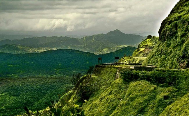
The base village for the fort is Samrad village near Ghatghar and Ratanwadi village. The Fort is located in Harishchandragad Kalsubai forest sanctuary. Sahyadri fort was found 45 minutes’ drive from Bhandardara Wilson Dam. Roads leading to both the villages of Samrad and Ratanwadi are in terrible condition. Sahyadri range has a beautiful landscape with dense forests on one side and the vast spread of Bhandardara lake, one of the oldest artificial catchment areas and High endurance level trek.
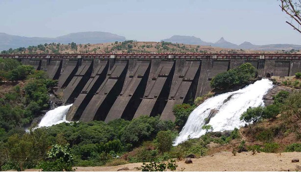
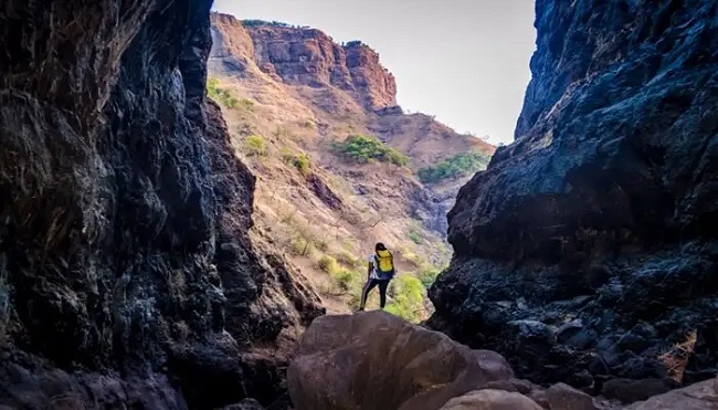
The ultimate ascend to the fort is made easy by the iron ladders constructed by the forest department. On the right side of the fort, you can see a thumb-shaped pinnacle, which is known as Ratangad Khutta. There is a natural crack in the mountain top caused by wind erosion. This natural rock cavity has an emerging at the top known as Nedhe or the ‘eye of the needle’ called due to its shape. The fort is the origin of the river Pravara/Amrutvahini. The Bhandardara dam was built on this river.
Route of Ratangarh-Kalsubai Trek
There is two routes to Ratangarh-Kalsubai Trek. The first trek starts from the base village of Bari. This village offers magnificent traditional homestays and meals. You could have some food before proceeding towards your trek. Once you start the trek from the Bari Village, elevation increases slowly. It starts from the eastern side of the mountain.
Also, read- Millions of year-old Ramgarh crater and Its Geo-Importance
The Second route via Indore is relatively unexplored and has a rugged terrain. Many people are not aware of this route. The route via Indore is raw with Rocky steps and a huge iron chain for support at the dangerous patches.
Igatpuri is the nearest railway station to Bari Village with a distance of about 31 km. Once you reach Igatpuri you can hire a cab or take a bus to Bari village. By road, you can take the route via Kasara-Igatpuri-Ghoti-Bari Village.
The best time to visit the Kalsubai peak is during the Monsoon season and the Winter season. The Monsoon season lies between July to October glorify the green canopy with moderate to heavy rains in the area.


