The Dangiala is profuse with environmental elements relevant to archaeology, astronomy, biodiversity as well as cultural elements, scholars consider the area a unique location in Sri Lanka.
Geology of Danigala Inselberg
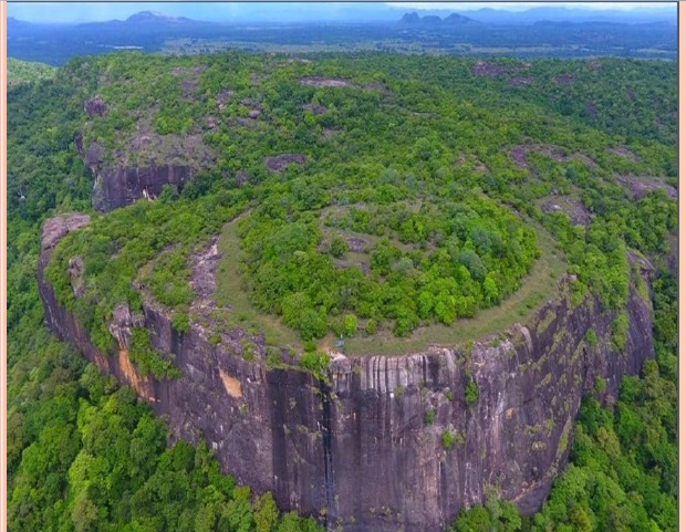
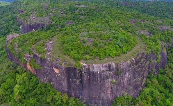
Danigala Circular Rock is an inselberg, isolated rocky outcrops generally consisting of Precambrian formation. This Rock structure is geologically situated in the Vijayan Complex, of the geological subdivision of Sri Lanka. Vijayan Complex includes, amphibolite-facies suite mainly consists of granitoid gneisses, migmatites, minor meta-sedimentary xenoliths, and calc-silicate rocks. It is known as bare rock mounds or turtleback-shaped inselbergs. This kind of Inselbergs stood out against the leveling process of nature mainly because they are made of resistant granitic rocks containing large proportions of quartz, one of the most stable rock-forming minerals.
The inselberg structure is formed due to the Weathering influences gradually the destruction of rocks under surface conditions, dissolving and removing it away or breaking it down into progressively smaller pieces. The circular structure is made due to physical processes like- mechanical weathering or chemical weathering.
According to locals, Danigala Rock is a “UFO sighting hotspot” and secrets of aliens are hidden in the Rock. Hence, the Rock is also known as “Alien Mountain”. Local, as well as foreign tourists, are of the view that Danigala Rock is similar to a roundabout.
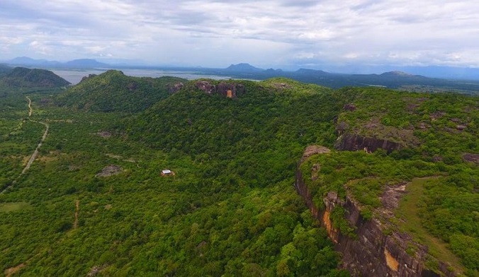
The hike to Danigala Rock takes approximately two hours and many hikers spend at least another two hours basking in the glory of the spectacular surroundings from the summit of the Rock. The best time to climb the Rock is early morning to avoid the harsh rays of the sun.
Erratic Boulder
An erratic boulder is a piece of rock that differs from the size and type of rock native to the area in which it rests. Erratic can range in size from pebbles to large boulders such as big rocks. Geologists identify erratics by studying the compositions and orientation of surrounding rocks in comparison to the composition and orientation of the erratic boulder. Due to the Pliocene-Quaternary climate changes, the earlier glacial sedimentary deposits in Sri Lanka.
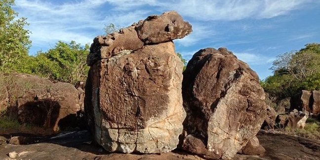
Glacial erratics are stones and rocks that were transported by a glacier and then left behind after the glacier melted. Erratics can be carried for hundreds of kilometers and can range in size from pebbles to large boulders. Geo-scientist often uses weathering and erratics analysis to help determine the ancient glacier movement.
Also read- Stromatolite Park Jhamarkotra in Aravalli supergroup and A Geo-heritage site
Petroglyphs of Danigala
Discovery of Petroglyphs that have been found in a part of the northwest slope direction of Danigala inselberg. Those bind runes are dominantly compared with other archeological sites in Sri Lanka and South Asia region. The evidence of the earliest habitation of the region has been found in two rocks between the two gorges. These types of symbols inscribed on the stone are also found in different parts of the world. The petroglyphs of Danigala are similar to those found at Edakkal Caves in Kerala, India.
These drawings are tentatively dated to 5500 – 4500 BC. The largest of the petroglyphs is 7.5 meters long and five meters high. Scholars are of the view that some sets of geometric symbols are indeed ancient which represent the lost astronomical counting system.
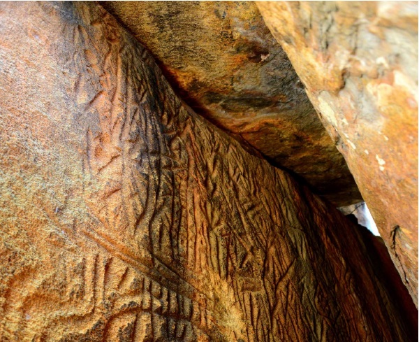
According to astrobiologists and exobiologists, these petroglyphs are closely related to astronomy. Geometric patterns, as well as primitive images of people with weapons in their hands, anthropomorphic figurines, peacocks, animals, stairs, arrows, and plants, have been engraved in these petroglyphs covering almost the entire space of the Cave.
Polonnaruwa
The Ancient Kingdom of Polonnaruwa was the second capital of Sri Lanka for three centuries from the 11th to the 13th centuries. After the Chola conquest of the Anuradhapura Kingdom, the center of administration was shifted to Polonnaruwa until 1232. Polonnaruwa has been declared a World Heritage Site by UNESCO.


