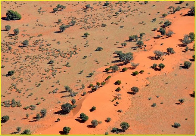
“The Kalahari desert”- Second biggest desert in Africa after Sahara and an amazing arid landscape
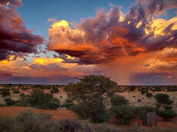
Photo-phys.org
The desert is part of the 970,000-square-mile Kalahari Basin, which includes the Okavango River Delta and other wetter areas. The Kalahari Desert received less rainfall and the summer temperature is very high. It usually receives 5-10 inches of rainfall per year. In summer, temperatures in the Desert can be reached highs of 40°C or more, while cooler temperatures can drop below 0°C.
Word ‘Kalahari’
The Kalahari Desert has been home to the native San bushmen for nearly 20,000 years. The word Kalahari is derived from the Tswana word Kgala, which means “the great thirst”, or Kgalagadi, meaning “a waterless place”. Most of the Kalahari Desert is not considered a real desert, due to the amount of rainfall the area receives. With somewhere between 12-25 centimeters of rain, the Kalahari Desert has a higher amount of rainfall than other deserts.
Crosses the border of three countries
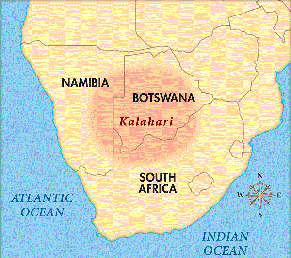
This massive African desert crosses the borders of three countries including, the eastern region of Namibia, a large portion of Botswana, and the Northern Cape Province in South Africa. The Kalahari Desert forms part of the larger Kalahari Basin. It includes wetlands such as the Makgadikgadi Pans and the Okavango Delta of Botswana. The Kalahari is the sixth biggest desert on Earth and the second-largest in Africa after the Sahara desert.
Geomorphology
The Kalahari Desert is a featureless, gently undulating, sand-covered plain, which everywhere is 900 meters or more above sea level. Bedrock is exposed only in the low but vertical-walled hills, called kopjes that rarely rise above the general surface. Apart from the kopjes, three surfaces characterize all of the Kalahari- sand sheets, longitudinal dunes, and veils.
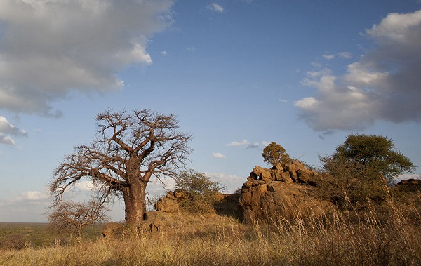
Kopje
Kopjes, is a term referring to relatively small, isolated rock hills that rise abruptly from the surrounding, flat savannah or plain. There are several places in the Kalahari Desert landscape where these impressive rock monoliths can be found.
Sand sheets
The sand sheets formed during the Pleistocene Epoch (about 2.58 mi to 11,700 years ago). In some areas, they appear to have been of fluvial origin. The sheets occupy the eastern part of the Kalahari. The depth of the sand there generally exceeds 200 feet.
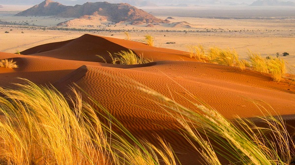
The Dunes
The entire western Kalahari Desert is characterized by long chains of dunes, oriented roughly to the north or northwest. The dunes measure at least 1 mile in length, several hundred feet in width, and 20 to 200 feet in height.
Vleis
Vleis, or pans, are the terminal features of desert drainage systems, the “dry lakes” at the end of ephemeral streams. Many are remnant features from an earlier period of greater precipitation. Very little water ever flowed to the sea from the Kalahari.
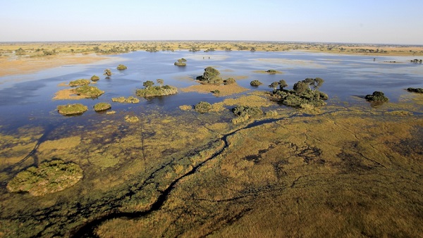
The Desert is not a completely arid landscape. The Okavango River flows through the land, starting from Angola and draining into the Moremi Game Reserve in Botswana. The Okavango Delta in Botswana is the fourth-longest river in Africa.
Biggest Diamond mines
The Kalahari Desert is home to one of the biggest diamond mines in the world. The Diamonds were discovered in this region around 30 years ago. The Ghaghoo Diamond Mine first opened in 2014. Unfortunately, the diamond mine was opened in the ancestral homeland of the Bushmen community and many families have been forced to leave their native homes and relocate to other areas.