The Geographical landmark for Astronauts- ‘Eye of Sahara’ and A mysterious structure in earth
Landmark for Astronauts
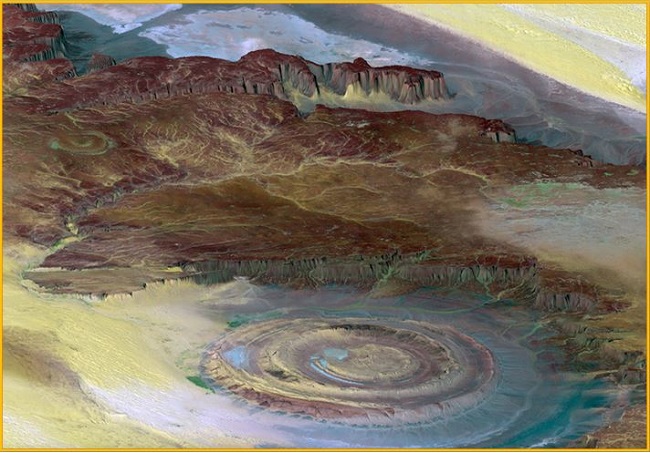
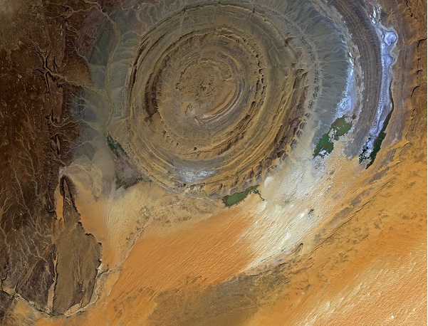
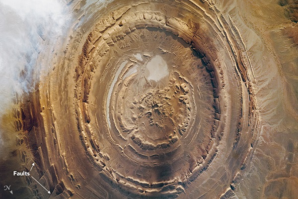
‘Eye of Sahara’ or Richat Structure located in vast Sahara desert just outside of Ouadane town in Mauritania. From space, this natural curiosity forms a distinct and unmistakable bulls-eye that once served as a geographical landmark for astronauts as they passed over the Sahara.
Geological Theory
Initially, this structure was interpreted as a meteorite impact structure because of its high degree of circularity but the formation is now widely believed to have been caused by the erosion of a geological dome formed by pressure from a bulb of molten magma below.
The desert floor ‘blistered,’ and the layers of rock were pushed up and fractured. This also created fault lines circling the Eye and crossing it. The molten rock also dissolved limestone near the center of the eye, which collapsed to form a special rock type known as Breccia. Due to the years of weathering gradually the structure leveled flat again and exposed the structures in distinctive concentric rings. Geologists classified this structure as a domed anticline. In this type of geologic structure, rocks exposed in the center of the “bull’s eye” are older than rocks forming the outer rings.
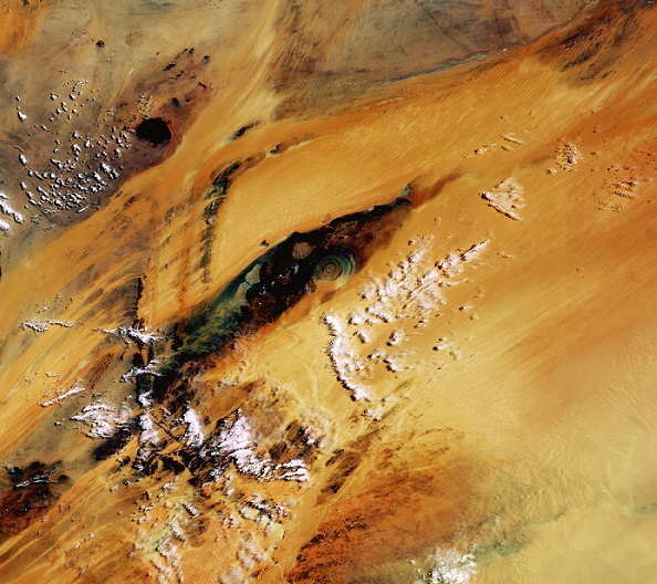
Most of Mauritania facing Dry climate conditions and periodic droughts due to its location in the Sahara desert. Approximately 3.7 million people live in Mauritania and much of the population lives along its Atlantic coastline, about 500 kilometers from the Richat Structure.
Also read- “The Great Belize Blue Hole” and Giant mysterious Sinkhole, Know the Geological factor and take a Geotourism around the place
Chinguetti and Ouadane town are UNESCO World Heritage Sites because they are vestiges of the once-flourishing civilizations that existed during the era of the Trans-Sahara salt trade. This civilization is known as Ksours.
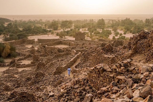
The dunes around the Richat structure are part of the Oudane. An enormous body of sand stretching hundreds of kilometers to Mali, within which still some ancient Ksours stand.