The Eparchaean Unconformity, in India that missed 500 Million year time gap-Geo heritage site
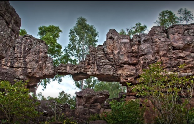
Silathoranam, a Natural arch, and a geological wonder are located in Tirumala Hills at a distance of 1 km from Tirumala Venkateswara Temple. The Arch measures 8 meters in width and 3 meters in height and is eroded out of quartzite of Cuddapah Supergroup of Middle to Upper Proterozoic(1600 Ma) by weathering agents such as water and wind.
What is Eparchaean Unconformity
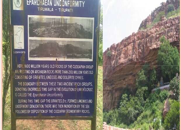
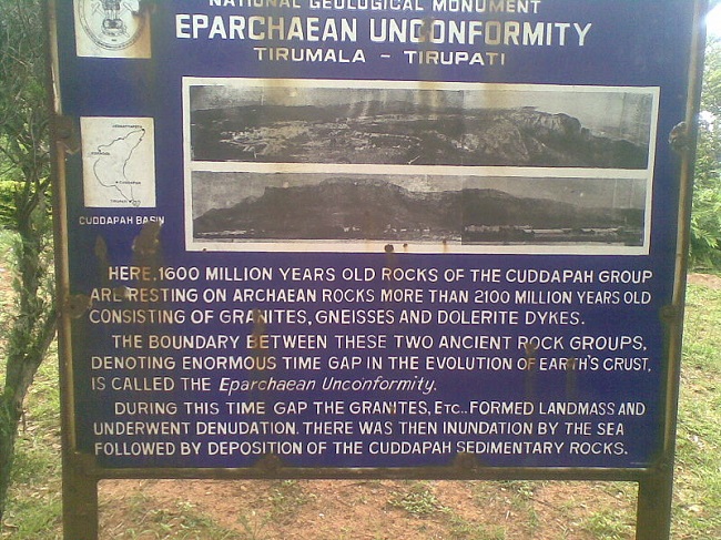
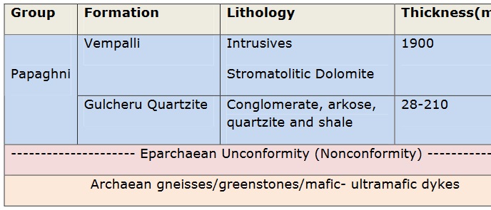
Tirupati Eparchaean Unconformity, a notified National Geo-heritage Monument is a major discontinuity of stratigraphic significance that represents a time gap of 500 Ma.in the geological history of the earth. This is due to the sudden changes and discontinuity in the rock layers in the earth’s crust. It is seen at the steep natural slopes and road scars in the Tirupati-Tirumala Ghat road in the Chittoor district of Andhra Pradesh, India.
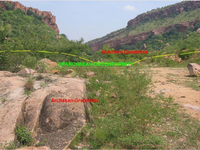
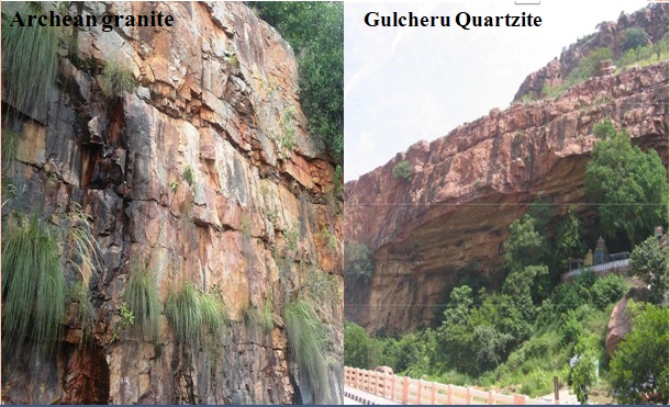
The details provided by the GSI for the Eparchaean Unconformity monument indicate that this feature forms the boundary surface between Proterozoic Gulcheru Quartzite (Papagni Group) and Archaean granite.
At this location, the boundary is between sedimentary rocks of the Cudappah Supergroup, 1600 million years in age, and Archaean rocks comprising granites, gneisses, and dolerite dykes that are more than 2100 million years old. This unconformity gives an indication of the enormous time gap in the creation of the earth’s crust.
Topography & Geology
The geological monument is located in the Tirupati valley, which is bounded between The basin is delimited between the Palakonda-Velikonda and Sanambatla-Srikalahasti and Nagari ranges of the Eastern Ghats. Tirupati Temple, the most famous pilgrimage center in South India is in the midst of the range of hills. The hills enclose the temple town to give it a form of an amphitheater setting.
Also, read- A forgotten Gossan-rich monument in India-The Rajpur-Dariba Mineralised belt
The Tirupati hills are situated at the foot of a range of hills. There are four geological units:
(1) Archaean rocks of the eastern Dharwar Craton (the granites and gneisses)
(2) the Eparchean unconformity (Quartzose sandstones overlying the granite with a distinct unconformity)
(3) Puranas (a general name for Proterozoic sedimentary sequences found in a series of basins deposited on the Indian Shield; including the Cuddapah Basin)
(4) Quaternary deposits
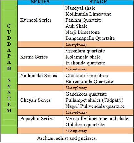
The hill ranges of the Tirumala rise to a height of 900 meters. The steep scarp of the ranges shows the Eparchian Unconformity’s topographic, structural and denudational features. The sedimentary thickness of the Cudappah basin is of the order of 12 kilometers and includes volcanic sequences in the form of sills and dykes.
A prominent Eparchaean Unconformity of the formation resting on the archaean peninsular gneissic complex is noted. Rocks of the Cuddapah Supergroup, and the overlying Kurnool Group, comprise the stratigraphic sequence of the basin. This feature is contiguous all along the defined Archaean-Cuddapah contact zone even though its age may vary along its traced path.
Geological Monument is well connected by road, rail, and air routes. The nearest railhead to Tirumala hills in Tirupati. The geological monument is located 10 kilometers northwest of Tirupati town, at the 12 kilometers point on the Tirupati-Tirumala Ghat road.
