The Dominican Republic Tourist Attractions-Mountain, Beaches, Coffee and many more
The Dominican Republic
The Dominican Republic is the second largest and most diverse Caribbean country, Known for its warm and hospitable people and astounding nature, intriguing history, and rich culture. Surrounded by the Atlantic Ocean on the north and the Caribbean Sea on the south, the lush tropical island boasts nearly 1,609 km of coastline, 402 km of the world’s top beaches, magnificent resorts, and a variety of sports, recreation, and entertainment options. Travelers can have luxurious and diverse accommodations, explore ancient relics of centuries past, delight in delicious Dominican foods, and enjoy ecotourism adventures in magnificent national parks, mountain ranges, rivers, and beaches.

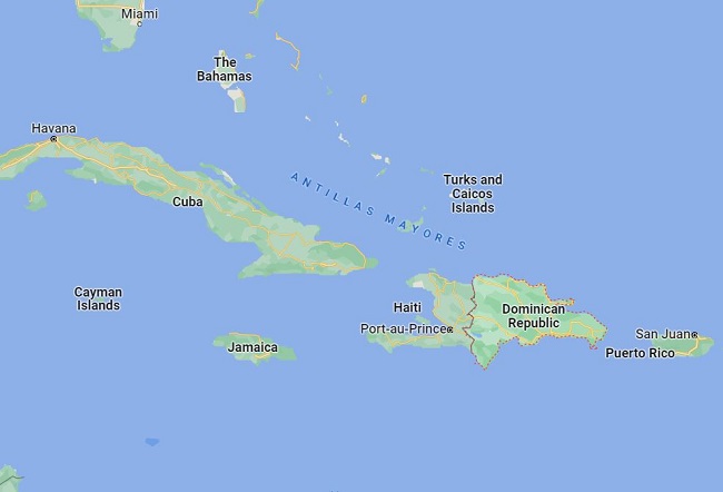
Map of the Dominican republic-The Dominican Republic is a country located on the island of Hispaniola in the Greater Antilles archipelago of the Caribbean region. A map of the Dominican Republic in the Caribbean sea shows Dominican Republic’s resorts and many other places. Weather in the Dominican republic-The Dominican Republic has a tropical rainforest climate in the coastal and lowland areas. Some areas, like the Cibao region, have a tropical savanna climate. The Dominican Republic has a diverse topography and the climate shows considerable variation over short distances. The annual average temperature is 25 °C. At higher elevations, the average temperature is 18 °C while near sea level the average temperature is 28 °C. January and February are the coolest months while August is the hottest month.
Geography
The country’s area variously consists of 48,670 km2 making it the second largest country in the Antilles after Cuba. The Atlantic Ocean lies to the north and the Caribbean Sea to the south. The Bahamas lies, to the north, and to the east, the US Commonwealth of Puerto Rico. The Dominican Republic’s capital and largest city Santo Domingo is on the southern coast.
Also read- The Amazon River system-The World’s Largest river, River Cruise, and Dolphin
The Dominican Republic has four important mountain ranges. The most northerly is the Cordillera Septentrional (Northern Mountain Range), which extends from the coastal town of Monte Cristi, near the Haitian border, to the Samana Peninsula in the east, running parallel to the Atlantic coast. The Cordillera Central is the highest range in the whole of the West Indies. The Cibao valley is the major valley and home to the cities of Santiago and La Vega and most of the farming areas of the nation.

Attraction in The Dominican Republic
Beaches
The Dominican Republic has white sand beaches, punctuated with slim coconut trees reaching the skies. Visitors will keep busy finding your favorite plot of sand along our 1,600-kilometer sandy coastline. Over 200 beaches line the Caribbean and the Atlantic coastlines, ranging from a brilliant white to a handful of black sand stretching southwest.
Visit Punta Cana’s world-renowned 48-kilometer stretch and Samana’s world-ranked beaches such as Playa Rincon. On the north coast, visitors find Playa Cabarete to Playa Grande, or Playa Punta Rucia. Caribbean-facing beaches are safe year-round, while our northern coastline requires more attention to weather conditions before swimming. Sundays are family beach days for Dominicans, with plenty of food and music.
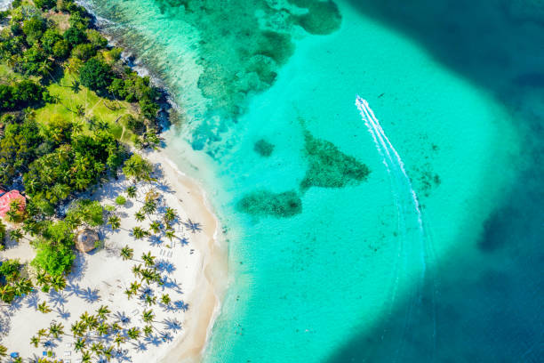
Juan Dolio Beach- Juan Dolio is a favorite weekend and holiday retreat for Dominicans, with palm trees. Juan Dolio is a compact destination with lots on offer within easy walking and driving distance. It is the ideal destination if you visiting for a few days, a stay at Juan Dolio gives you the chance to relax, swim, dive, and explore food and drink. During the 80s, Juan Dolio beach was the focal point of the DR’s booming tourist trade and one of the biggest drawcards for international visitors.


Pingback: Rishikonda Beach-A Popular scenic Destination near Visakhapatnam - Geotourism