The best Adventure in the Majestic ‘Red Rock Canyon’ of Nevada
Red Rock Canyon
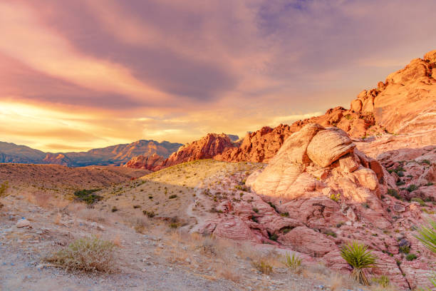
Red Rock Canyon is a beautiful natural conservation area located in Nevada, USA, just a few miles west of Las Vegas. The canyon features unique geological formations and stunning red rock formations that are millions of years old. One of the most popular attractions in the Red Rock Canyon is Loop Road, 21 km. a scenic drive that winds through the canyon, offering visitors breathtaking views of the surrounding landscapes. Along the way, there are plenty of places to stop and take in the scenery, including hiking trails and picnic areas.
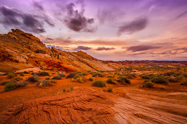
The conservation area showcases a set of large red rock formations- sandstone peaks and walls formed by thrust faults including the Keystone Thrust. The walls are up to 910 m high, making them a popular hiking and rock climbing destination. The highest point is La Madre Mountain, at 2,485 m.
A visitor centre is at the start of the loop road. The loop road is also popular for bicycle touring with a moderate climb, then is mostly downhill or flat. The conservation area covers over 195,000 acres and is home to a wide variety of flora and fauna, including over 600 different plant species and 200 species of birds. Visitors can explore the area by hiking, rock climbing, mountain biking, and even horseback riding.
Red rock canyon national conservation area
The Red Rock Canyon National Conservation Area is a stunning natural area in the Mojave Desert. The conservation area covers over 195,000 acres of land and is managed by the Bureau of Land Management.
The area is characterized by its unique red rock formations, which were formed over millions of years through a combination of geological processes, including erosion and uplift. The conservation area is also home to a wide variety of desert flora and fauna, including several species of cacti, yucca plants, and wildlife such as desert bighorn sheep, coyotes, and bobcats.
Visitors to the Red Rock Canyon National Conservation Area can enjoy a range of recreational activities, including hiking, rock climbing, mountain biking, and even horseback riding. The area offers over 48 km of hiking trails, ranging from easy strolls to challenging hikes that offer stunning views of the surrounding landscapes.
Overall, the Red rock canyon Nevada is a must-visit destination for anyone traveling to the Las Vegas area and looking to experience the natural beauty of the American Southwest.
Also read- Joshua Tree Desert and National Park-Best Hiking Trail in the Mojave Desert
Geology
The Red Rock area has a complex geological history. The region’s dramatic landscape is create over millions of years. The Red Rock area was under an ocean basin during the Paleozoic Era 600 million years ago. Up to 2,700 m of limey sediments were deposited and eventually lithified to limestone. During the Mesozoic Era 250 million years ago, the earth’s crust started to rise due to tectonic shifts, and marine shales and sandstones were deposited.
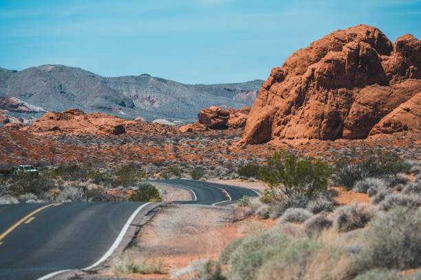
As the basin became isolated evaporite salt and gypsum were deposited. Oxidation of the iron minerals in the sediments resulted in the red colors of some of the rocks. Deposition by streams and in swamp environments resulted in the formation of petrified wood in the area. By 180 million years ago, the climate continued to change and the area became a desert with vast expanses of huge shifting sand dunes.
During a mountain-building period called the Laramide orogeny around 66 million years ago, the Keystone Thrust Fault developed. The Keystone is part of a series of thrust faults that ran through much of western North America and the Red Rock Conservation Area.The movement of this fault forced the older gray sedimentary rock over the younger red rocks, forming the varicolored landscape that can be seen in the mountain today. The thrust is exposed over a distance of 13 miles (21 km) along the Red Rock escarpment.
Red rock canyon trails
Red Rock Canyon in Nevada offers a wide range of hiking trails for visitors to explore. Some of the most popular trails in the area-
Moenkopi Loop- Triassic fossils and various desert flora can be seen on this open country trail which starts at the visitor center and traverses a prominent limestone ridge. In addition to panoramic views of the Wilson Cliffs, there are connecting trails to the Calico Hills area. Calico Tanks Trail – This trail runs along the base of the Calico Rocks from Calico Basin to Sandstone Quarry. It is a moderate hike that offers stunning views of the red rock formations and the Las Vegas skyline. The trail is approximately 2.5 miles round trip. Turtlehead Peak Trail – A challenging hike that rewards hikers with panoramic views of the surrounding landscape from the top of Turtlehead Peak. The trail is approximately 5.5 miles round trip.
Ice Box Canyon Trail – A moderate hike that takes hikers through a narrow canyon with stunning rock formations and seasonal waterfalls. The trail is approximately 2.6 miles round trip. Lost Creek Trail – A relatively easy hike that takes visitors through a lush canyon and ends at a small waterfall. The trail is approximately 3 miles round trip. First Creek Canyon Trail – A moderate hike that takes visitors through a scenic canyon with views of the surrounding red rock formations. The trail is approximately 3.5 miles round trip. Pine Creek Canyon Trail – A moderate hike that offers stunning views of the surrounding canyons and rock formations. The trail is approximately 2.5 miles round trip.
How to reach Red rock canyon
The easiest way to reach Red Rock Canyon is by car. From Las Vegas, take the West Charleston Boulevard (State Route 159) westbound, and you’ll reach the park entrance in about 15-20 minutes. The park entrance is located off the highway, and there is a fee to enter the conservation area.
There are several tour companies that offer guided tours to Red Rock Canyon from Las Vegas. These tours typically include transportation to and from the park, as well as a guided hike or other activities. This can be a good option if you don’t have a car or prefer to have a guide.
There is no public transportation that goes directly to Red Rock Canyon. However, you can take the Regional Transportation Commission (RTC) bus route 206 to the intersection of Charleston Boulevard and Moenkopi Road, which is about 6 miles from the park entrance.

