9 Secrets that You Shouldn’t Know About Bhutan Country
Bhutan country in south Asia
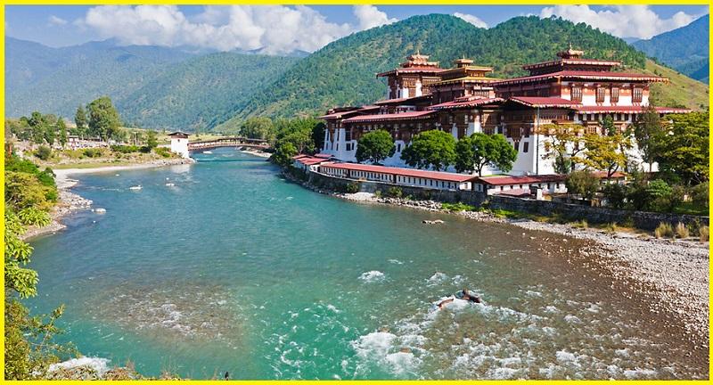
The Kingdom of Bhutan is a small, landlocked country in the Himalayas, located in South Asia between China and India. It is a mountainous country, known as “Druk Yul,” or “Land of the Thunder Dragon”. Nepal and Bangladesh are located near Bhutan but do not share a land border. Bhutan is a constitutional monarchy with Vajrayana Buddhism as the state religion. Bhutan and neighboring Tibet are influenced by the spread of Buddhism which originated in the Indian subcontinent during the lifetime of Gautama Buddha. With a forest cover of more than 80%, Bhutan is considered one of the 10 biodiversity hotspots. Relying largely on hydropower, Bhutan is also the only carbon-negative country in the world. Gangkhar Puensum is Bhutan’s highest peak and is the highest unclimbed mountain in the world. The capital and largest city are Thimphu.

Bhutan green country
Bhutan is the world’s happiest country. It’s also one of the greenest. The government has developed the Gross National Happiness index based on four pillars: sustainable development, environmental protection, cultural preservation, and good governance. The Himalayan kingdom is not only carbon neutral but carbon negative and this is happening despite increasing tourism. As a travel destination, Bhutan remains unique the isolated nation only opened up to foreign visits in 1974 and allowed TVs in 1999.
Geography and Geology
Bhutan country is on the southern slopes of the eastern Himalayas, landlocked between the Tibet Autonomous Region to the north and the Indian states of Sikkim, West Bengal, and Assam to the west and south. The Indian state of Arunachal Pradesh bound it to the east. The land consists mostly of steep and high mountains crisscrossed by a network of swift rivers that form deep valleys before draining into the Indian plains.
Bhutan is mainly Palaeozoic in age. Geologically the Bhutan Himalaya can be divided from South to North into the Foreland, the Siwalik Molasse Belt, the Permo-Carboniferous Damuda Belt, the Lesser Himalaya, the High Himalaya, and the Tethys Himalaya. Some of the oldest rocks in Bhutan are part of the Indian Shield in the Shillong Basement and part of a foreland basin. The Bhutanese foothills are separated from Precambrian crystalline rock by the 35-kilometer foreland, where rocks are folded and faulted by newer tectonic events and covered in Quaternary sediments. The South Himalayan molasse is represented by the Siwalik Belt, with 4 kilometers of siltstone, sandstone, and conglomerates in the southeast. The Damuda Belt dates to the Carboniferous and Permian in the Paleozoic with coal seams, plant remnants, and lenses of much younger Eocene limestone included during the Himalayan orogeny.
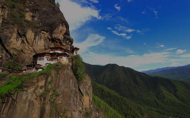
The Lesser Himalayas, to the north of the Damuda Belt, contain Precambrian sedimentary rocks such as slate, dolomite, and several kilometers of quartzite. “Slices” of basement granite and gneiss form mylonite at the edges. These rocks are believed to be part of the Indian Shield and are one billion years old. Geologists also define the High Himalayan Crystalline rocks extending 150 kilometers from the Main Central Thrust to Tethys Ocean sediments in the north. Sillimanite, garnet, and biotite are especially common in this area. The Tethyan Sedimentary Series is a deformed, mainly low-grade package of sedimentary rocks deposited on the Indian margin of the Tethyan Ocean from the Neoproterozoic to Mesozoic times.
Bhutan Tourism places to visit
Gangkhar Puensum
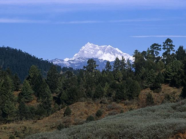
Gangkhar Puensum is the highest mountain in Bhutan and the highest unclimbed mountain in the world, with an elevation of 7,570 meters. Its name means “White Peak of the Three Spiritual Brothers” in Dzongkha. Gangkhar Puensum lies on the border between Bhutan and Tibet. After Bhutan was opened for mountaineering in 1983 there were four expeditions that resulted in failed summit attempts in 1985 and 1986. In 1999, a Japanese expedition successfully climbed Liankang Kangri, a 7,535 meters subsidiary peak, separated from the main peak by a 2 kilometers long ridge to the north-northwest. Since 2003, mountaineering has been banned in Bhutan.
Jigme Dorji National Park
The Jigme Dorji National Park named after the late Jigme Dorji Wangchuck is the second-largest National Park of Bhutan. It occupies almost the entire Gasa District, northern areas of Thimphu District, Paro District, Punakha, and Wangdue Phodrang Districts. It was established in 1974 and stretches over an area of 4316 km², ranging in elevation from 1400 to over 7000 meters. It is listed in Bhutan’s Tentative List for UNESCO inclusion. The park has some of the most notable and precarious glaciers in Bhutan. These glaciers are significantly responsible for forming of lethal and destructive glacial lakes. Chief among the glaciers and glacial lakes within the park are Thorthormi, Luggye, and Teri Kang.
Samtengang Winter Trek
The Samtengang Winter Trek is one of the most exciting and unique ways to explore the Paro valley. One can embark on this 4-day trek that takes through the villages of Chungsakha and Sha, as well as through forests and valleys where touristic can see the Paro river and rhododendron and oak trees lining the roads and hills. The trek offers a glimpse of the unexplored authentic traditional beauty of our country boasting some of the most beautiful forests, and remote historical & religious sites. from here explorers can see the Punakha and Wangdi Valleys.
Haa District
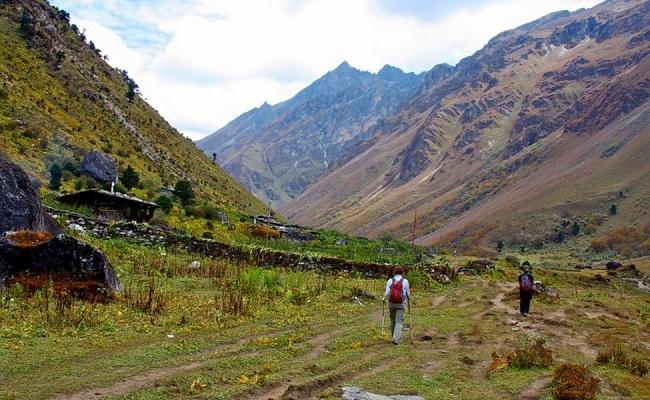
Haa District is one of the 20 dzongkhag districts comprising Bhutan. An alternative name for the district is “Hidden-Land Rice Valley.” The river Haa Chhu, originating at Jomolhari mountain, flows through the district. The southern part of the district covers some sub-tropical areas. However, the district is largely a temperate alpine area. Its northern part is above the tree line. The gewogs of Bji, Katsho, Eusu, and Samar are in the north while Gakidling and Sombaykha are in the south. Haa valley is known for trekking. Haa valley–Saga La–Drukgyal Dzong trek is an easy trek of 23 km that can be covered in 2-3 days. This trek is also called the ‘Haa Planters’ Trail’ as it was used by rice planters. The trek passes through villages in the valley and dense forests near Paro.
Phobjikha Valley
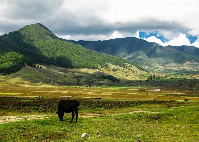
Phobjikha valley is situated on the western slopes of the Black Mountains in Wangdue Phodrang. Valley boasts wonderful sightseeing through the Valley. Phobjikha is a winter home to black-necked cranes that fly from Tibet to escape the harsh winter. Tourists encounter countless black-necked cranes and seemingly endless expanse of the beautiful valley. The place is popular for cultural trips and the best place for hiking and trekking trails is surrounded by an excellent natural landscape with a lot of villages surrounding it. The several places that are famous near Phobjikha Valley are, Gangtey Goemba, Kuenzeng Chholing Shedra, Kumbhu Lhakhang, Nyelung Dechenling, and Khewang Lhakhang.
Aja Ney, Omba Ney, Negkhor
The Aja Ney is located at an altitude of more than 3,500 meters under Sherimuhung Gewog. This is the sacred place with 100 imprints left by Guru Rinpoche on the rock cave. The Nye also has a medicinal spring that the locals believe can cure 18 diseases. It is said to remove defilements in a person. It takes a minimum of three days to complete a pilgrimage to all the sacred sites. There is a belief that Omba Ney of Trashi Yangtse, Aja Ney of Mongar, and Hungrel Dzong of Paro are three equally important religious sites in Bhutan because their names start with the letters Om, Ah, and Hung to complete the Buddhist Mantra of Om Ah Hung. The trail connecting Aja Ney and Ugyen Draphu in Mongar, and Sheri Dzong in the Mongar-Trashi Yangtse border has made pilgrimage more convenient.
Bumthang cultural trek
Bumthang is a religious place in Bhutan and comprises some of the oldest temples of Buddhists. Jakar is a town and is the district capital of Bumthang. The name Jakar roughly translates as “white bird”. Bumthang Valley is located in a spacious and tree-covered forest and is also a popular tourist destination. Jakar town in the Bumthang Valley along with its undulating terrain, numerous temples, and apple trees is a sheer delight for tourists. The visitors can see the scenic Trongsa Dzong that lies on the top of the steep ridge which drops off amidst the clouds.
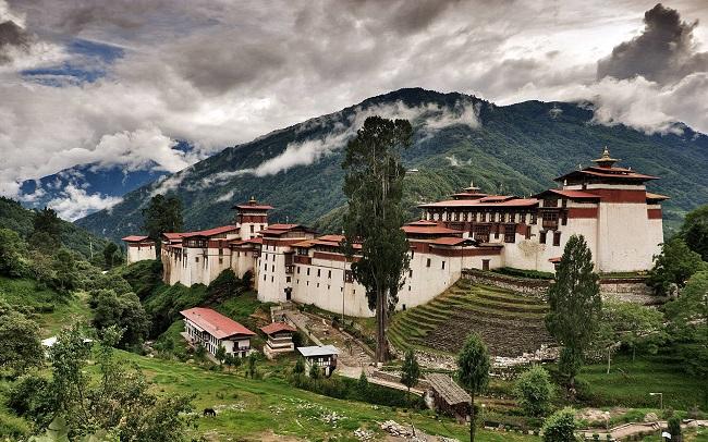
Dechen, Bhutan Country
Dechen Phodrang Monastery is located in the north of Thimphu. The meaning of Dechen Phodrang is “Palace of Great Bliss”. It is the best place for people who are interested in history and paintings, the monastery has paintings that date back to the 12th century and it is one of the amazing places to see in Thimpu. The monastery also houses a statue of Shabdrung Ngawang Namgyal, who was popularly known as the ‘Bearded Lama”. Since 1971, the Dechen Phodrang Monastery is a monastic school where around 300 monks seek education.
Also, read- Know The Secret of ‘Poyang Lake Under Water Road’ China
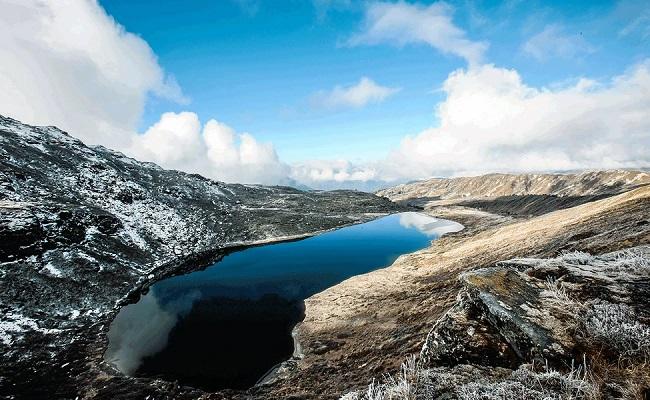
Dagala Thousand Lake
Located in the area of Thimphu and Paro, the Dagala Thousand Lakes is one of the iconic trekking trails in Bhutan, and a unique chance to see some of the most stunning high mountains of Bhutan’s Himalayas in a short trek. There are a huge number of small pristine lakes along the route, that is filled with fish, and when the days are clear, the rainbow trout can be seen swimming deep in the placid waters. This is one trek that you will not want to miss in the Land of the Thunder Dragon.
How to Reach Bhutan Country
Bhutan is sharing an international border with India and can be reached easily through multiple Indian destinations. The best way to reach Bhutan is by air. The only international airport in Bhutan is Paro International Airport. It has connecting flights from various cities such as Mumbai, Guwahati, and other major cities around the world.
