Stages of Mineral Exploration and their techniques
Mineral Exploration
Mineral exploration is the process of searching for evidence of any mineralization hosted in the surrounding rocks. The general principle behind mineral exploration is to get geological information from several places and extrapolate this over the larger area to develop a geological picture. Initial exploration activities, such as mapping, will start over a large area and then target smaller and smaller areas. The aim is to see if mineralization is at levels large enough to be commercially extracted from the Surrounding area. Exploration works in stages of increasing sophistication, with cheap, field-related methods implemented at the start, and if the resultant information is economically viable, more advanced (and expensive) techniques can be employed.
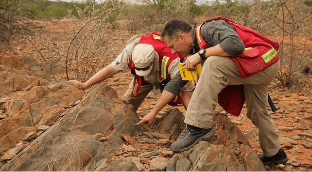
The objective of the Mineral exploration
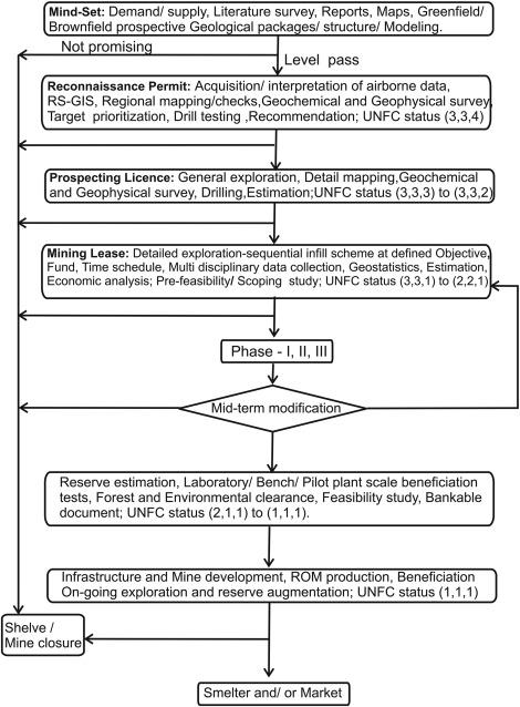
Mineral exploration is a complete sequence of activities employed in the evolution of Ore deposits. It starts with a reconnaissance survey and ends with an evaluation of the property for economic mining (feasibility study). Various exploration techniques have been followed over the centuries. Exploration is conducted by a combination of available techniques and depends on many factors such as Mineral type, the convenience of infrastructures, funds from the exploration institution, size and complexity of the deposit, price of end products, government policy, and royalty structures.
Mineral exploration includes multidisciplinary data generation in a sequential way. In addition to technical inputs, Other activities included infrastructures around the area, such as accessibility road, rail, airport, and seaport, average rainfall, availability of potable and industrial water, power grid and supply system, local community, living conditions, health care, security, forests, and environmental issues. Background information about agencies from governments and the public and private sectors.
Minerals exploration and mining are not allowed in national or state parks. More than 20 laws apply to exploration and mining to protect the environment, Indigenous heritage, water, land, Native Title, plants and animals, biodiversity, and water catchment.
Mineral exploration methods
Various steps are employed in mineral exploration to help determine if there are minerals under the ground. If the exploration process identifies minerals that can be commercially extracted, then mining in the future may be possible. Exploration for minerals may involve- Mapping, Surveying the ground from the surface or air, Testing water and soil samples, and Drilling.
Exploration is strictly regulated by government bodies. Minerals explorers need to apply for an exploration license. The license gives the explorer sole rights to search for a specific mineral within the specified area. An exploration license does not permit mining or guarantee that a mining license will be granted. The license holder may also apply for a mining or retention license.
Geological Mapping
Geological Mapping is the foundation of all geological-related studies, whether it be Mineral exploration, geotechnical, groundwater Environmental hazards, etc. It is necessary for developing the base-level picture of an interesting area. When mapping for a mineral exploration focus includes- reconnaissance survey and geological prospecting of the area.
Soil Sampling
Soil Horizon is very important for Mineral exploration. This Particular horizon or layer, catches the metal ions leaching from the underlying rocks. This is the desired layer in soil sampling, from where the specimen is collected to test the chemistry of the geology beneath.
Stream Sediments
The stream sampling method works on the principle that sediment in stream beds is transported from the erosion of the rocks further upstream. Therefore sampling stream sediments in various locations can give clues as to the geology of the upland area, as well as being tested for their chemistry to provide information to whether any metals of interest may be hosted within these beds or not.
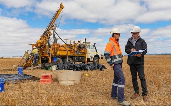
Drilling
Drilling is the one step ahead in the mining campaign. Drilling programs is an extremely expensive process and so will use in the locations where minerals have proven considerably interesting for their mining. Drilling also provides physical evidence of the rock below and is used to confirm the theories of the underlying geology, which were developed during earlier techniques such as soil sampling etc. Drilling is an essential component of late-stage exploration projects.
Geophysical Methods
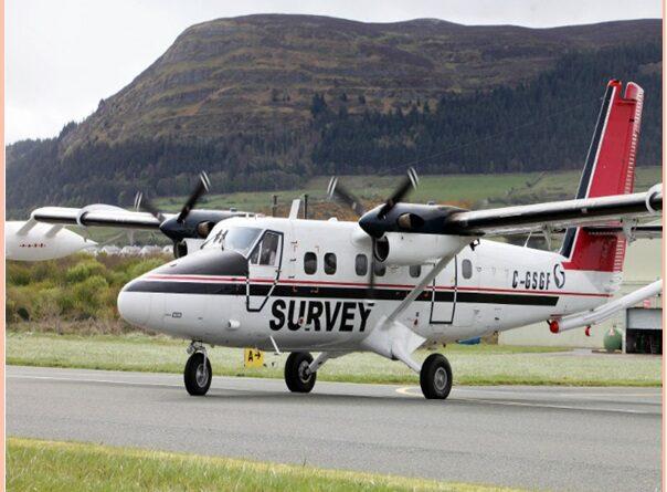
The geophysical method is used for some exceptional minerals investigation. This methods analyze the chemistry of the geology below the surface and is used to test for the physical properties of the rock. These techniques can boost an exploration campaign collaborate with geochemical studies.
Benefits and Value
Everything we use in today’s life began with a mineral. Car, PC, mobile phone and power supply are all made with materials derived from minerals. Exploration is an important step in finding minerals so they can be mined for country needs. Our demand for minerals is increasing, for example, we need more copper to build renewable energy such as wind turbines. This demand is helping drive an increase in exploration across the state.
Also, read- Major mineral group and their Properties
Modern techniques for Mineral exploration
Mineral exploration techniques advanced over the years. Many new techniques were involved to evolved the Mineral deposit. These are Aerial photographs, satellite imagery, geological maps, geophysical maps, and geochemical maps to delineate areas of interest. Remote sensing is an important technique in mineral exploration. Data generated by these techniques are stored in a thematic and textual database using suitable software. These techniques of data have developed over the years, where computers play an important part. These data can be utilized for 2D or 3D modeling of Ore deposits. The data can be selectively combined to obtain information for the likely locating of ore deposits.
Evaluation of Mineral exploration
Geological, geochemical, and geophysical anomalies are important factors in mineral exploration. In the Reconnaissance survey stage, geological, geochemical, and geophysical methods are employed to follow up the anomalies or targets.
At this stage, pitting, trenching, sampling, and wall logging programs are conducted to delineate the bedrock geology of the area in order to confirm the resources and to determine accurate grade estimates of the deposit. A hand drill or an auger may be used for shallow drilling to understand the geology of the anomaly and ascertain the position of the deposit. Soil samples are taken at fixed intervals to offer a more clear shape and structure of the ore body. The geophysical methods may include gradient array induced polarization, resistivity, magnetic, and gamma-ray spectrometry.

Pingback: Types of Volcanoes And its example - Geotourism