Spiti Valley: Gateway to Himalayan Serenity
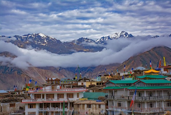
Approximately 412 km from Shimla, The Spiti Valley is a desert mountain valley, which also qualifies for heaven on earth. Located at an average height of 12,500 feet above sea level, Spiti Valley consists of stark high alpine lands, scattered with small postcard-perfect villages of whitewashed mud-homes and monasteries.
Separated from the Kullu Valley by the Rohtang pass, Spiti, which means ‘the middle country’ has beautiful snowcapped mountains that reach out to the clear deep blue skies and the pretty Spiti green river nestled between snow-capped barren mountains and blue lakes.
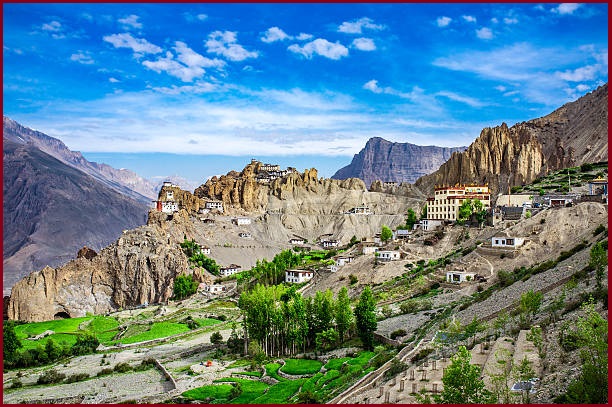
The most popular things are here villages of Spiti Valley including Asia’s highest villages – Komik and Kibber. Marvel at the wondrous structure of the Ki Monastery and get ready to be amazed by the Tabo Monastery a 1020-year-old UNESCO World Heritage Site.
You can spend a night, gazing at the Milky Way and the millions of stars while camping around the stunningly beautiful Chandratal Moon lake Lake.
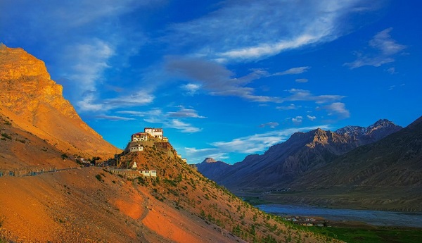
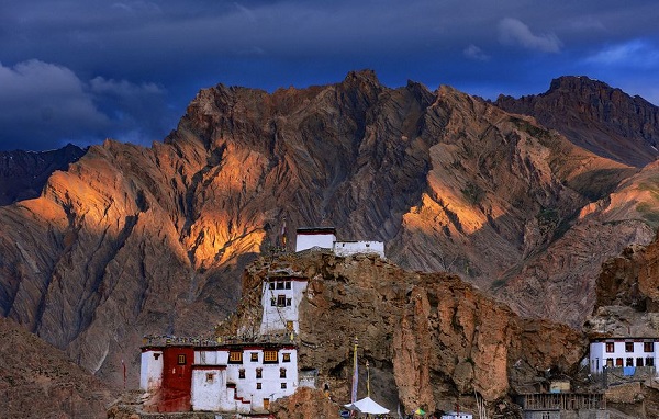
The most interesting aspect of Spiti is its Buddhist Gompas, and the most interesting aspect of these Gompas is their unique location. Perched high atop mountains, these monasteries are isolated from civilization.
Almost all the villages have a monastery on the ridge above the village. Apart from the many village-level monasteries, there are five major monasteries in Spiti- Monastery, Tangyud Monastery, Dhankar Monastery, Tabo Monastery, and Kungri Monastery.
The biggest surprise of all is Around a 500-year-old mummified body of a Buddhist monk, named Sangha Tenzin. What is surprising is that the process of mummification of the monk’s body is completely natural and no chemicals were used in the process.
Rohtang Pass 13,050 ft. and Kunzum Pass 15,060 ft. are high mountain passes that come on your way to Kaza (Spiti Valley) via the Manali route. Crossing these high-altitude passes on your way to the Spiti Valley adds to your experience. These passes connect the Kullu and Lahaul valleys with the Spiti valley.
Geological History-
The present location of Spiti was in pre-historic times the bed of the Tethys sea, separating the Asian mainland from the Gondwana continent.
As the latter moved towards the former, the tectonic plates rubbed against each other, and the movements of the earth’s crust pushed up the intermediate ground of the Tethys Sea. Over time the sea dried up, and the greater Himalayas rose to create the arid climate of today.
The old sedimentary deposits forming the river valleys are easily erodable and the glacial movements of the Pleistocene era have left a deep impact. Now all major streams. meander over wide beds of sand, gravel, and stone leaving steep-sided high terraces on one bank or the other, and rush through rocky gorges at the end of their course.
Spiti lies across the main range of the Himalayas, called the Trans-Himalaya. The cold desert mountain valley has barren hills and grey scree slopes. The terrain has an immature topography and is traversed by deep valleys and high hill ranges.
Valley fills include both fluviatile deposits and moraines. These deposits occur as narrow and elongated strips along the main streams. The glacial deposits are under the influence of running water and have been termed glacial-fluviatile deposits.