Zealandia
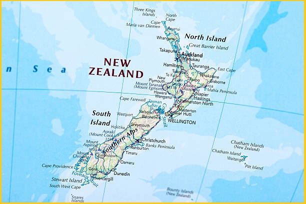
Zealandia is a long, narrow microcontinent located in the South Pacific Ocean, with most of its landmass submerged beneath the sea. A microcontinent is a fragment of continental crust that has broken away from a larger continent. Zealandia separated from Antarctica around 100 million years ago, and later from Australia about 80 million years ago.
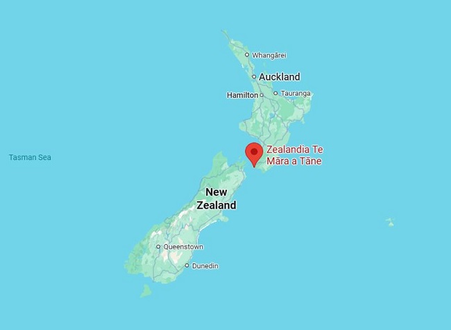
Although it covers roughly half the area of Australia, only about 7 percent of Zealandia lies above sea level. Most of this exposed land forms New Zealand’s two main islands—the North Island and the South Island. Stewart Island, situated just south of the South Island, along with numerous smaller islets, also belong to Zealandia. At its northern end, the islands of New Caledonia (an overseas territory of France) mark the continent’s tip.
The mapping of Zealandia was completed in 2023. Covering an area of about 4,900,000 km² it is far larger than any landmass typically described as a microcontinent or continental fragment. If considered a microcontinent, Zealandia would rank as the largest in the world—six times bigger than Madagascar, the next-largest example. Geologists from New Zealand, New Caledonia, and Australia have argued that Zealandia meets all the criteria to be classified as a continent, rather than merely a microcontinent or continental fragment.
Geology
Zealandia is primarily composed of two nearly parallel ridges, divided by a failed rift that terminated in a filled graben. These ridges rise about 1,000–1,500 m above the seafloor, with several rocky islands emerging above sea level. Although the ridges consist of continental rock, they lie lower than typical continents because their crust is unusually thin—about 20 km causing them to sit lower on Earth’s mantle compared to most landmasses.
Around 25 million years ago, tectonic movement caused the southern portion of Zealandia, situated on the Pacific Plate, to shift relative to the northern portion, which lies on the Indo-Australian Plate. This movement along the Alpine Fault displaced the landmass by nearly 500 km, a shift clearly visible in geological maps. The same boundary motion also offset the New Caledonia Basin from its earlier alignment with the Bounty Trough.
Volcanic activity
Zealandia is one of the most tectonically active regions on Earth. The microcontinent straddles two major tectonic plates, with its western portion lying on the Australian Plate and its eastern portion on the Pacific Plate.
The northern part of Zealandia is highly volcanic, containing six major volcanic regions. The largest of these is the Taupō Volcanic Zone on New Zealand’s North Island. Ongoing interaction between the Australian and Pacific plates also fuels widespread geothermal activity, giving rise to numerous natural geysers and hot springs across the region.
