Mount Etna
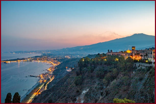
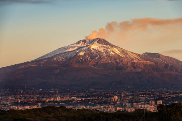
Mount Etna, located on the eastern coast of Sicily, is an iconic landmark and is the tallest mountain on any Mediterranean island and the most active stratovolcano in the world. The volcano’s eruptive history spans 500,000 years, with at least 2,700 years of documented activity. Its diverse and accessible volcanic features, such as summit craters, cinder cones, lava flows, and the Valle del Bove depression, attract researchers and educators from around the world.
Mount Etna is one of the world’s most active and renowned volcanoes, serving as an excellent example of ongoing geological processes and volcanic landforms. This stratovolcano is known for its nearly continuous eruptive activity from its summit craters, along with frequent lava flows from craters and fissures on its slopes. Today, it is one of the most thoroughly studied and closely monitored volcanoes globally, continually shaping the fields of volcanology, geophysics, and other Earth sciences. Mount Etna’s prominence, scientific relevance, and cultural and educational value are of worldwide importance.
Geological History
Volcanic activity at Mount Etna began around 500,000 years ago, with the first eruptions occurring beneath the sea off the ancient coast of Sicily. Approximately 300,000 years ago, volcanic activity shifted to the southwest of what is now the summit, and about 170,000 years ago, it moved toward the present-day center of the volcano. During this period, the first significant volcanic structure was formed as a stratovolcano, characterized by alternating explosive and effusive eruptions. The growth of Mount Etna was periodically interrupted by major eruptions, which caused the summit to collapse and form calderas.
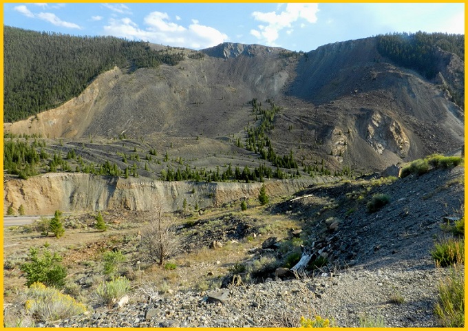
Between 35,000 and 15,000 years ago, Mount Etna experienced several highly explosive eruptions that produced large pyroclastic flows, resulting in extensive ignimbrite deposits. Ash from these eruptions was carried as far as 800 kilometers north, reaching areas south of Rome. Thousands of years ago, the eastern flank of Mount Etna underwent a catastrophic collapse, resulting in a massive landslide similar to the 1980 eruption of Mount St. Helens. This landslide created a large depression on the side of the volcano, known as the “Valle del Bove” (Valley of the Ox).
Also Read- Sicily Italy-A Dazzling Island in Mediterranean Sea
The steep walls of the valley have experienced multiple collapses since then, and the exposed strata provide a valuable and accessible record of Etna’s eruptive history. The most recent summit collapse is believed to have taken place about 2,000 years ago, forming the Piano Caldera. Although subsequent lava eruptions have nearly filled this caldera, it remains visible as a distinct break in the mountain’s slope near the base of the current summit cone. Mount Etna is gradually moving toward the Mediterranean Sea at an average rate of 14 mm per year, with the massif sliding over an unconsolidated layer above older, sloping terrain.


