Did You Know? Russia Covers 1/8th of Earth’s Landmass
Russia
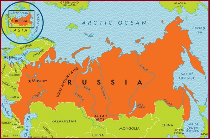
Everyone knows that Russia is massive—it’s the largest country in the world. But it’s still astounding to grasp just how vast it truly is. This enormous nation occupies one-eighth of the Earth’s total landmass. To put it into perspective, you could fit nearly two Canadas within its borders. Russia spans an immense area of over 17,125,191 km², which accounts for more than one-eighth of Earth’s inhabited land. The country stretches across eleven time zones and shares borders with sixteen sovereign nations, the most of any country globally.
A transcontinental nation, Russia extends across both Europe and Asia, occupying the northernmost part of Eurasia. It boasts the world’s fourth-longest coastline, measuring 37,653 km, and is one of only three countries—alongside Canada and the United States—with coastlines on three oceans-the Arctic, Pacific, and Atlantic. However, its connection to the Atlantic Ocean is minimal. This geographic position gives Russia access to more than thirteen marginal seas.
Situated between latitudes 41° and 82° N and longitudes 19° E and 169° W, Russia is larger than three continents and has a surface area comparable to that of Pluto. It is home to the largest forested area of any country, making it a significant contributor to the planet’s natural resources and biodiversity.
The Russian landscape is incredibly diverse, ranging from deserts to frozen coastlines, towering mountains to vast marshlands. Much of the country consists of rolling, treeless plains known as steppes, while Siberia, which makes up three-quarters of Russia, is dominated by expansive pine forests called taigas. Russia is home to around 100,000 rivers, including some of the world’s longest and most powerful. It also features numerous lakes, including Europe’s two largest, Lake Ladoga and Lake Onega. Siberia’s Lake Baikal holds more water than any other lake on the planet, making it a global natural treasure.
Also read- Offbeat Meghalaya: A Journey to Nongkhnum River Island
Topography
Russia’s mountain ranges are primarily concentrated in specific regions across its vast territory. The Ural Mountains mark the country’s continental divide, while the Caucasus Mountains dominate the southwestern border. Along the border with Mongolia, the eastern and western Sayan Mountains, as well as the westernmost part of the Altay Mountains, form prominent features. In eastern Siberia, a complex system of ranges lies in the northeastern corner of the country, including the spine of the Kamchatka Peninsula, with smaller mountain chains extending along the coasts of the Sea of Okhotsk and the Sea of Japan.
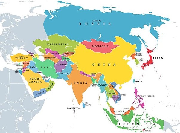
Russia is home to nine major mountain ranges. Generally, the eastern half of the country is far more mountainous than the western half, which is characterized by expansive low plains. The Yenisei River valley traditionally serves as the dividing line between eastern and western Russia. Flowing from near the Mongolian border northward into the Arctic Ocean, west of the Taymyr Peninsula, the Yenisei separates the western edge of the Central Siberian Plateau from the vast West Siberian Plain.
