An Unusual Comb ridge Utah-Geology and its Origin
Comb ridge canyons Utah
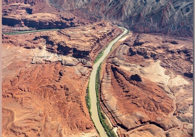
Comb Ridge is an unusual geologic formation found in southeastern Utah. This sandstone monocline runs for many miles from the Abajo Mountains to the San Juan River and then on to Kayenta in northern Arizona. It gets its name from the unusual shape of this ridge of sandstone because one side of this massive rock formation is scalloped out in a pattern resembling a comb. Comb Ridge sandstone formation tilted at an angle of about 20 degrees and is almost 193 kilometers long, about 1.6 kilometers wide, and runs north and south.
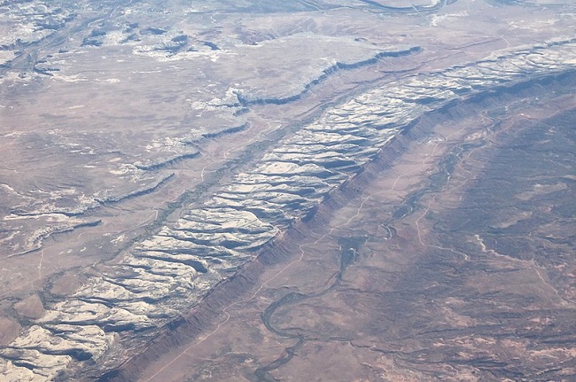
Geologically, the Comb is a monocline. It means a single fold in the Earth’s crust that was created by a cataclysmic slippage of deeply buried tectonic plates some 65 million years ago. That primeval upheaval left a scar across the desert landscape. This sharp ridge of sandstone stretches unbroken from east of Kayenta, Arizona, to some ten miles west of Blanding, Utah. Both Butler Wash and Comb Wash flow into the San Juan River which cuts through Comb Ridge bluff and Mexican Hat.
Comb Ridge Utah is an extremely primitive area with no water, no facilities, and generally difficult access. There is not a single mile of established trail in the Comb’s reach, which is one reason why no humans, have ever done Comb ridge Utah hikes of its length. Similar structures have been found in the San Rafael Swell, Capitol reef, and Colorado National monument near Grand Junction. All are closely related in origin and timing. At Comb Ridge the uplifted region consist of some world-famous monument Cedar Mesa, the San Juan River Canyon, and Monument Valley.
Comb ridge Utah 95
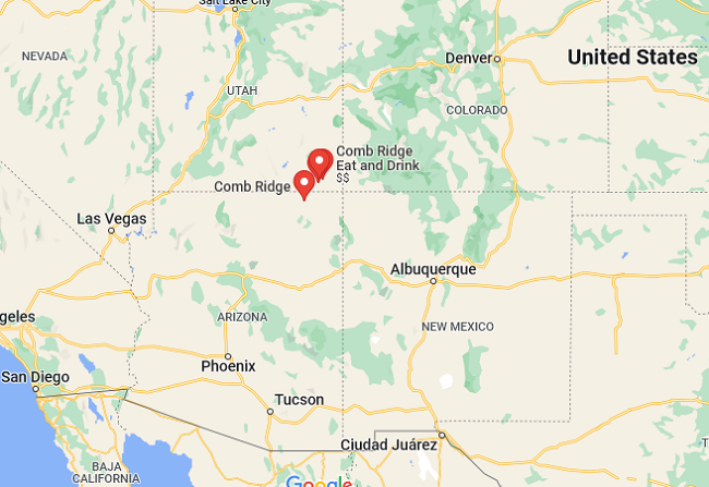
The most prominent section of Comb Ridge Utah formation lies where the ridge is crossed by Highway 95 and Highway 163. For a stretch of 25 miles, the faultline is easily seen at a height of 700 feet above its surroundings. Comb Ridge features gently sloping ground to the east, formed by the top of a layer of white Navajo sandstone. See the Comb ridge Utah map.
Comb ridge Utah geology
Comb Ridge, has a hogback topography of eastward-dipping rocks extending through the area and far to the southwest, which is the most striking topographic feature and an impassable barrier. Monocline fold includes the Jurassic-aged Navajo Sandstone, Kayenta Formation, Wingate Sandstone, Chinle Formation, Triassic Moenkopi Formation, and Permian Organ Rock Formation. The Comb structure is the surface expression of a deep reverse fault along the east margin of the Monument Uplift.
The term monocline refers to a single-limbed fold; in simple geometric terms, a ramp. The ramp of steeply tilted strata separates uplifted regions from those that have dropped downwards. The monoclines formed at the same time as the jagged Rocky Mountains of Colorado and Wyoming. This mountain-building event is the result of a widespread pulse of compression that rippled across western North America 65 to 50 million years ago.
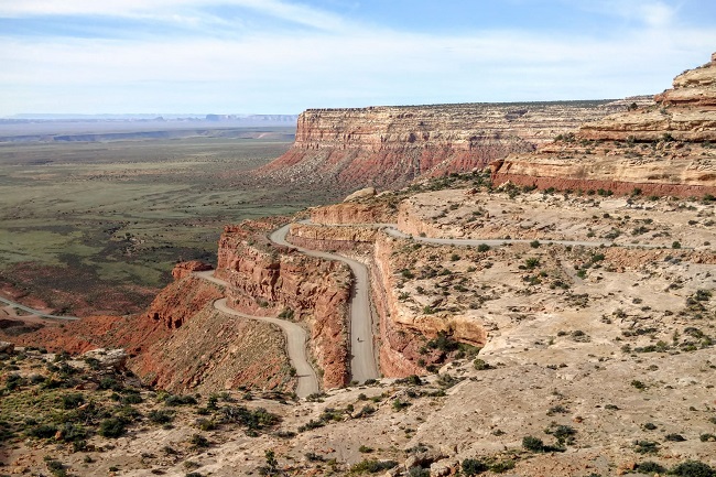
The crust of the Colorado Plateau resisted the large-scale uplift of alpine mountains but did not escape unscathed. Most monoclines are the surface expression of a reverse fault in the older rocks deep beneath the surface. This intense compression shoved older rocks eastward and upward over younger rocks along a low-angle fault, tilting the sedimentary layers far above.
Also read- Reinebringen And Lofoten island Norway, Wonderful place for Hike
San Juan River is the major drainage course and the only perennial stream. It cuts across Comb Ridge Utah, follows the strike in softer beds for 2 miles, and then flows in a deep, tortuous canyon through steeply dipping hard rocks. Comb and Butler Washes are the two principal tributaries, flowing in strike valleys. These streams and their numerous branches show close adjustment to the nature and structure of the formations over which they run.
The exposed sedimentary formations range in age from Pennsylvanian to Recent and aggregate 1524 meters or more in thickness. The oldest rocks the upper part of the Hermosa and the lower part of the Rico are exposed in the deep canyon of the San Juan River. Hard upper limestones of the Rico form the surface of a structural uplift and topographic upland near the river. The Cedar Mesa sandstone member of the Cutler formation usually made up chiefly of a thick series of massive gray to buff sandstones, has a soft zone about 130 feet thick at its base in the northern part of the area.
Comb ridge Utah Petroglyphs
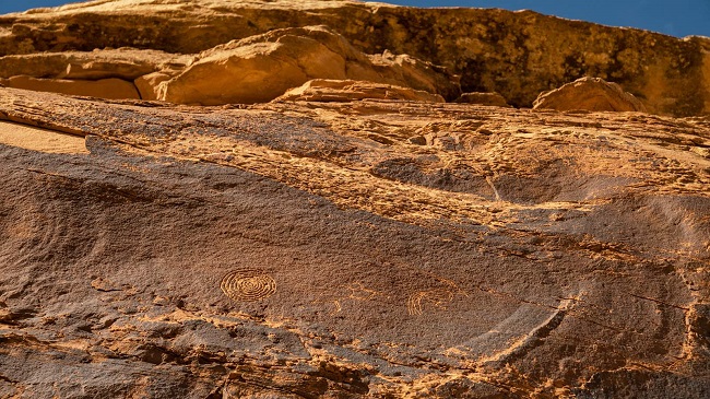
The ancient Ancestral Puebloans lived here over 1,000 years ago, building cliff dwellings, granaries for storing seed corn, and pecking galleries of exquisite petroglyphs on varnished sandstone walls. The petroglyphs reflect their lives, depict their culture and clothing, show clan symbols and migrations, and relate supernatural journeys. The Procession Panel and the nearby Wolfman Panel in Lower Butler Wash are the best-known petroglyph sites at Comb Ridge.
