A Wonderland of Rocks- Chiricahua Mountain Range in Arizona
Chiricahua Mountain
Chiricahua Mountain Massif is located in southeastern Arizona, in the United States. They are part of the larger Basin and Range Province of America and are known for their unique rock formations. The Chiricahuas are part of the Coronado National Forest and cover an area of approximately 1,166 sq. km. They are home to a number of different plant and animal species, including black bears, mountain lions, javelinas, and over 300 species of birds. The mountains are also home to the Chiricahua National Monument, which preserves the unique rock formations and scenic beauty of the area. The monument is a popular destination for hiking and camping and offers a range of trails and facilities for visitors. Chiricahua Mountain Range has a rich cultural history and was home to the Chiricahua Apache tribe before they were forced to leave the area in the late 1800s after a war between the Apache tribes and the United States government in the late 1800s.
Chiricahua mountain geology
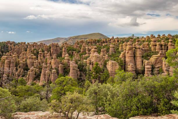
Chiricahua Mountain Range is composed primarily of volcanic rocks that were formed during the late Oligocene to early Miocene period, about 25 to 35 million years ago. These volcanic rocks were produced by a series of explosive eruptions and are mainly rhyolitic in composition, which means they are rich in silica. The Chiricahua Mountains are unique because of the spectacular rock formations that are found throughout the range. These formations are the result of volcanic activity and erosion, and they include hoodoos, spires, pinnacles, and balanced rocks. One of the most famous of these formations is the “Cochise Head,” which is a large rock formation that resembles a human head. The Chiricahua Mountains are an uplifted structural block of the Basin and Range. It contains Precambrian basement rocks, Paleozoic and Cretaceous sedimentary rocks also. Sedimentary rocks such as limestone and sandstone. These rocks were deposited during the Permian and Triassic periods, between 299 and 252 million years ago. The Mountains are home to a number of mineral deposits, including copper, lead, zinc, and silver.
Also, read- Lake Powell Page and Horseshoe Bend-A Stunning Landscape in the USA
Chiricahua mountain monument
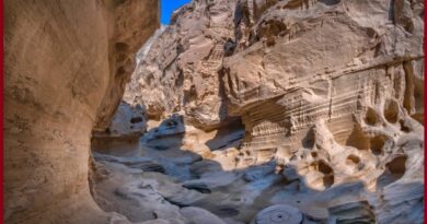
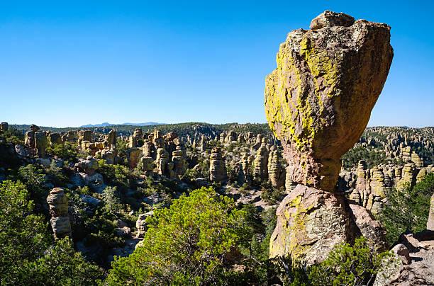
Chiricahua National Monument is a protected area located in the Chiricahua Mountains of southeastern Arizona. The monument was established in 1924 to preserve the unique rock formations and scenic beauty of the area. The monument covers an area of approximately 12,000 acres and includes a variety of landscapes, from high-elevation pine forests to lowland deserts. The most famous feature of the monument is the “Wonderland of Rocks,” a collection of towering rock spires and balanced rocks that have been eroded into fantastic shapes over millions of years.
Best place to go in Chiricahua Mountain
The Chiricahua Mountains offer a variety of great places to visit, depending on your interests and the amount of time you have available. Here are some of the best places to check out in the area- Wonderland of Rocks-This is the most famous feature of the Chiricahua National Monument and a must-visit for anyone traveling to the area. The Wonderland of Rocks is a collection of towering rock spires and balanced rocks that have been eroded into fantastic shapes over millions of years. The Echo Canyon Trail is a great way to explore this area. Faraway Ranch Historic District located within the Chiricahua National Monument, this historic district includes the former home of Swedish immigrants who settled in the area in the early 1900s. Visitors can tour the ranch house and learn about the history and culture of the Apache people who lived in the area.
Rustler Park- located at an elevation of over 2,438 meters, Rustler Park offers stunning views of the surrounding mountains and valleys. It’s a great place to camp, hike, and enjoy the cool mountain air during the summer months. Turkey Creek- located on the eastern side of the Chiricahua Mountain Range, is known for its lush riparian habitat and abundance of bird species. It’s a great place for birdwatching, hiking, and exploring the unique ecosystems of the area. Chiricahua Wilderness Area– For those looking for a more remote and rugged experience, the Chiricahua Wilderness Area offers over 87,000 acres of protected wilderness to explore. The wilderness area is home to a variety of wildlife, including black bears, mountain lions, and bighorn sheep, and offers some of the best backcountry hiking and camping opportunities in the region.
Chiricahua Mountain Waterfalls
There are a few waterfalls in the Chiricahua Mountain Range, but they are not very prominent or easily accessible. Here are a couple of waterfalls you may be able to visit in the area:
Bridal Veil Falls- Located in the Coronado National Forest, Bridal Veil Falls is a small waterfall that can be reached via a short hike from a nearby parking area. The trail is less than a mile round-trip and is relatively easy, although there are some rocky sections and a creek crossing.
Rustler Park Creek Falls-This waterfall is located in Rustler Park, a high-elevation area in the Chiricahua Mountains that offers stunning views of the surrounding landscape. The waterfall is not marked or well-known, but can be found by following Rustler Park Creek upstream from the main campground.
Chiricahua mountain camping
Camping is a popular activity in the Chiricahua Mountain Range, and there are several campgrounds in the area that offer a variety of camping experiences. Here are some of the best camping options in the Chiricahua Mountains-
Bonita Canyon Campground- This campground is located within the Chiricahua National Monument and offers tent and RV camping sites, as well as group sites and cabins. The campground is situated in a forested canyon and offers access to hiking trails, picnic areas, and visitor centers.
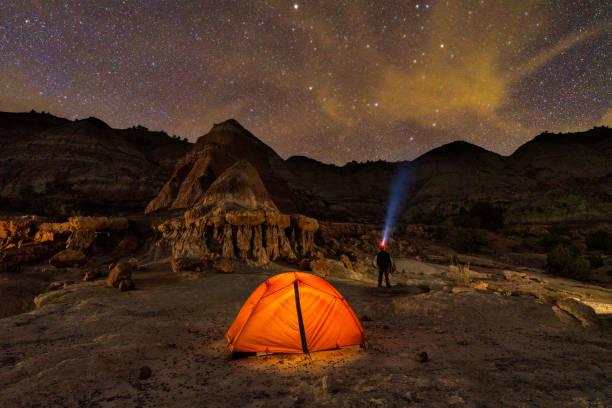
Rustler Park Campground- Located at an elevation of over 2,438 meters, Rustler Park is a high-elevation camping area that offers cooler temperatures and stunning views of the surrounding mountains and valleys. The campground has tent and RV sites, as well as a group site and vault toilets.
Sunny Flat Campground-This campground is located in the Coronado National Forest and offers tent camping sites and vault toilets. The campground is situated near several hiking trails and offers easy access to the wilderness areas of the Chiricahua Mountains.
Turkey Creek Campground-This campground is located in the Coronado National Forest and offers tent camping sites and vault toilets. The campground is situated near a lush riparian area and offers access to several hiking trails and birdwatching opportunities.
Chiricahua mountain hikes
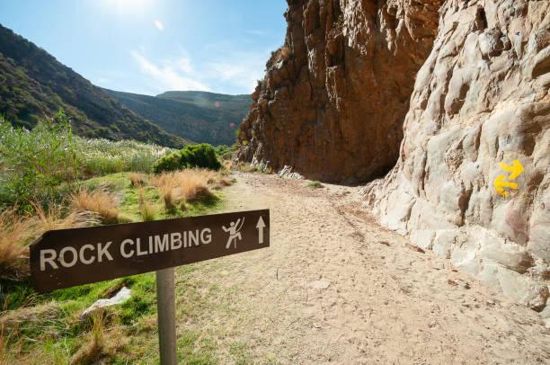
Chiricahua Mountain Range offers a variety of hikes, ranging from short and easy walks to more challenging backcountry trails. Some of the best hikes in the area is Echo Canyon Trail a 5.3 km loop trail that is the most popular hike in the Chiricahua National Monument and takes visitors through the heart of the Wonderland of Rocks. The trail features stunning rock formations, balanced rocks, and scenic vistas. Big Balanced Rock Trail is a 1.9 km round-trip trail that takes visitors to one of the most iconic rock formations in the Chiricahua National Monument. The trail features a gradual climb through a forested canyon, culminating in a dramatic view of the balanced rock.
Chiricahua Peak Trail is a 15.1 km round-trip trail that is the highest peak in the Chiricahua Mountain Range and offers stunning views of the surrounding landscape. The trail is challenging, with steep switchbacks and rocky terrain, but is well worth the effort for the panoramic views at the summit. South Fork Trail is a 19 km round-trip trail is located in the Coronado National Forest and follows a riparian stream through a lush canyon. The trail features several waterfalls, swimming holes, and opportunities for wildlife viewing. Flys Peak Trail is an 11.6 km round-trip trail that is a challenging hike that leads to the second-highest peak in the Chiricahua Mountains. The trail features steep switchbacks and rocky terrain but offers stunning views of the surrounding wilderness areas.
How to reach Chiricahua Mountain
The Chiricahua Mountains are located in southeastern Arizona, near the border with New Mexico. The nearest major airport to the Chiricahua Mountains is Tucson International Airport, which is located about 145 km northwest of the mountains. From the airport, visitors can rent a car and drive to the Chiricahua Mountains. Amtrak offers train service to Benson, Arizona, which is about 97 km northwest of the Chiricahua Mountains. From Benson, visitors can rent a car or take a shuttle service to the mountains. Greyhound offers bus service to Willcox, Arizona, which is the nearest town to the Chiricahua Mountains.