Puerto Rico Tourism: 5 Best Geological natural Sites
Puerto Rico Tourism-Geological features
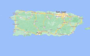
Puerto Rico is a Caribbean island and unincorporated U.S. territory. It has a landscape of mountains, waterfalls, and the El Yunque tropical rainforest. San Juan is the capital and largest city, known for its hotel strip, beach bars, and casinos. Puerto Rico tourism is booming with countries with rich natural resources, culture, exceptional food, pristine beaches, and adventure that are all packed in a Caribbean paradise. Here are the 5 best Geological features that make Puerto Rico a wonderland.
Pozo de Jacinto
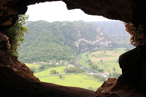
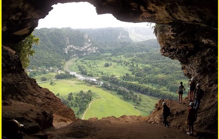
The Pozo de Jacinto is a striking open sea cave found on Jobos beach in Isabela on Highway 466. The cave is over 10 meters deep and on one side it faces the Atlantic Ocean while on the other it faces the scenic Jobos beach, making the area an impressive sight. Exploring this 1.0-km out-and-back trail is the best to experience in the region. The trail is great for hiking and walking, and it’s unlikely to encounter many other people while exploring. Pozo de Jacinto is a top travel site in the puerto Rico. The Puerto Rico map is available in the Puerto Rico market. It can be very helpful to explore this geological feature.
La Piedra Escrita
La Piedra Escrita means “the written stone”, located inside the Rio Saliente, La Piedra Escrita partially blocks the path of the river, forming a tidal pool safe for swimming. The area surrounding La Piedra Escrita has the best picnic spot, viewing towers, and a wooden boardwalk that goes to the river. Travellers can float and relax in the natural pool, and thrill-seekers often climb la Piedra Escrita and jump into the water. The rock has petroglyphs on the rock that reflect the lifestyle and beliefs of the Taino people of the Pre-Columbian era. If you are a Travel adventure this is the best destination to see Puerto Rico tourism.
Also read- 9 Oldest Geological features on Earth That you couldn’t know
Tres Pueblos Sinkhole
Tres Pueblos Sinkhole is the perfect surprise for your trip. It includes swimming pools, houses, and villas that are popular options for a stay near Tres Pueblos Sinkhole. It is located outside of the Las Cavern in Camuy. Travelers can visit the “Miradores” with amazing views of El Sumidero. Each Mirador is located in three cities (Camuy, Hatillo, and Lares) with one Mirador by city. View the incredible crater from the platform made in the El Rio river. The sinkhole can be enjoyed crossing the hole by cross-walking. Between the Hatillo and Lares “Mirador,” visitors can experience the incredible Spiral Cave.
Canon Blanco, Puerto Rico tourism
Canon Blanco is the hidden gem in Puerto Rico’s central mountain region, in the town of Utuado. Canon Blanco is a Magical and beautiful place, Reaching this spot requires a bit of hiking. Aside from a beautiful landscape, keep an eye out for the indigenous petroglyphs etched into some of the area’s large rocks.
A 1.6-km out-and-back trail near Utuado, Central Region is considered a moderately challenging route. The trail is great for hiking, and it’s unlikely you’ll encounter many other people while exploring. This glowing, white rock canyon, stands out against the lush rainforest and bamboo on the mountains. Carved from years of water running through the rock, Canon Blanco Puerto Rico is the perfect place to stop to explore, swim and soak in the sun.
Flamenco Peninsula
Flamenco Peninsula is rewarded with the striking scenery of the sea and rugged cliffs. It is formed due to the intense erosion of the area. In Flamenco, you’ll find some cool attractions near the coastal region. Explore Flamenco Beach, Culebra Ferry Terminal, and Zoni Beach also. Flamenco Beach is a beach on the Caribbean island of Culebra. It is known for its shallow turquoise waters, white sand, swimming areas, and diving sites. It stretches for a mile around a horseshoe-shaped bay. Playa Flamenco is a popular beach destination for both Culebra and Puerto Rico.

Bosque Rocoso de Piedra
Bosque Rocoso de Piedra rocks formation is almost unique in the world since it is only found in Spain, China, and other Asian countries. but to a lesser extent. The forest covers over 5,200 acres of land in this region. Travelers can visit the rocky forest, with the coordination of the Office of Culture, Art, and Tourism. The rock formation and surrounding area is the best holiday destination.
Natural Protected Area Canon de San Cristobal
The Canon de San Cristobal Natural Protected Area is a top travel site with and best geological features. It is located in the municipalities of Barranquitas and Aibonito, at an elevation ranging from 227.8 m to 652.2 m in Puerto Rico’s Central Region. The area owes its name to its most outstanding topographic feature, the San Cristobal Canyon. Extending for approximately 9 km in the heart of Puerto Rico’s Cordillera Central, the Canon de San Cristobal is a unique geomorphological phenomenon resulting from tectonic movements that caused the rise of the superficial terrestrial crust along the region. Canon de San Cristobal is famous for the best vacation trip. Puerto Rico’s tourism development mainly focused on natural resources.
The rocky riverbed of the region captures the water from the system of tributaries throughout its nearly 10.5 km of length, creating waterfalls and natural ponds. It includes the breathtaking Salto La Vaca, the highest waterfall in Puerto Rico at approximately 91.4 m.
Pingback: Niger River-The 3rd largest river of Africa, Know its origin place - Geotourism