7 Outstanding location in Tyrol Austria for GeoTourism
Tyrol, Austria
Tyrol is a beautiful state in Austria and is home to rugged peaks, picturesque valleys, and rolling mountain valleys. Tyrol is Stretching along the western side of Austria and is sandwiched between Bavaria and Italy. It is one of the country’s nine federal states. The state covers much of the Eastern Alps and is renowned for its skiing, snowboarding, and skiing in winter. The region also offers plenty of scope for outdoor adventure and relaxation in summer, when travelers can enjoy a variety of hiking trails, traditional festivals, and rich culture, all in genuinely warm Austrian hospitality. Important rivers in Tyrol are the Adige, Inn, and Drau. The region is characterized by many valleys, the most important one is Inn Valley and Adige Valley. As the Tyrolean region is located in the Alps, the landscape is heavily influenced by the mountains.
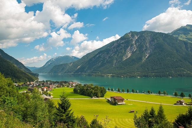
Tyrol Austria attractions
Tyrol is the perfect destination for outdoor enthusiasts, because of its towering peaks, gushing mountain streams, and Alpine meadows. the place is offering a huge range of activities, from hiking and biking to rafting, horse riding, and climbing. Historically part of the Holy Roman Empire and Austrian Empire, nowadays Tyrol is split between two countries and three regions. The northernmost portion is Austria’s Tyrol region, the central part is Italy’s South Tyrol and the southernmost part is the Trentino region.
Innsbruck
Innsbruck is the capital of Austria’s Tyrol region, and is an important entry point for the area. visitors here find attractive architecture in its old town, Inn river valley, with lofty mountain ranges framing the skyline from north to south. North of the city, the jagged peaks of the Nordkette rise to over 2000m and are easily accessible by cable car. There are numerous hiking trails from both upper stations, and in winter there’s a ski area here, including the famously steep black run down from Hafelekar.
The Otztal valley and Area 47
The Otztal valley is the longest side valley, running right up to the border with Italy at the Timmelsjoch pass, west of Innsbruck. It’s a fantastic destination for outdoor activities, with hundreds of peaks to hike up, Scenic routes for mountain biking, and excellent glacier skiing at Solden. It’s also a great destination for climbers, with hundreds of climbing routes. 159-meter Stuibenfall, Tyrol’s highest waterfall, is giving an excellent view of this point.
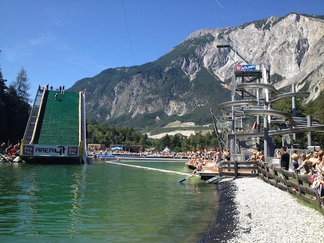
The perfect place for watersports- Is area 47, located at the bottom of the valley, where the Otztaler Ache river joins the river Inn. Area 47 also offers canyoning tours, sliding gorges, and a fascinating caving tour through tunnels dug by the Nazis during World War II. Area 47 is also a huge adventure park with water slides, wakeboarding and climbing walls.
Also, read- 9 Secrets That You Shouldn’t Know About Bhutan Country
The Dolomites
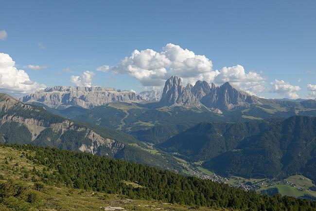
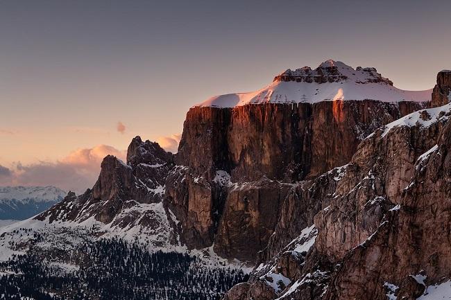
The other main attraction in Tyrol for outdoor adventurers is the Unesco-listed Dolomites mountain range. The landscape here is beautiful, characterized by pale, vertical rocky pinnacles. The outcrops glow red in the morning and evening light. Locals live in pretty mountain villages in isolated valleys, such as the Val Gardena and Val Badia. The area is famous for its excellent hiking, biking, and climbing and Alpe di Siusi, Europe’s largest high-altitude Alpine meadow, where dozens of family-friendly hiking routes and bike paths are available. In winter the whole area becomes a huge playground for skiers and snowboarders.
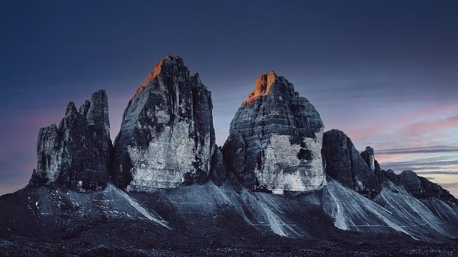
The 3 Peaks nature park
The 3 Peaks nature park is part of the Dolomites mountain range and the UNESCO World Heritage site comprises an area of over 11,000 hectares across the parishes of San Candido, Sesto, and Dobbiaco. The natural park is situated in the northeastern corner of the Dolomites and is framed by the Val Pusteria in the North, the Sesto valley in the East, the country border to Belluno in the South, and the Val di Landro in the West. The nature park features stunning landscapes and Dolomite peaks, in particular the world-famous 3 Peaks.
Lake Garda and the Brenta Dolomites
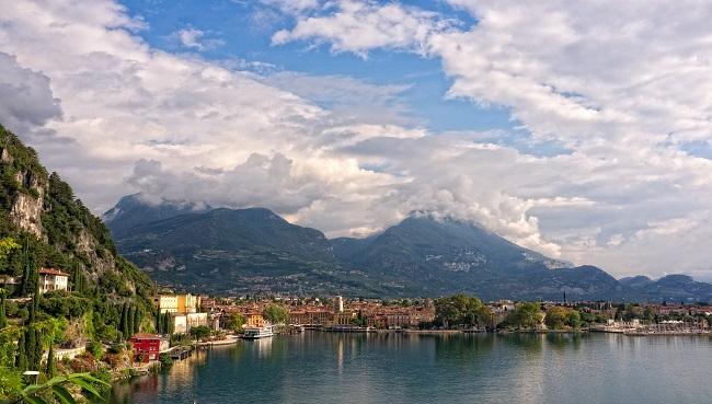
Lake Garda and the Brenta Dolomites is a fantastic destination for skiing, hiking, mountain biking, climbing, and Via Ferrata. The area consists of mountain lakes, perfect for cooling off in the heat of summer. One of the most beautiful places is Lake Molveno, which is bordered by Brenta Dolomite peaks. A great way to experience the lake and its towering surroundings is paragliding. The real jewel of the area is Lake Garda, Italy’s largest lake. The lake is a magnet for sailing and windsurfing enthusiasts. The town of Arco is a world-class sport climbing destination, just a few kilometers north of the lake. A dozen excellent limestone crags sit within the town, some with impressive views down over Lake Garda.
The Sella massif
The Sella massif lies between the four Ladin valleys of Badia, Gherdeina, Fascia, and Fodom and is divided between the provinces of South Tyrol, Trentino, and Belluno. In winter it is possible to ski around the entire massif by using the Sellaronda ski lift. Also, each winter the alpine touring ski race is held, which leads around the entire Sella and covers 42 km of mountain trails.
How to Reach Tyrol
The nearest airport to Tyrol is Innsbruck International Airport which is 13.8 km away. Tyrol is a region that can be visited year-round. world-class hiking start in the summer, which begins in early June and runs through to late August. Wildflowers are at their most colorful in June and winter is more blissful between the end of May and October.
Sources-Nationalgeographic, Lonelyplanet.com, timesofindia, wikipedia.org
Pingback: Unforgettable places in Gulmarg Kashmir for GeoTourism - Geotourism