National Geo-heritage monument & infamous Geo-sedimentary Structure- “Eddy Current marking of Panchmahal”
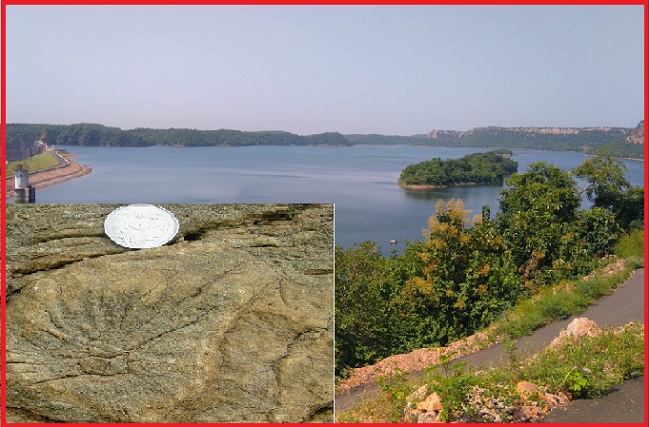
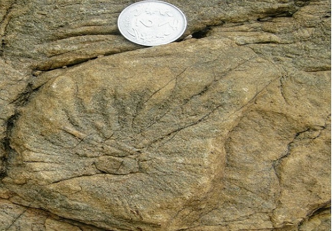
During the course of geotechnical investigation of the Kadana Reservoir area, observed well-preserved spiral markings with a central core in Quarry Hill, Kadana Dam, Panchmahals, Gujarat, India, which provide one of the best-preserved records of eddy currents.
Eddy Marking of Panchmahal district, Gujarat is exposed in Quartz-Arenite formation of Upper Aravalli Lunavada Group of rocks. The area is located on the left bank of the Kadama Dam, Panchmahal district, at about 600 m southeast on the right side of the approach road to the querry sites. The Kadama Dam is linked to the main towns of Rajasthan and Gujarat by roads and can be reached via NH-8. The nearest railheads are Dungarpur and Lunavada via Godhra.
The radiating circular Eddy Marking of Panchmahal is preserved on rock from the Precambrian era. The site very well represents the geological evolution of the Upper Aravalli Lunavada Group. In actuality, These marks result from dragging a small limb of a larger floating log caught in a vortex or eddy current of a stream or from a movement of a pebble. The petrified marks of the eddies around the whirl balls, form spiral ribs.
Also read- The amazing Marine Gondwana Fossil Park, Manendragarh, Take a Geotourism around the Geo-Heritage site
Formation of Eddy current marking
Millions of years ago, during the Aravalli Orogeny the incompetent sedimentary rocks got transformed into metamorphic rocks. This orogeny movement of metamorphic rocks imposed a lot of stress and this stress hence generated cross-stratification, horizontal stratification, planar cross-bedding, flute, and groove marks on the rocks. These markings on the rocks that there are on the surface made up of quartz-arenite from the Upper Aravalli Lunavada group (The Precambrian Proterozoic) are one of the most marvelous and rare markings that can depict the timeframe or evolution of the ranges of Aravalli.
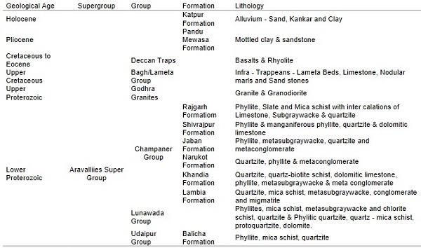
This site is of strategic importance for the study of evolution in the Upper Ranges of Aravalli. The entire area is made up of sedimentary and metamorphic rocks, but all of them have one thing in common, the rocks have circular markings on them, which is dated to be preserved on these rocks since the Precambrian Era.
MORPHOLOGY OF SEDIMENTARY STRUCTURES
Eddy Marking of Panchmahal is preserved as spirals, 8-16 cm diameter, on the top of the bedding plane of a fine-grained, quartz arenite bed. In the center of these spirals, whirl balls, 1-2 cm diameter, are seen, comprised of medium-grained quartz arenite and with their axes sub-vertical to the bedding plane.
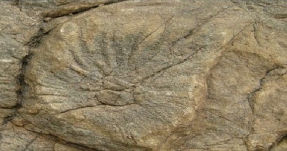
The petrified record of the eddies around the whirl balls are crowns of spiral ribs. the spiral markings, randomly oriented rill marks are seen in the outcrop. The occurrence of whirl bails, eddy marks, and rill marks from the Upper Aravalli rocks of Kadana, hitherto considered as marine (geosynclinal) sediments, provides interesting information for the understanding of the depositional environment of these rocks.
Kadana Dam
The Kadama Dam is Located on the Mahi River in the Mahisagar district of the state of Gujarat. It is an earthen and masonry dam. The construction of the Kadana Dam started in 1979 and was finally opened in 1989. Still, in an operational state, the purpose of the dam is power, irrigation, and water storage.
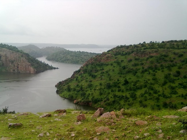
The dam has an installed capacity of 240 MW. Near the Kadana Dam is the Kadana Eddy Marking Sedimentary Structures, which have been declared as the National Geological Monuments of India by the Geological Survey of India (GSI), for their protection, maintenance, promotion, and enhancement of geo-tourism.
