Pōhutu Geyser: The Majestic Giant wonder of New Zealand
Pohutu Geyser
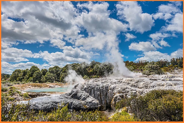
The Whakarewarewa Thermal Valley is a geothermal wonderland renowned for its vibrant geothermal activity and cultural significance. The valley features bubbling mud pools, steaming fumaroles, and several geysers, including the iconic Pōhutu Geyser. It is a key part of the Taupō Volcanic Zone, a region known for its dynamic volcanic and geothermal features.
In addition to its natural wonders, Whakarewarewa is deeply intertwined with Māori culture. The valley is home to the Tūhourangi Ngāti Wāhiao people, who have lived in the area for generations, utilizing the geothermal resources for cooking, heating, and bathing. Visitors to the valley can explore its geothermal landscapes while learning about the traditions, stories, and heritage of the local Māori community.
Also Read- Ahom Moidams: The Sacred Mound-Burials of Assam
Whakarewarewa’s unique combination of natural and cultural attractions makes it a popular destination for tourists seeking to experience the intersection of geothermal phenomena and Māori culture.
Geology
Pōhutu Geyser is part of Taupō Volcanic Zone a geologically active volcanic region located on the North Island of New Zealand. It has been active for at least two million years and remains highly dynamic today.
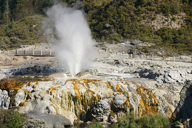
The zone begins at Mount Ruapehu in the southwest and extends northeast through the Taupō and Rotorua regions, continuing offshore into the Bay of Plenty. It is part of the broader Central Volcanic Region, which has been active for four million years and stretches as far as the Coromandel Peninsula. The Taupō Volcanic Zone lies within the tectonic Taupō Rift, an intra-arc continental rift. This rift is widening unevenly east-west, with the highest rate of expansion occurring at the Bay of Plenty coast, minimal widening near Mount Ruapehu, and a rate of approximately 8 mm per year near Taupō.
The zone is named after Lake Taupō, which occupies the massive caldera of the Taupō Volcano, the largest in the region. It features a vast central volcanic plateau along with a variety of distinctive landforms shaped by its volcanic activity. Surficial geology includes several hydrothermal eruption breccia units, collectively mapped as the Parariki Breccia, and thick sequences (tens of meters) of Holocene tephra fall (e.g., Hinemaiaia, Waimihia, and Mapara tephra) and pyroclastic flow deposits (e.g., Taupo Pumice).
How to Reach Pohutu Geyser
Pohutu Geyser is about a 5–10 minute drive from the Rotorua city center. Take State Highway 30A and follow the signs to Te Puia or the Whakarewarewa area. It’s approximately a 2.5–3-hour drive south via State Highway 1 and State Highway 5 From Auckland. Rotorua doesn’t have an extensive public transport system, but local buses may take you close to the Whakarewarewa area. You might need to walk or take a taxi for the final part of the journey.
