Trinidad and Tobago Tourism
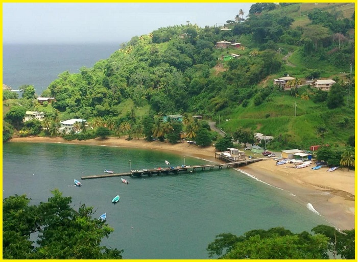
Trinidad and Tobago Island is a twin-island Caribbean nation near Venezuela. Its landscape offers mostly plains, with some hills and low mountains. In the north, within the Aripo Massif, El Cerro del Aripo at 940 m. is the nation’s highest point. In Tobago, a Central Ridge is running down its spine, with elevations exceeding 600 m. The islands have numerous small rivers and streams. Its coastline is ringed by bays, beaches and a narrow coastal plain that rises into the hills. Tobago island is of volcanic origin and primarily hilly. Several Geological features can be seen all around the island. Here are the 5 best Geological wonders of Trinidad and Tobago.
Trinidad and Tobago weather-
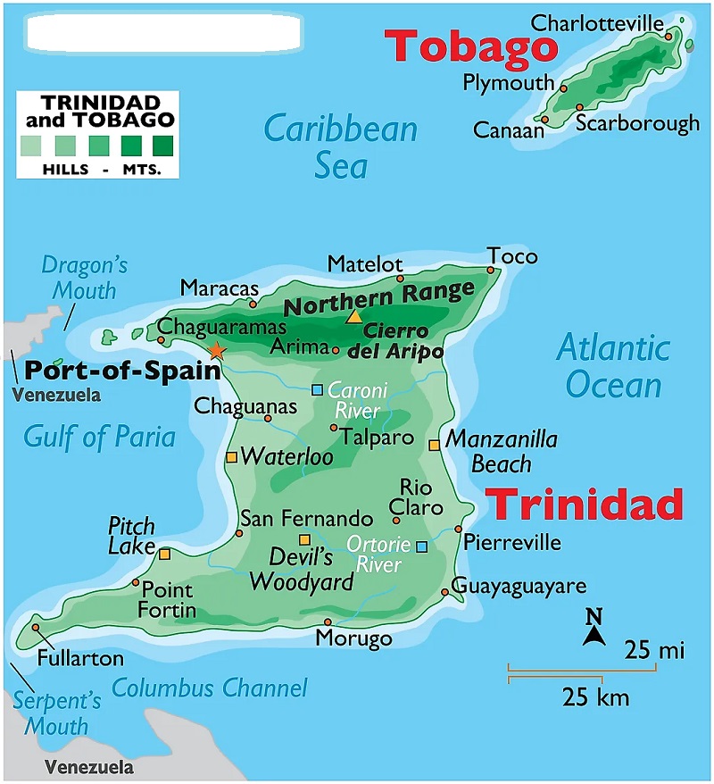
The climate in Trinidad and Tobago island is hot, oppressive, windy, and overcast. The temperature typically varies from 72 °F to 90 °F and is rarely below 69 °F or above 93 °F. The best time of year to visit Trinidad and Tobago for hot-weather activities is from late December to early April. Trinidad and Tobago map-Located just a few miles off the South American continent, Trinidad and Tobago map show the major Places.
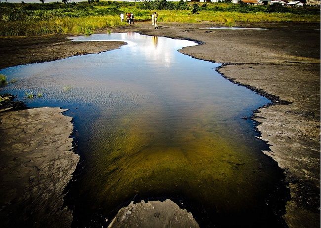
The Pitch Lake
The Pitch Lake is found in southwest Trinidad in the village of La Brea. The lake measures approximately 41 hectares and is estimated to be 76 meters deep in the centre. It holds about ten million tons of pitch. It is situated very close to the sea, in a depression immediately south of hillock. This is the largest and most significant pitch lake in the world, the natural phenomenon of Pitch Lakes is an important aspect of earth’s history; it relates to the formation of oil and gas. This renowned “Pitch Lake” is the largest, commercial deposit of natural asphalt in the world. La Brea Pitch Lake is a major tourist attraction in Trinidad and Tobago. People occasionally swim in the waters of the pitch lake, which some say is therapeutic because of the sulfur content.
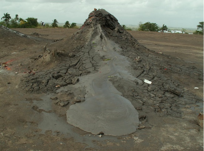
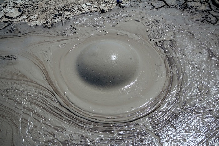
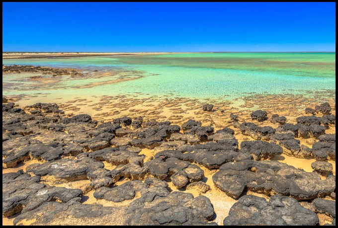
The Piparo mud volcano
The Piparo mud volcano is located within the Naparima Fold Belt of the Central Range of Trinidad. Unlike most of the other mud volcanoes in Trinidad, the Piparo mud volcano has extruded numerous rock clasts in the mud. These clasts are made up of several formations which the fluidized mud has passed through on its way to the surface. Within the area, the Nariva Formation, a shale-dominated unit, consists of minor sand outcrops. The extruded mud contains fragments of oil-impregnated sandstone, chert, fibrous calcite, lignite and marl. The place is a UNESCO World Heritage Site and a top travel destination in Trinidad and Tobago.
Devils Woodyard
Devil’s Woodyard is one of the most visited locations of Trinidad’s many mud volcanoes. Located in Hindustan in New Grant near Princes Town, the series of several vents appeared in 1852. It is said that a young volcanic site got its name after its first eruption in 1852. Which shook the entire village and fell the tall trees and frightened the Amerindian villagers. Villagers at the time believed that the devil had come from beneath the earth to fell the woods. The mounds of earth which occasionally bubble and hiss continue to amaze visitors of the site.” The site is over 65 million years old. More than 24,000 tonnes of volcanic mud had been spewed during the eruption, and some of this dirt remains extremely valuable to beauticians and estheticians. Volcanic dirt is wonderful, It is a natural skin purifier rich in minerals, like sulfur, magnesium and zinc, that can cure many diseases.
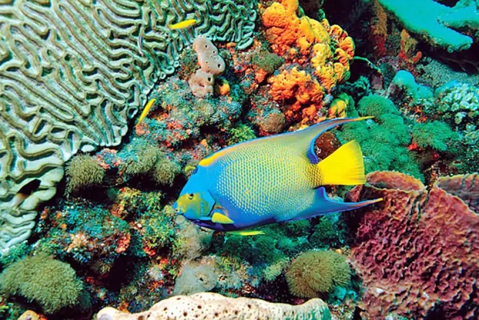
Coral Gardens
Coral Gardens is a small patch of reef located in the Bon Accord Lagoon in the Buccoo Reef Marine Protected Area. This is one of the better-known treasures of Buccoo Reef. Travellers can visit the site by snorkelers and glass bottom boat tours. Coral Gardens are dominant in reef-building, also known as the potato coral, and host many reef fish.
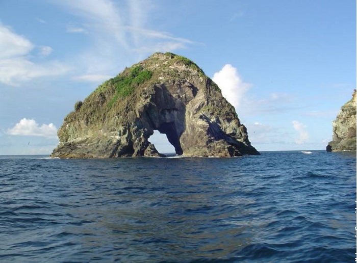
London Bridge Natural Arch
London Bridge Natural Arch is a large rock that has a hole right in the middle of it, with half the passage above the water surface and the other half submerged, making this site a thrilling dive experience.
Where are Trinidad and Tobago
Trinidad and Tobago is the southernmost island country in the Caribbean. Consisting of the main islands of Trinidad and Tobago, and numerous much smaller islands, it is situated 130 Kilometers south of Grenada and 11 Kilometers off the coast of northeastern Venezuela. Trinidad and Tobago shares maritime boundaries with Barbados to the northeast, Grenada to the northwest and Venezuela to the south and west. The island country’s capital is Port of Spain, while its largest and most populous city is San Fernando.
Also, read-Trekking adventures in The Highest mountain in South America-Mount Aconcagua


